
Quick report
- Aspect
- North
- Red Flags
- Wind Loading
- Elevation
- 2896 m
- Slope Angle
- 30°
- Red Flags Comment
- <p>Wind loading. albeit minor would be my red flag of the day. Some transport but only minor drifting. Could be more in the alpine, I was below tree line.</p>
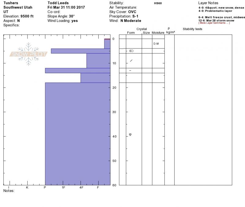
Upper snow pack is a snow/crust sandwich from the last three storms. Two crusts at the top of the 1st 2 of 3 storms sitting on top of the march high pressure surface. The mid and low pack is mostly isothermal from the march high pressure which was responsible for a big melt/loss of snow. The low and mid pack is pretty well locked up until another major warm-up.
Mostly a low danger below treeline today, this might increase with warmer weather as forecasted this weekend. I would speculate a moderate hazard in the alpine which was mostly obscured today.
Snowpack
- Instability Comment
- <p>Minor wind slabs. </p> <p>Minor today but may increase with warmer weather over the weekend.</p>
HST = 4" of dense snow sitting on a semi supportable to breakable crust. Some damp snow after noon below 9,500'.
Big Flat Snotel showed 5" at 10,500'.