
Quick report
At this observation location the 12/18 storm interface is currently 15 - 20 cm (~6 - 10in) deep and its character changed from a rain crust to a difference in snow hardness at around 5600 elevation. Recent, and forecasted, winds are adding loaded pockets and varying surface conditions. Variable conditions exist within the upper snowpack based on elevation and aspect but also on mountain range scale from south to north. Be mindful of terrain and attentive to changing conditions with the incoming storms.
Weather
- Cloud Cover
- overcast
- Wind Loading
- moderate
- Rain Elevation
- ~4000
- Recent Snowfall
- 15-30 cm since 12/18
- Snow Avail For Transport
- moderate amounts
Moderate to strong southerly ridgetop winds, calm to light winds a couple hundred vertical below ridgetop. Steady light snowfall , about 4 cm (~1-2 inches) fell during the day. Rain/snow line was around 4000’.
Snowpack
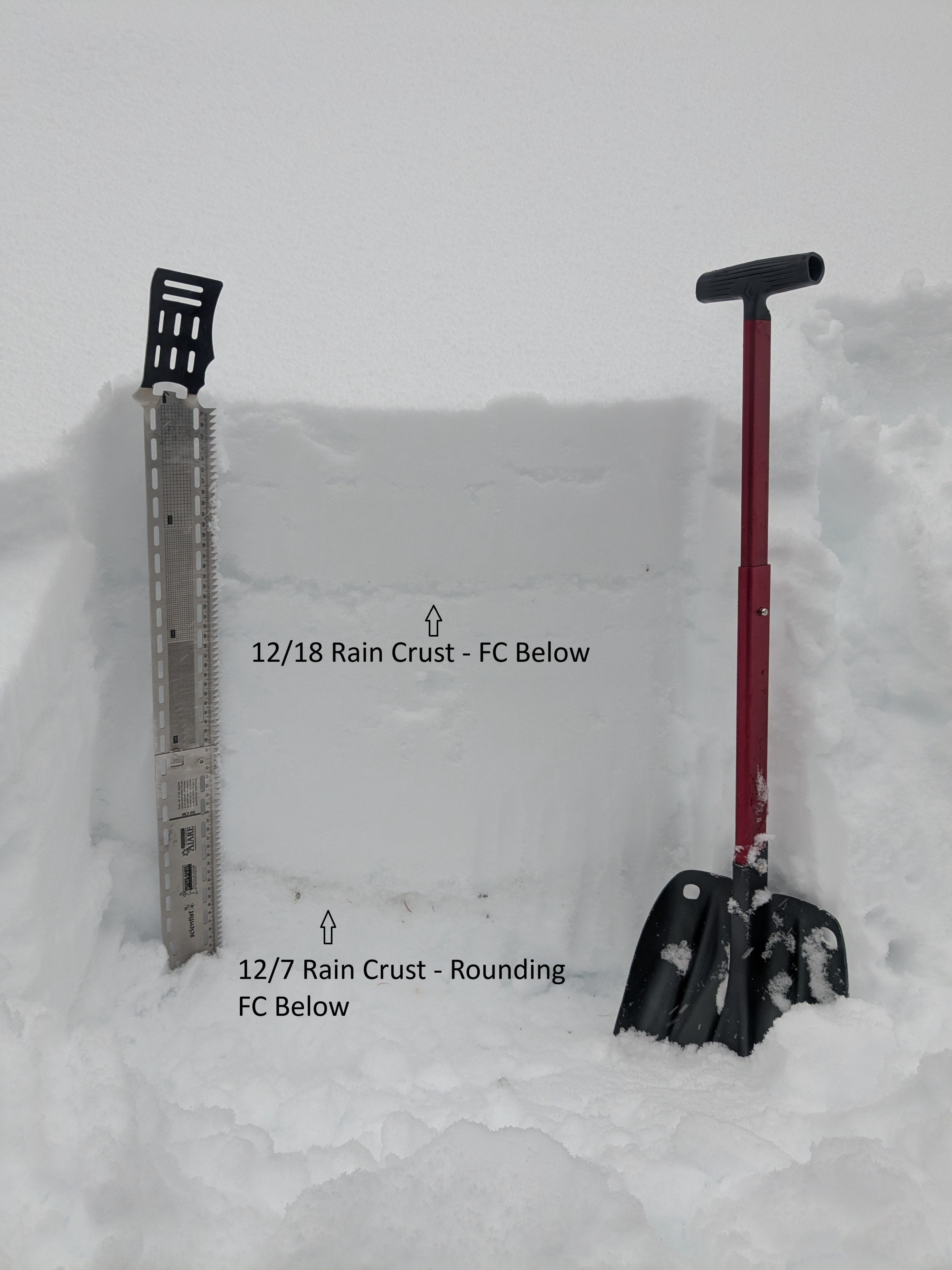
At 5300’ there was 8cm new snow overnight. 15cm (6in) sits on top of the 12/18 rain crust, P hard. We observed easy CT progressive compression results in the top 15 cm and CT11 SC down 15cm under the crust. Deeper test results were CT23 SC sudden collapse in facets below 12/7 crust. The 12/7 crust is down 50cm, 1cm thick, and K hard.
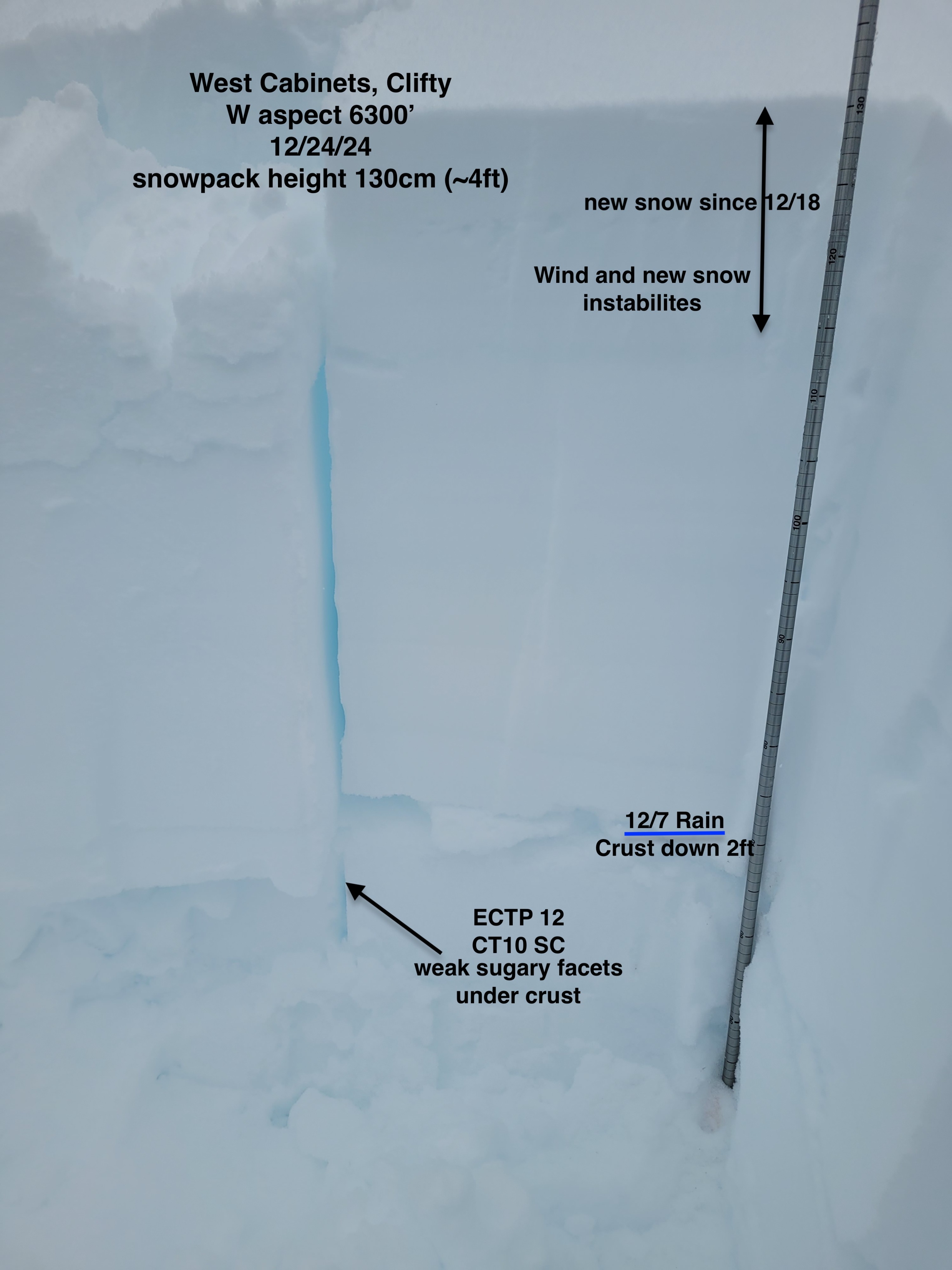
At 6300’ on a West aspect, the snowpack height was 130cm (~4 ft). We observed the same easy CT PC results, and easy ECTN results, within the top 20cm recent snow. The 12/18 interface is identifiable as a snow hardness change but no crust. Deeper in the snowpack, the 12/7 layer is down 60cm (2ft) as a 2cm thick K hard rain crust. Weak sugary facets, 0.5-1 mm grain size, are prevalent as a 4F hard layer underneath the 12/7 crust. We observed sudden collapse and propagation test results in the facets under 12/7 crust: CT10 SC, and ECTP 12. Recent and newly built wind drifts, likely becoming more sensitive on northerly aspects, were present along open ridgeline elevations.