
Quick report
Overall a great day to get out exploring a new (to me) zone. Stability was quite good with no results on test slopes nor avalanches observed although we did not engage with avalanche terrain today. The new snow from the previous storm was low-density and unconsolidated with no slab in all of the wind-sheltered terrain we traveled through.
Weather
- Air Temp
- 26
- Cloud Cover
- overcast
- Wind Loading
- none
- Recent Snowfall
- 15
- Snow Avail For Transport
- large amounts
The NWAC weather forecast from this morning validated very well. Partly cloudy skies in the morning gave way to overcast high clouds by afternoon. Light snowfall started just as we left the trailhead at the end of the day.
Snowpack
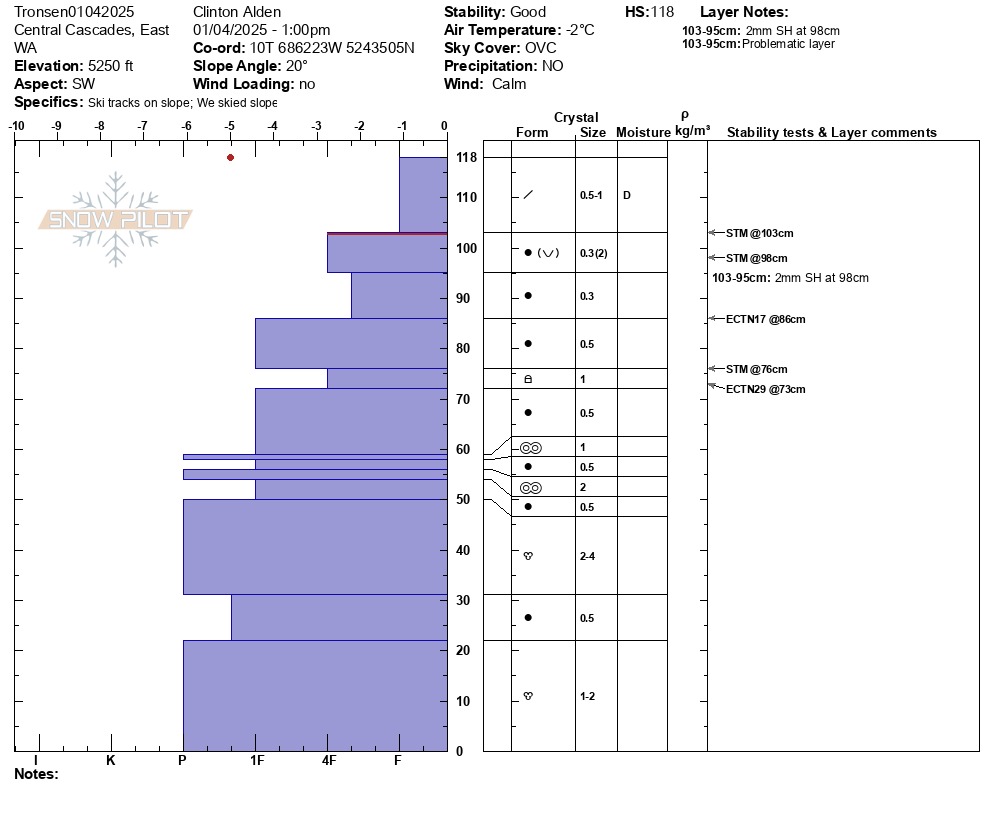
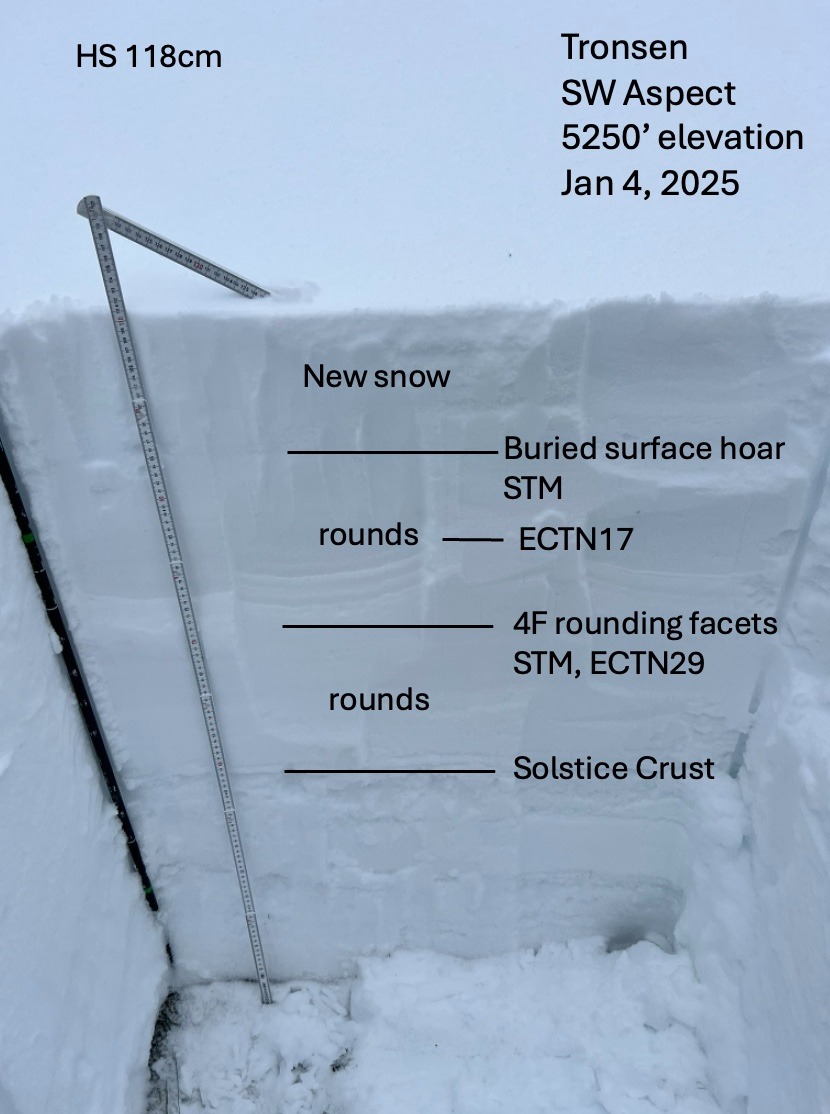
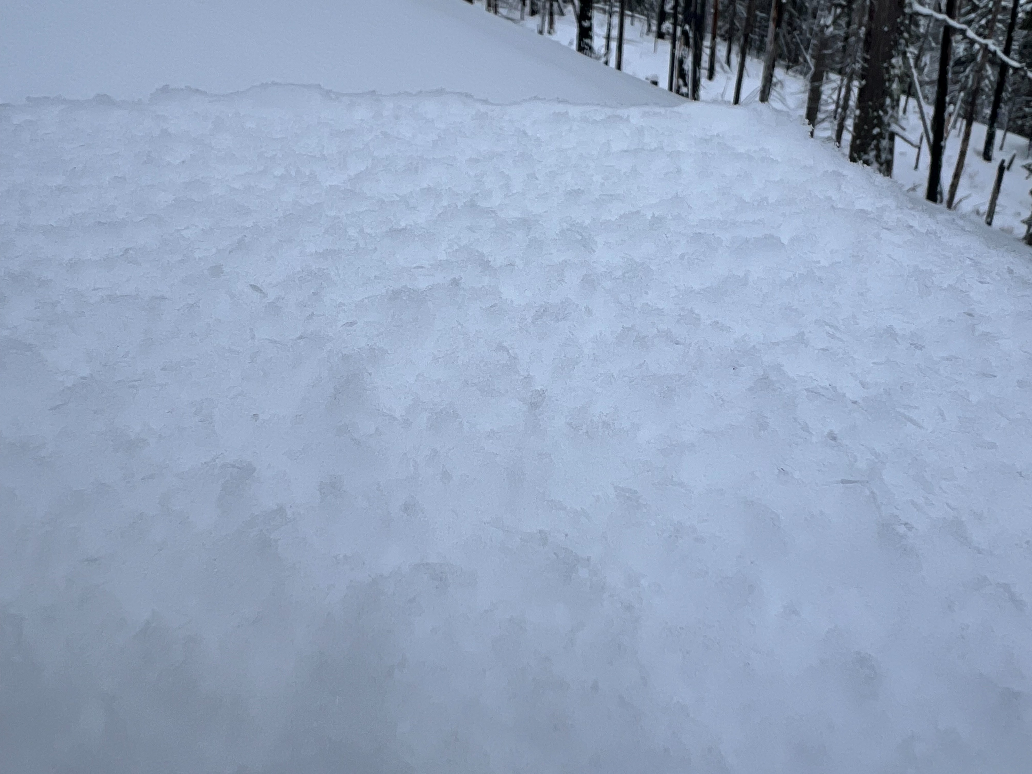
We dug a pit hunting for some of the instabilities noted by previous forecasts and the avalanche activity that has been more active in the East South zone. The crust below the new storm snow was observed near the trailhead but disappeared quickly above 4500'. The snow depth for the snowpit on this SW aspect at 5250' was 118cm. The buried surface hoar layer was initially a little tricky to find on our SW aspect but was identified with a shovel tilt test failing with moderate force (STM @98cm, Q2). These grains were challenging to pick out on a crystal card with a loupe. They were however more pronounced on the bed surface on which the shovel tilt test failed, with feathery grains sticking up. Another layer of interest appeared to be a layer of rounding facets that also failed with moderate force in a shovel tilt test (STM @76cm) and failed in an extended column without propagation (ECTN29 @73cm). We also found another interface buried 30cm below the surface that failed in an extended column test without propagation (ECTN17 @86cm). Given the various interfaces in the top 50cm of the snowpack with a variety of test failures, it will be interesting to see how this upcoming storm and its warm temperatures add weight to the snowpack.