
Quick report
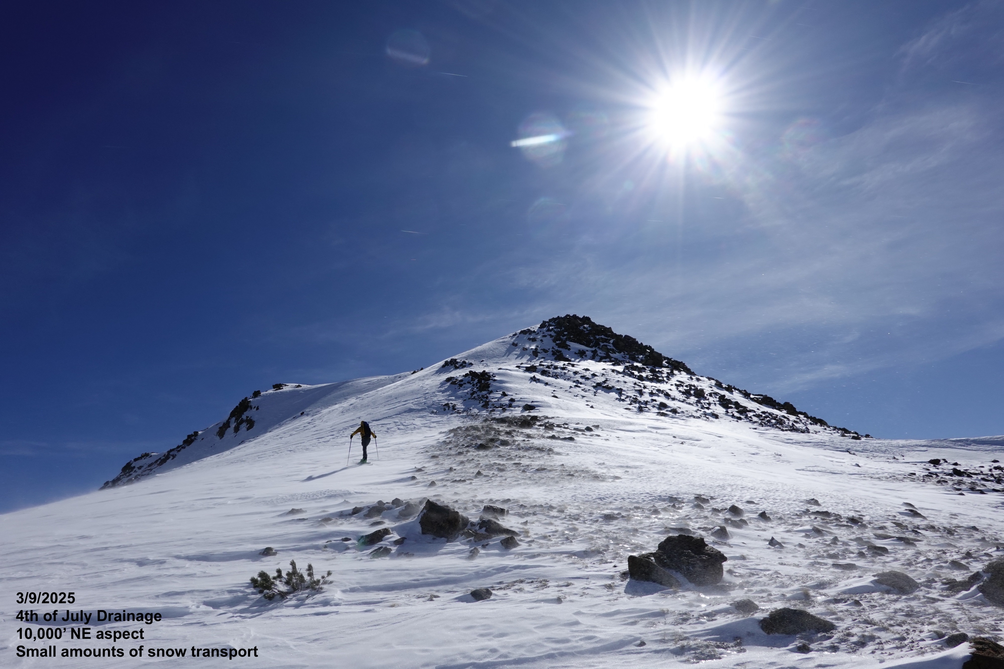
We observed generally stable conditions and saw no obvious signs of instability, but we still gave cornices a wide berth. There was plenty of wind moving in open terrain, but very little snow being transported.
We felt comfortable entering steeper terrain where we didn't find wind-slab like surfaces, stuck to one-at-a-time travel protocols (to minimize our exposure), and selected low-consequence terrain when we did choose to venture onto steeper slopes.
Weather
- Air Temp
- 5-30
- Cloud Cover
- clear
- Wind Loading
- previous
- Recent Snowfall
- 0
- Snow Avail For Transport
- none
Cold in the Salmon River valley bottom this morning. Moderate gusting strong SW winds above 9500 feet.
Snowpack
Despite the winds, very little snow was being transported, and we were unable to find any fresh reactive wind-slabs... but there are plenty of old wind-hammered surfaces throughout the alpine.
- Widespread firm refrozen surfaces held until approximately 2pm below 9000 feet, when the crusts began to soften and moisten.
- Above 9000 feet, soft decomposing snow (mixed with some near surface facets) remains on protected northerly slopes and wind-pressed surfaces dominate most open terrain.
- We found A 4-6 foot (1.5-2m) deep settled snowpack on shaded aspects with much more variable and shallow depths throughout W, SW, and S aspects.
- Weak faceted snow can easily be found near the ground at lower elevations (great trapdoor for snowmobiles) but becomes harder to pinpoint above 9500 feet where we travelled today.
Avalanche
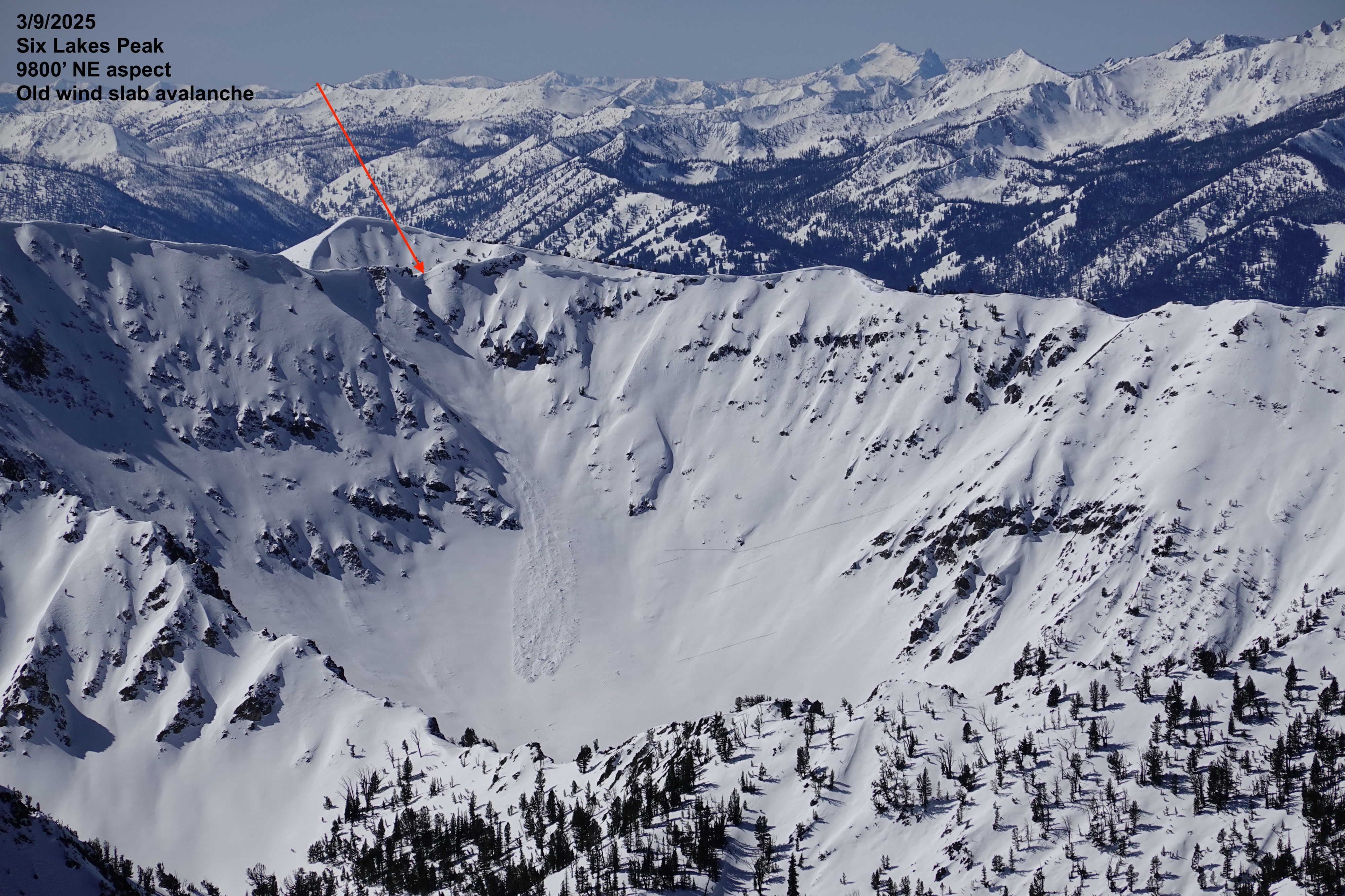
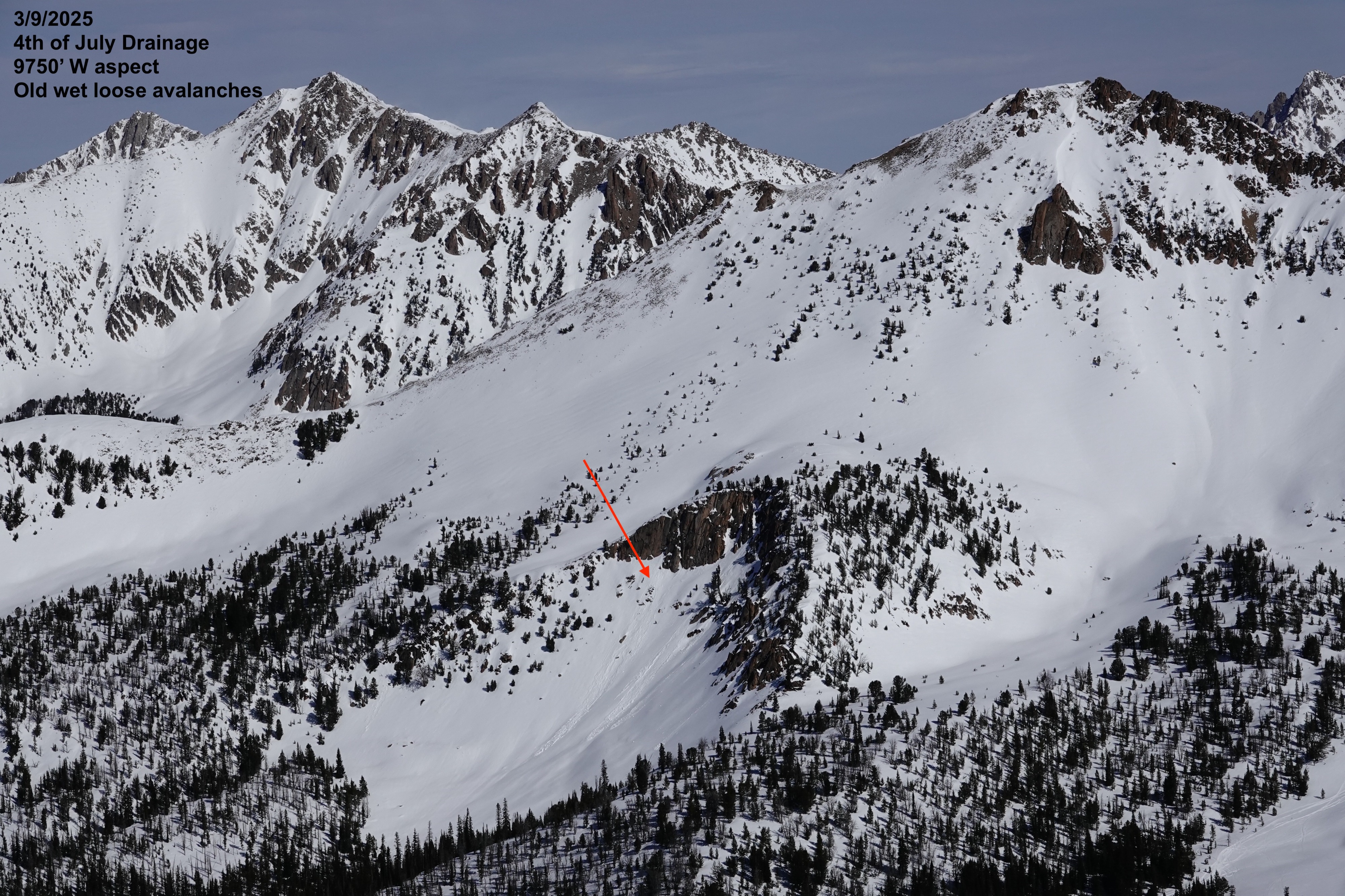
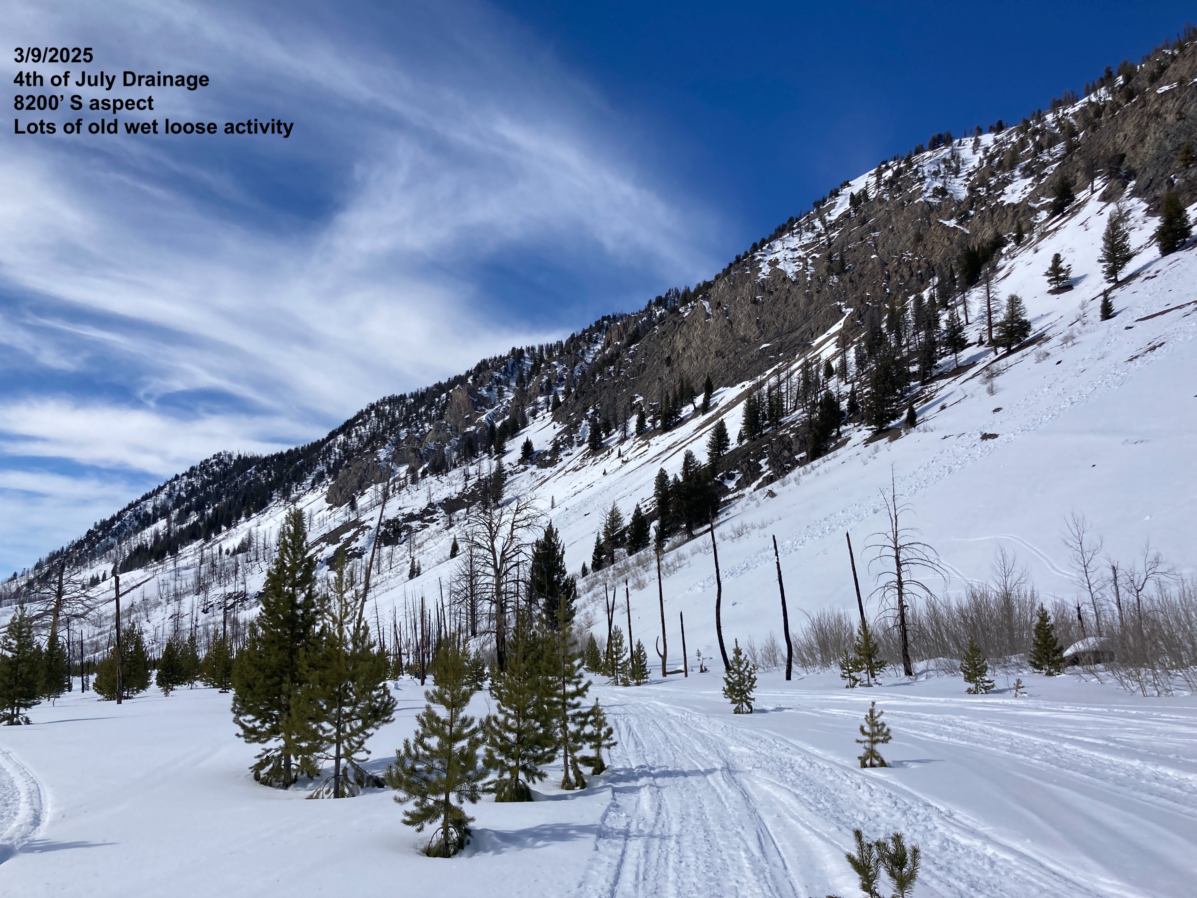
Evidence of old wet loose avalanches in steep solar terrain with rocks/cliffs from earlier warming. Observed a couple of old large debris piles from early/mid-February large storm cycles.