
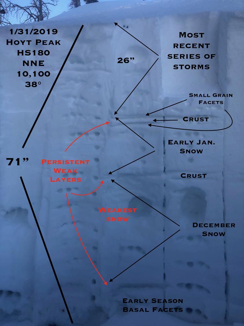
Quick report
- Aspect
- Northeast
- Red Flags
- Rapid Warming, Poor Snowpack Structure
- Elevation
- 3078 m
- Slope Angle
- 38°
Melt/freeze crust and surface faceting.
East facing wet surface instabilities.
The snowpack is tired and relaxed right now. In lower angle terrain the danger seems to be low to moderate but if you're venturing into steep, open terrain, especially on the north half of the compass or in the wind zone the danger seems to be more considerable with scary, unmanageable consequences. Tricky avalanche conditions indeed.
Snowpack
- Instability Comment
- <p>Not a huge problem but steep east facing slopes had wet surface instabilities, mostly off rocky areas and cliffs. Something to watch out for tomorrow with more warm temps forecasted. </p> <p>We're dealing with a few persistent weak layers and the problematic ones are mid to deep in the pack. These aren't going to heal anytime soon but seem stubborn to fail right now. With wind and snow in the forecast these weaknesses can easily come to life. The upper portion of the December snow is weak and incohesive. Capping both the December and early January snow is a thin wind crust (?) with small grain facets on either side of the crust.</p> <p>Pit tests were stubborn and somewhat inconclusive but I would be hard pressed to jump into steep terrain on the north half of the compass, especially if there is an easterly component to the slope. Things will be changing by the weekend and early next week with the addition of more water weight to the snowpack.</p>
A wide range of snow conditions from damp on solar aspects and at lower elevations to melt freeze crusts up to an inch thick to dense and faceted loose snow. Widespread surface and near surface faceting at all elevations. Surface hoar in cold pools. The snow surface will potentially be a problem with the new snow.