
Quick report
- Cracking
- specific
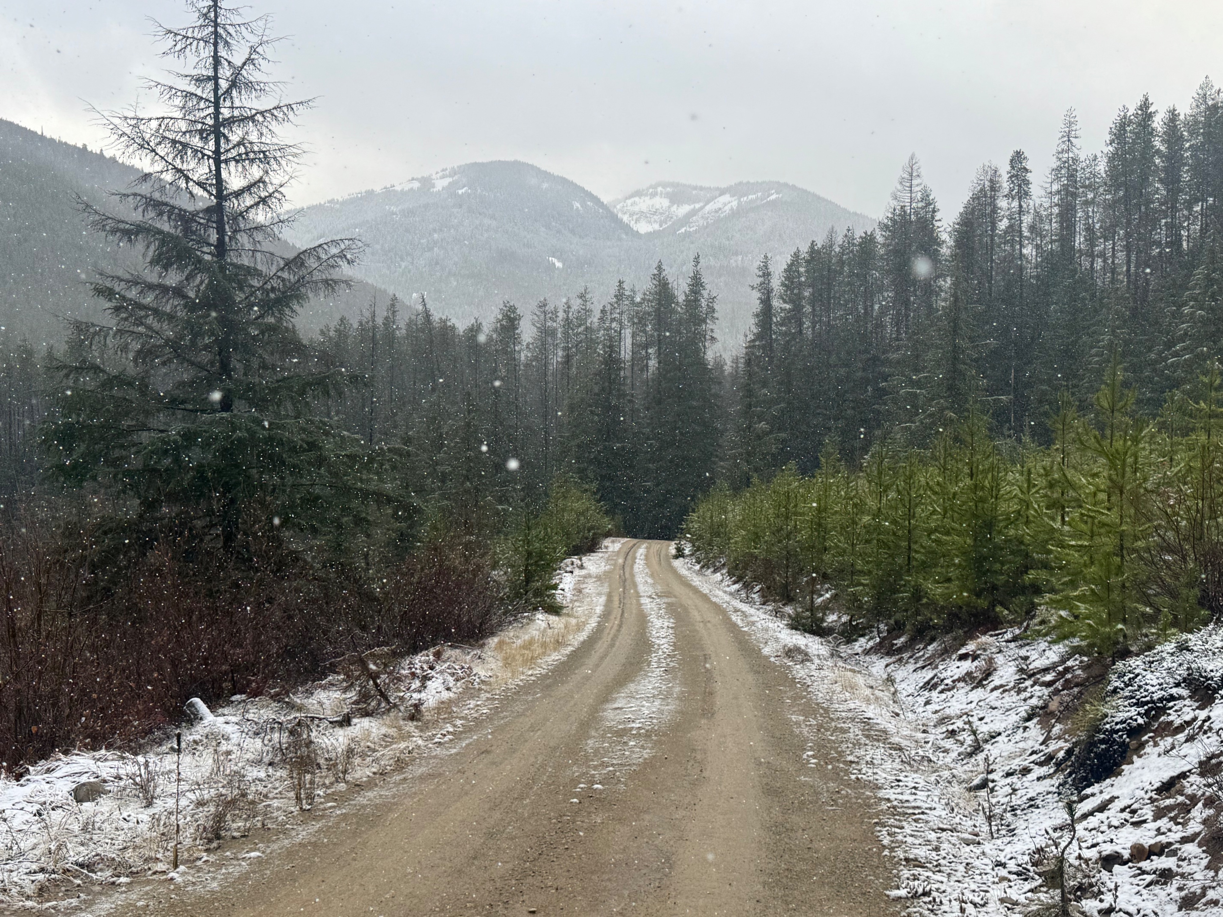
Toured into the East Cabinet Mountains to continue gathering baseline snowpack data, and verify storm totals/freezing levels from this weekend's storm. Snowfall reached the valley floor today, but did not accumulate much below 3500 feet.
Storm totals by elevaiton
•3000-4500 feet: trace- 3 inches
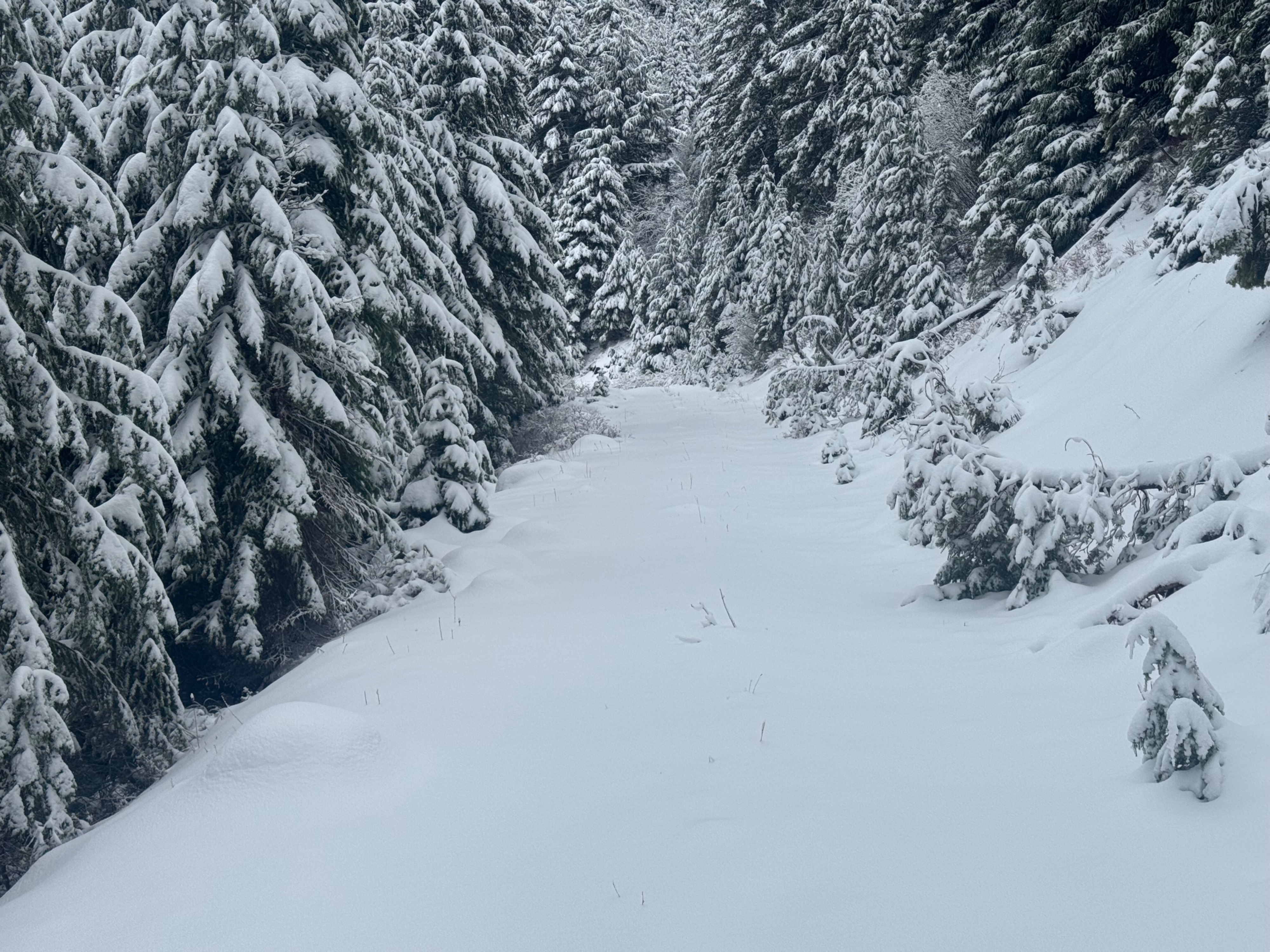
•4500-5000 feet: 3-6 inches
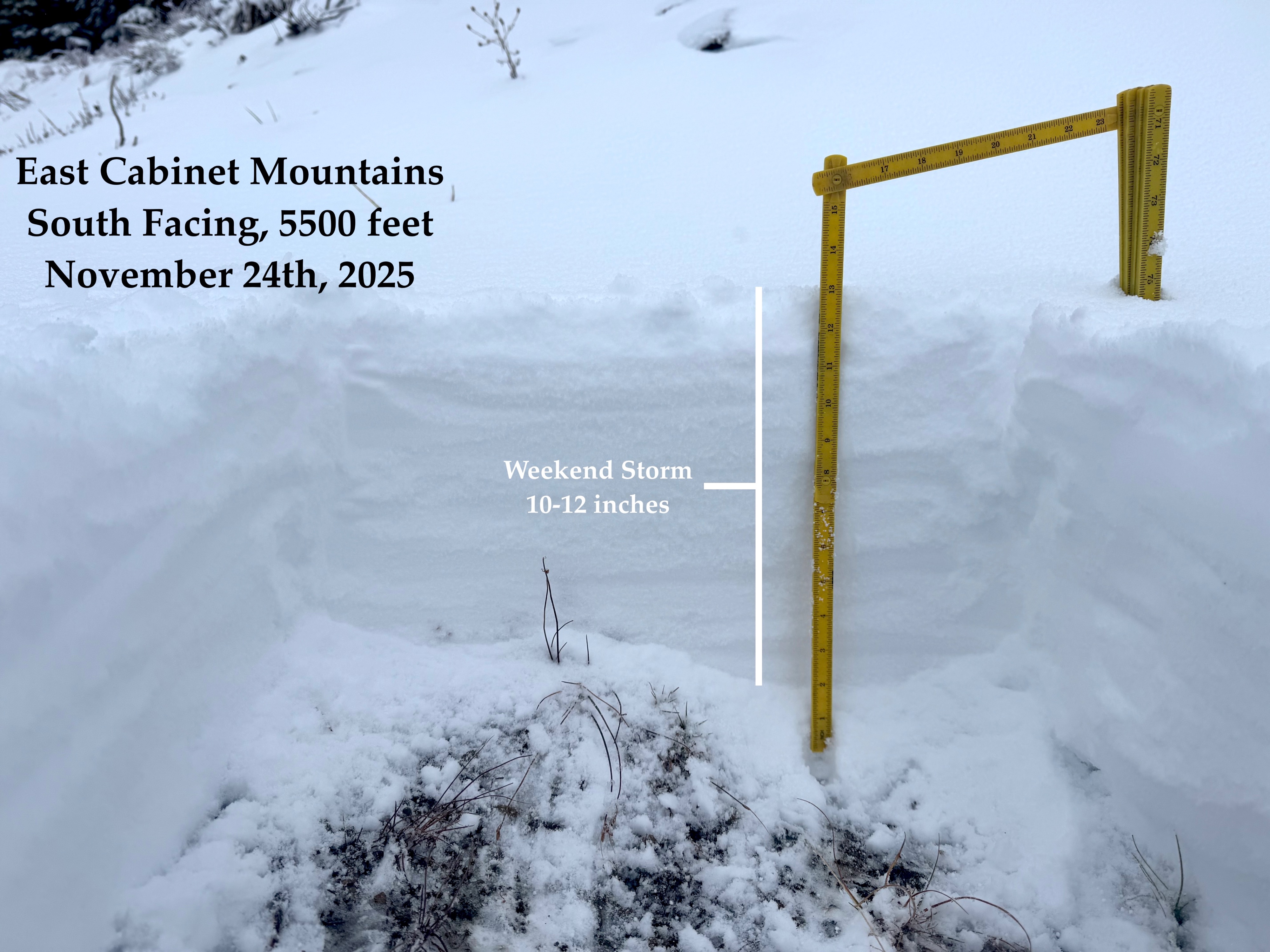
•5000-6300 feet (my day's high point): 6-12 inches
* Around 5500 feet, storm totals increased abuptly. I suspect that 5500 was the primary rain/snow line Sunday evening.
Keep reading for more snowpack and weather details.
Weather
- Air Temp
- 24
- Cloud Cover
- overcast
- Wind Loading
- moderate
- Rain Elevation
- not observed
- Recent Snowfall
- 26
- Snow Avail For Transport
- moderate amounts
Overnight freezing level appeared to be about 5500 feet (visable in a distinct snow line on the morning commute). By late morning, fresh snowfall was reaching the valley floor and accumulating above 3500 feet. Wind speeds were moderate with strong gusts out of the west, but gradually diminished to light/moderate by late afternoon. Fresh wind slabs were developing on lee slopes, and cross loading onto some southerly slopes. Wind slabs were prevalent at upper elevations, but could also be found in open terrain at middle elevations. Snowfall rates during daylight hours were mostly light (S1) and periodically moderate (S2). *Around 6pm while driving east on Highway 2, snowfall rates were at least 1-2 inches per hour (S5) on the valley floor between Marion and Kalispell, MT.
Snowpack
Broadly speaking, the regional snowpack can be divided into two general catagories. Areas with snow prior to November 23rd and areas without. Thanks to the productive storm the last few days, it is no longer obvious which slopes belong to which catagory. Fortunately the IPAC team has been collecting information across the region the last three weeks to help us paint the picture moving forward.
• Above 6000 feet, I suspect that numerous slopes in the East Cabinets survived the rainfall and warm temps, so long as they primarily face north or east.
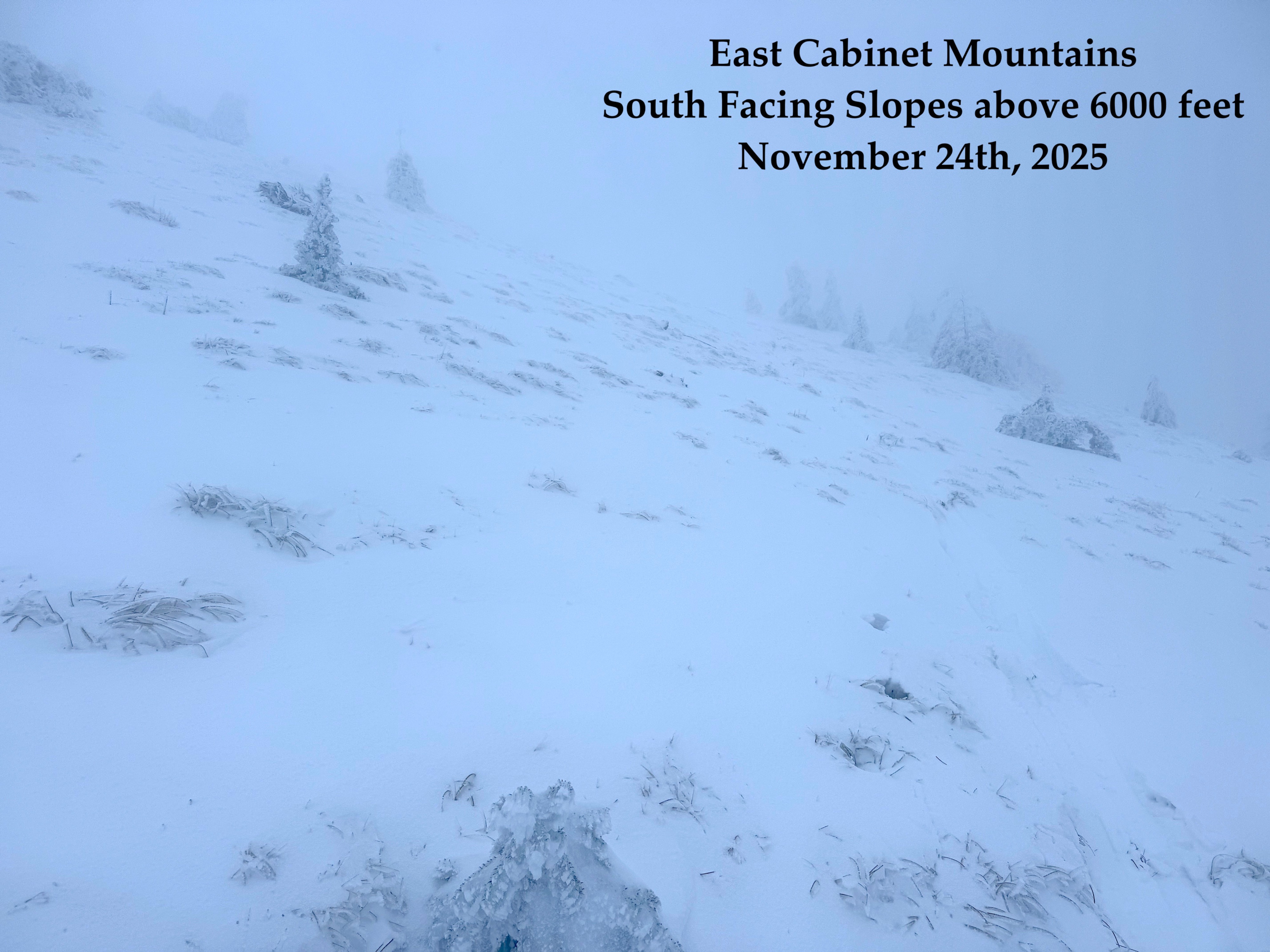
• Windward slopes (south and west) are more variable and a bit trickier to pin down. Old snow coverage is much more spotty at upper elevations, and dependent on specific terrain nuances rather than elevation alone.
Today's tour highlighted these differences as I traveled along the Cabinet Divide between 5900 feet and 6300 feet.
• The snowpack on south and west facing slopes was almost exclusively composed of recent snow from the last two days. However isolated pockets were noted with a thin layer of crusty old snowpack beneath the new snow. These small patches of old snow were very sporadic and hard to sniff out.
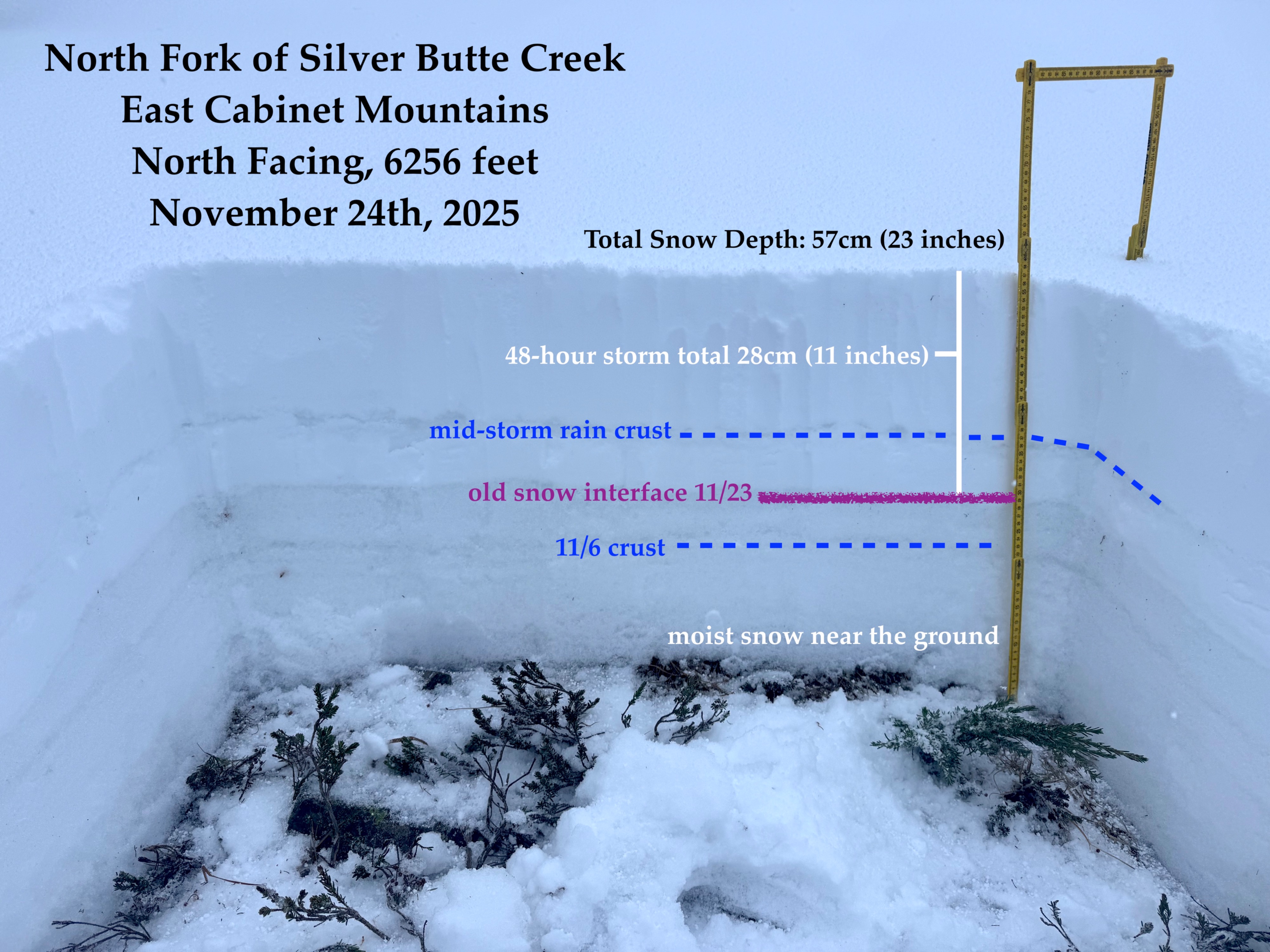
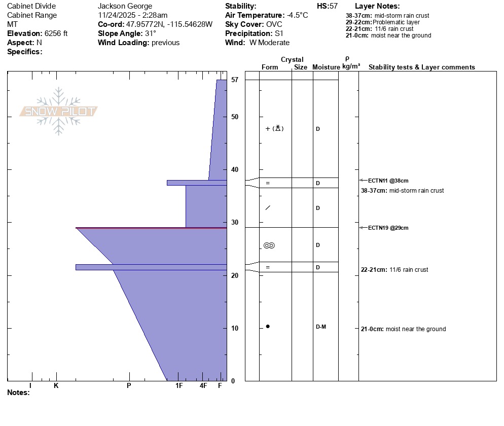
• On north and east facing slopes. The old snow interface seemed much more widespread and continuous. At 6300 feet, I observed 10-12 inches of new snow resting on top of 15 inches of firm refrozen old snow. I dug a pit in one locaiton to take a closer look, but was able to verify that this structure was widespread by quickly probing around adjecent areas and feeling the very distinct structure across the entire slope.
For more specific snowpack details, I've attached a pit graph.