
Quick report
- Slope Angle
- 42°
Avalanche
- Slab Width
- 53 m
- Weak Layer
- Facets
- Trigger Type
- Natural
- Vertical Fall
- 61 m
- Avalanche Type
- Hard Slab
- Slab Thickness
- 152 cm
- Start Zone Aspect
- West
- Avalanche Problem
- Wind Slab
- Start Zone Elevation
- 3383 m
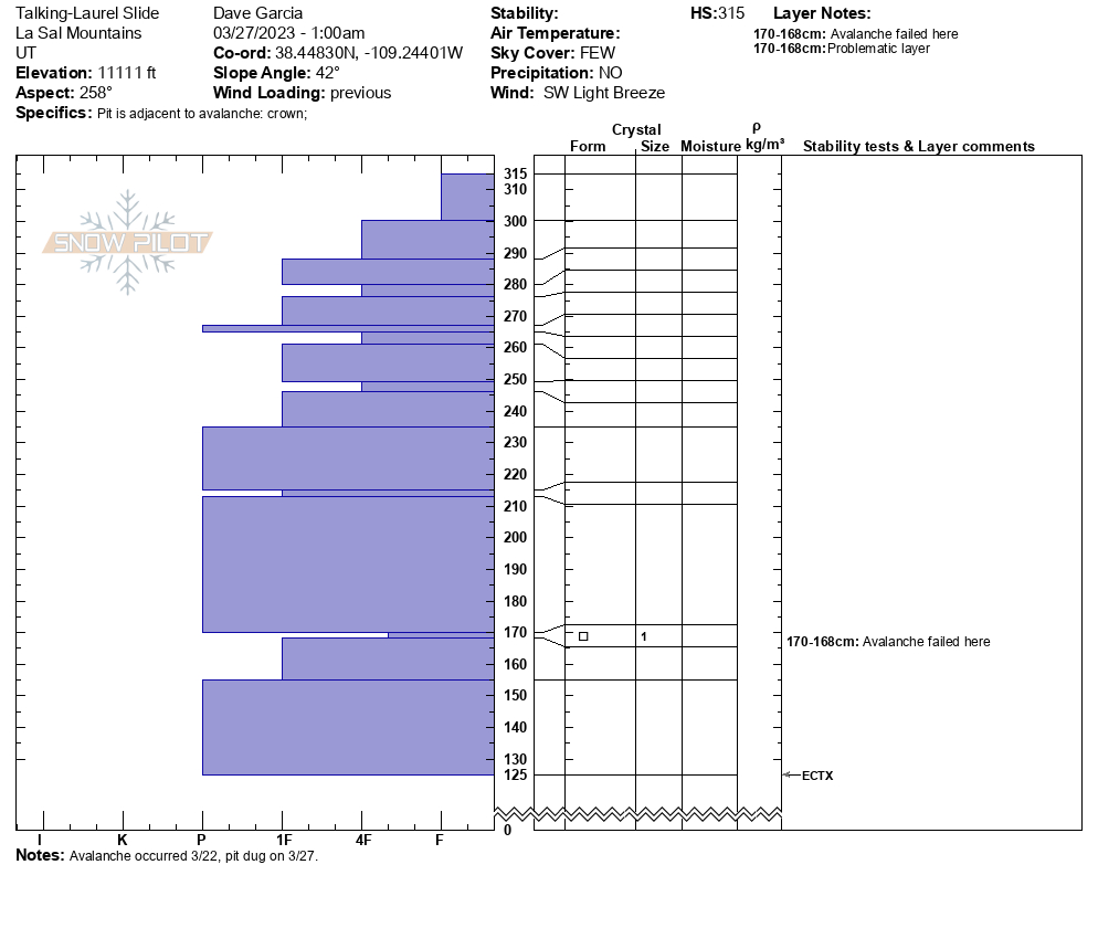
Two avalanches occurred on this slope about 600 feet apart from each other. The crown profile and dimensions above are for the avalanche on the lookers right of the slope. It is possible that one avalanche initiated and sympathetically triggered the other. The average depth of the crown was about four feet, with a maximum depth of 5 feet. The depth of the crown diminished along the left flank where there was less wind loading.
These avalanches most likely occurred on Wednesday 3/22 during the middle of a series of storms. The avalanche danger on 3/22 was rated HIGH. The snow started falling Sunday night into Monday 3/20 and by Wednesday the La Sals had received about 2 feet of snow and 2.6 - 3.0" of SWE. Extreme winds out of the SW blew 50-70 mph Tuesday night and Wednesday. This slope was heavily wind loaded. The avalanche failed on 1mm facets down about 1.5 meters. This avalanche is an example of how strong winds can create unusual loading patterns in the mountains.
HS-N-R2-D2.5-O
In the third photo the paint brush is sitting on the bed surface that the avalanche ran on. The bed surface is down 147cm.