
Quick report
- Aspect
- North
- Red Flags
- Wind Loading
- Elevation
- 3109 m
Traveling up the basin today it was interesting to see the changes that elevation and aspect had on the snow. The lower portions of broads fork had a thick melt freeze crust at the top. As we moved up the canyon the snow started to become better in quality on everything east facing. The westerly faces showed significant warming from the days before. There was a lot of wet loose avalanche and roller balls at the bottom of the west facing slopes. The wind was calm to light for most of the morning.
Snowpack
- Instability Comment
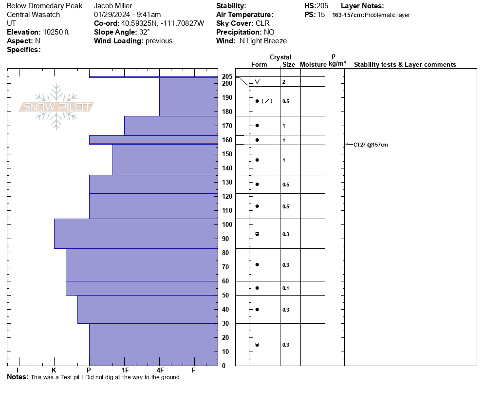
- <p>The snowpack shows general signs of healing. The hand hardness was rather consistent throughout the depth that we dug. We did a compression test that resulted in a failure at CT27. The danger is decreasing but there is still a possibility of triggering a large avalanche that could step down in weaker snow below.</p> <p>The north-facing slope was wind board with small wind ripples. Setting the skin track I was able to promote small cracks in the newly wind moved snow about 5 cm long and 1 cm deep. There was also significant cornice formation on the ridge lines indicating that there had been wind movement in the past few days. There however did not seem to be a large amount of snow for wind transport.</p>