
Quick report
- Collapsing
- specific
Toured up to the weather station to clear the board and above to 9.8k. 4-5 new inches of light-density snow, no wind yet. Made for excellent skiing.
At the weather station (9200') there were 44 inches (110 cm) of snow, 4 inches in the last 24 hours. The interval board has not been cleared in a couple of weeks, and there were 27.5 inches of snow and 3.9 inches of water.
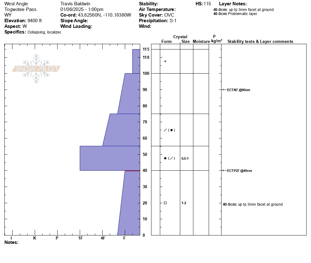
Dug on a west aspect at 9400 feet. ECTP27 down 29 inches on top of basal facets.
The current midpack on Togwotee is made up of a four-finger to 1 finger dense slab sitting on about a foot of loose, sugary facets. I have talked recently about how warmer temperatures this winter have perhaps lessened the amount of advanced facets out there and even caused more rounding than usual within some of the facets. However, a recent conversation with a long-time snow professional about persistent weak layers was a good reminder that facets will behave as facets whether rounding is observed or not. So, even though we have seen some observations with rounding in the basal facets, there is still a weak layer of snow at the base of the snowpack that can be triggered if impacted. The most likely place to impact this layer remains thin spots like steep, rocky and wind-blown slopes. And until almost all of the facets have rounded (think springtime) we will continue to have a weak layer to think about on Togwotee.
Collapsing observed above 9400 feet in exposed meadows and wind-loaded areas.
Weather
- Cloud Cover
- overcast
- Wind Loading
- light
- Recent Snowfall
- 10
- Snow Avail For Transport
- moderate amounts