
Quick report
- Aspect
- Southeast
- Red Flags
- Wind Loading
- Elevation
- 3139 m
- Slope Angle
- 30°
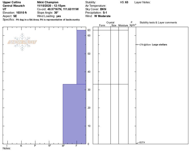
Photo of the right-side up snowpack sitting on the ground.
Photo of coverage, and tracks seen today.
Snowpack
- Instability Comment
- <p>The wind was actively drifting the snow throughout the day. I would expect with the increased winds, up to 70 mph near hidden, there will be a few shallow slabs of wind drifted snow at all upper elevations.</p>
Alta reported 32" of snow with 2.50" of water from 0500 on November 7th to 0800 on November 10th. This new snow fell directly on bare ground on almost all aspects and elevations. Before this storm we had very little old snow (if any) left on the upper elevation northerly facing terrain. We walked by the Collins study plot around 11:00am and the storm board had settled to roughly 21", meaning 10" of snow settlement has occurred over the last 36 hours. The new snow is right side up and stable with no risk of avalanching out of the wind zone. What a great way to start the season!
At upper elevations winds were higher, and there were signs of snow beginning to form shallow wind drifts on the uppermost east and northerly facing slopes. As of now the biggest concern would be triggering an isolated wind slabs at upper elevations. Any avalanche triggered off a steep wind loaded slope would have heavy consequences with our shallow snowpack. The rocks are just under our skis, board or sled.
Photo of the low-density snow on the ground and trees.