
Quick report
- Aspect
- Northeast
- Red Flags
- Wind Loading, Cracking, Poor Snowpack Structure
- Elevation
- 2835 m
- Slope Angle
- 28°
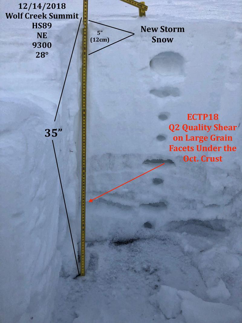
We still need more water weight on the pack to start activating the persistent weak layer but in areas that received a lot of wind and snow transport you could possibly see avalanche activity, otherwise the pack seems mostly stable. I was finding that the new snow fell on weak surface snow and I had easy and clean shear in the new storm snow but I imagine this will settle out quickly. With no snow forecast for the near future I'll be monitoring the snow surface and temperature gradient within the pack until we see another storm. Moderate danger in the wind zone and low in protected terrain out of the wind zone.
Snowpack
- Instability Comment
- <p>The weakest interface is the just below the October rain crust. Not a lot water weight in this last storm, even with with wind transport, to overload this layer. </p> <p>New wind slabs were stubborn; they would crack but not move. Wind slabs should continue to settle out. </p>
Yesterday's wind stripped a lot of snow off the high ridges. Variable snow conditions.