
Quick report
- Aspect
- Southeast
- Elevation
- 2896 m
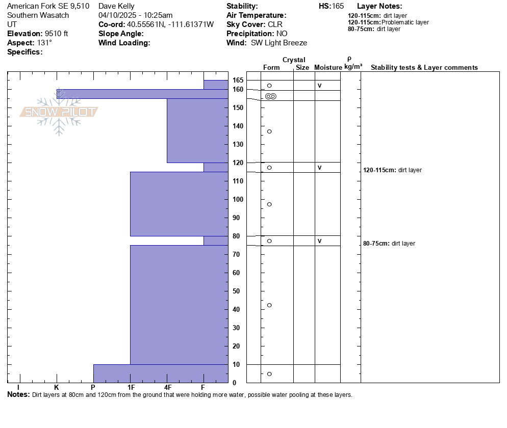
This snowpit was on a southeast aspect at 9,500'. Total height of snow was 5.5' (165cm). There were two layers that were fist hard and both of these had more water pooling and were dirtier (dust layers). The snowpack in this location was isothermic which means that it was the same temperature 32°F (0°C) from the top to the bottom. What this means is that water had percolated throughout the snowpack and it is starting to turn into a spring pack. Even with clear weather and temperatures hovering just above freezing at night, the snowpack is not freezing from the top to the bottom. We were traveling on the surface melt layer supported by the knife hard melt freeze crust just below the surface. Later in the afternoon this layer would have been saturated and we would be sinking through the upper layers of the snowpack even with skis on.
Photo of large wet grains at the layer that was 4' (115-120cm) from the ground.
We played the sun today and traveled on steep slopes facing east-south-west, timing our travel by getting onto those slopes just after the sun had warmed them, so they were soft, but before they became so wet that we were sinking in. The danger where and when we traveled today was LOW.
Snowpack
- Instability Comment
- <p>Photo of wet loose avalanches running on a dirt layer on a south facing slope at 10,600' in elevation.</p>
Snow surface was mixed between a melt-freeze crust and damp snow surface depending on timing and aspect. The east facing warmed up first. We were off of steep slopes as they warmed up in the sun and avoided traveling through any snow where we were sinking into the surface. North facing slopes on the ascent were frozen and by the time we were exiting the south and west facing slopes were warming up. We observed signs of old roller balls and wet loose avalanches from the past few days of warming.