
Quick report
Felt like winter today on Togwotee with temps dropping to the teens, s1 snow, and consistent moderate westerly winds. No signs of instability where I travelled. A thin, breakable crust existed in most places up to 10k feet, where it was starting to disappear. I did not travel above 10k. Visibility wasn't great. Skiing wasn't either.
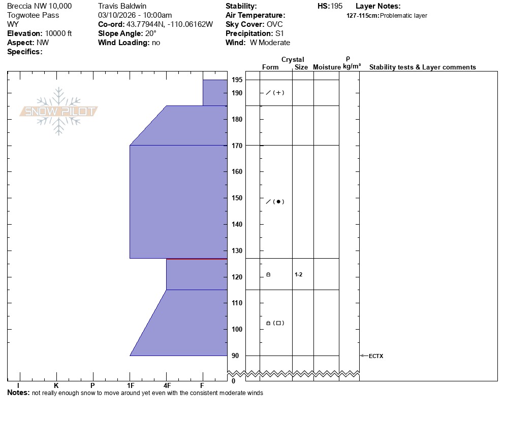
I dug on a northwest aspect at 10,000 feet: HS 195 cm, ECTX
There is a stiff, one-finger slab sitting above the weak snow formed in January and February. That interface is about 28 inches down from the surface. There is a single hardness change at that lever (one finger above and 4 finger below). The facets below are small, 1-2mm, and have some rounding. I did not find surface hoar at this location, as we have seen around Angle.
The snowpack is slowly gaining strength, but the weak structure remains (as it often does on Togwotee). This situation requires evaluating steep, northerly avalanche terrain before committing. North-facing slopes hold the weakest snow and, consequently, the highest avalanche danger.
Monitor snow totals with the unsettled weather over the next few days and keep an eye out for exposed slopes getting loaded by the wind. Avalanche danger will also be elevated around heavily drifted terrain.
Weather
- Cloud Cover
- overcast
- Recent Snowfall
- 2
Snowing s-1, moderate westerly winds with occasional strong gusts.