
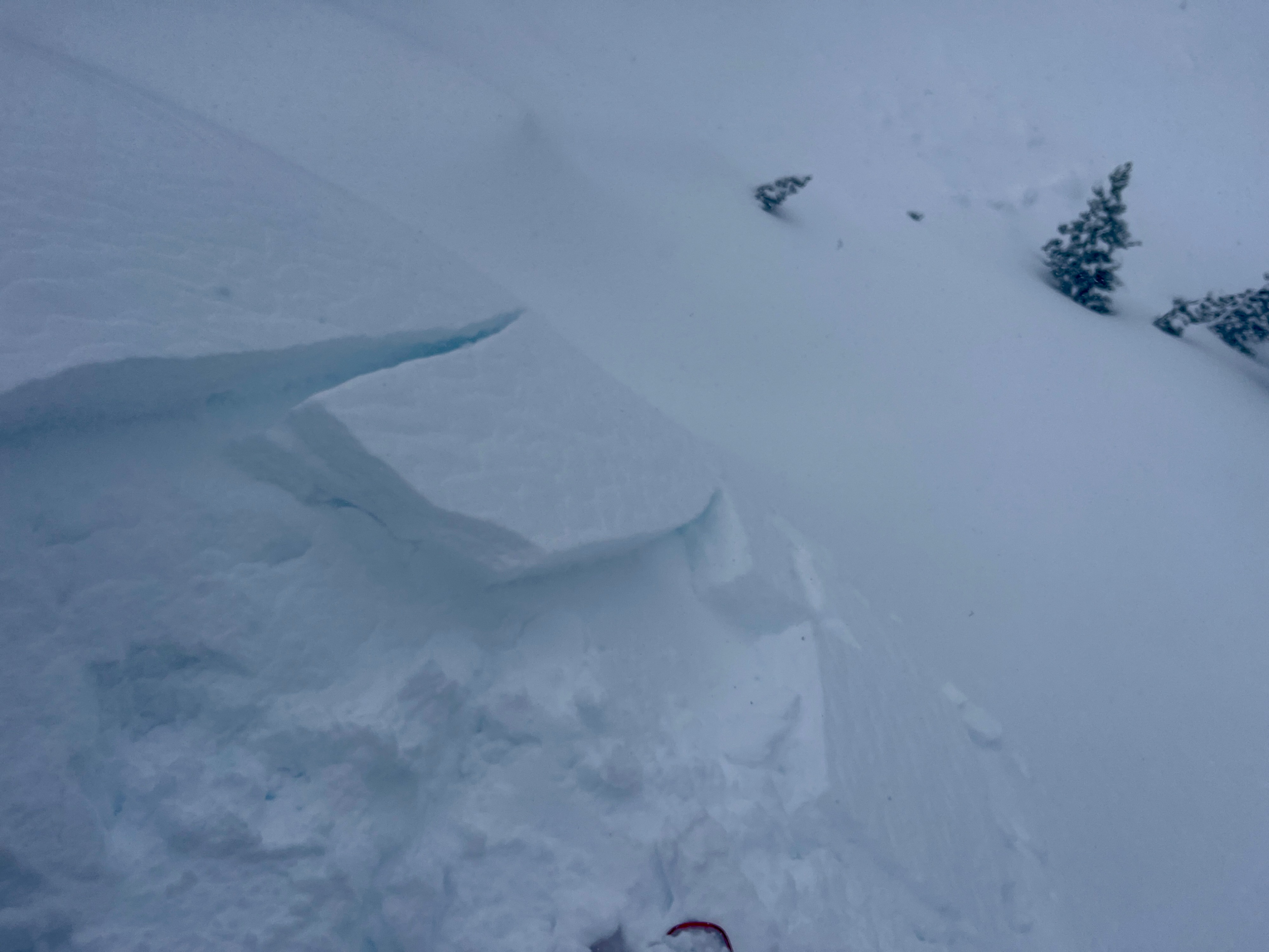
Quick report
- Cracking
- isolated
Today's storm came in warm, with rain leading the charge. Generally, this will cause good bonding with the old snow, and in this case with the surface crust on all aspects from warm temps the past few days. I couldn't get any hand shears to fail on top of the crust, including up to 8000'. However, if it snows 8" or more, we could certainly have a storm slab by tomorrow, and windslabs were already starting to form.
In the long run, that double melt-freeze crust sandwich, buried today, March 4th, will be one to look out for. The 1-2" of snow between the two layers may weaken and facet and crusts act as smooth bed surfaces for a slab. I found this sandwich on W, N and E aspects from the parking lot up to 8050'.
Even 4" of storm snow at mid elevations had slabbed up and showed isolated cracking, perhaps due to warm temps early on. I found only 1 ridgeline wind roll that produced a 6' shooting crack.Weather
- Air Temp
- 24.5
- Cloud Cover
- obscured
- Wind Loading
- moderate
- Rain Elevation
- 4000
- Recent Snowfall
- 12
- Snow Avail For Transport
- small smounts
Temps notably dropped through the afternoon and snowfall pulsed through at S1 or .5"/hour. Winds gusted to moderate out of the W and N.
Snowpack
8070' E on Poster Ridge had 165cm or 5' of total snow. I found a sandwich of 1cm melt-freeze crusts under the 6" of new snow. CTM (RP)x2 and ECTN14 down 15cm below this March 4 crust. I did not find the Valentine's surface hoar in this location, but the January facets were still notable 60cm down. CTH (SC)x2 down 60cm on FC size 1.5. ECTX on the Jan facets.