
Quick report
- Cracking
- specific
Winter is back! It was snowing and blowing hard today in the mountains. We observed constant snowfall (with pulses of over 1"/hour rates) and consistent moderate to strong S and SW winds. The winds were transporting large amounts of snow above 9000 feet and actively building wind slabs in open locations. We found localized cracking in wind-kissed pockets and a weak interface below storm snow on NW aspects. Given the rapidly changing conditions, we avoided avalanche terrain today and enjoyed low-angle deep powder turns.
Observed localized cracking in areas where the wind had stiffened the surface snow.Weather
- Air Temp
- 28-34
- Cloud Cover
- obscured
- Wind Loading
- intense
- Recent Snowfall
- 30 overnight (50 storm)
- Snow Avail For Transport
- large amounts
Snowing and blowing hard today. S1 - S3 snowfall rates throughout the day with moderate gusting strong S and SW winds transporting large amounts of snow.
Snowpack
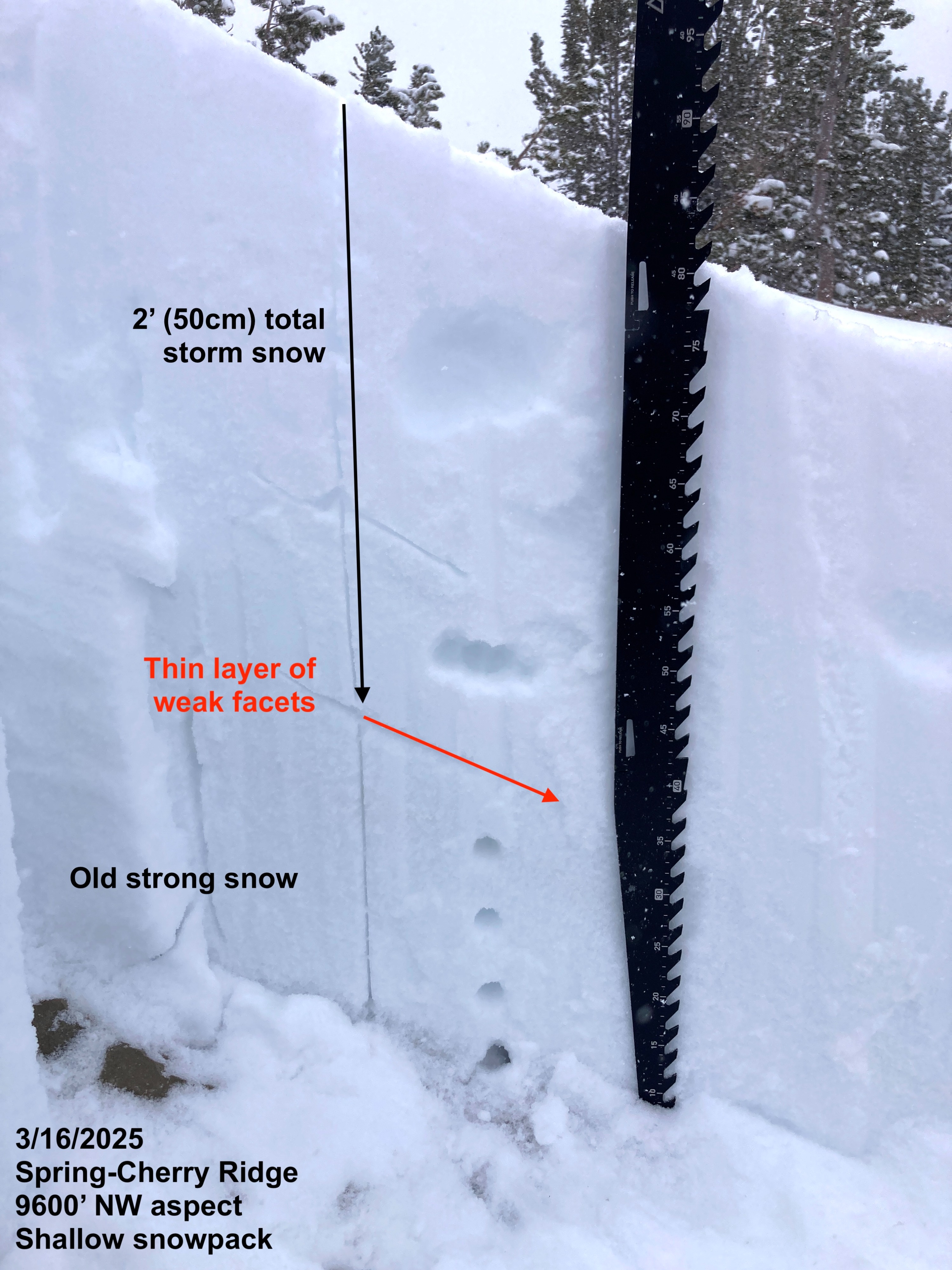
30cm+ of snow overnight, with 50cm+ of new storm snow accumulated since Wednesday evening and increasing depths with elevation. On W, SW, S, and SE aspects, the new snow was bonding remarkably well to the stout crusts it fell on. On NW aspects (and suspect N/NE as well), the new snow fell on weak, faceted snow... which is the most concerning moving forward. Slopes were scoured down to old surface crusts on wind-exposed southerly locations due to the consistent strong winds over the past couple of days.
Dug a quick pit at 9600 feet on a NW aspect and found a thin 1cm layer of F-hard facets between the storm snow and old 1F-hard moist rounding facets that is worth keeping an eye on. ECTX and PST 90/100 END test results, but there was not much of a slab formed in the storm snow (yet).