
Quick report
- Aspect
- Southwest
- Elevation
- 3444 m
- Slope Angle
- 23°
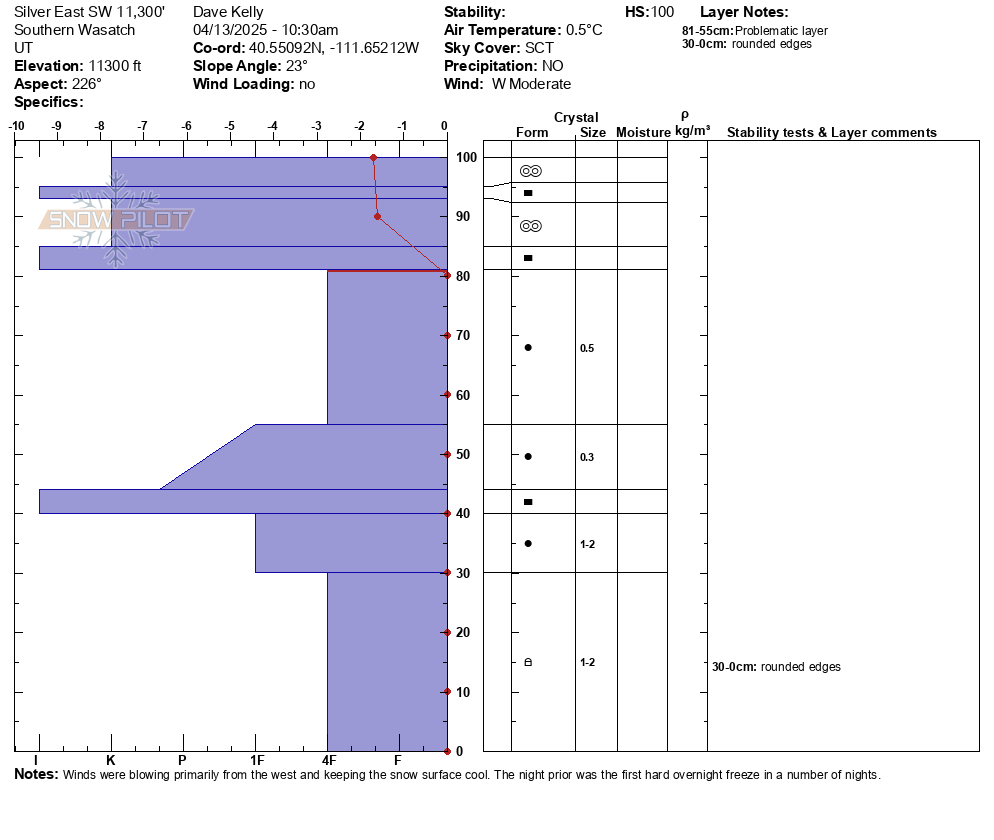
This snowpit was on a southwest facing aspect. Total height of snow was around 3' (100cm) and was pretty isothermal (same temperature) with the exception of the surface snow that was below freezing. Isothermal snow is interesting in that it can be frozen solid like what I found today, or west mush, like what I found yesterday. Isothermic snow can exist as either a liquid, solid, or gas. So even though today's snowpit was frozen solid in the morning, I would guess that if someone dug in the same location later this afternoon the upper layers would be complete mush potentially down to the crust 16" (40cm) from the ground.
As we wrap up our forecast season, I would like to say thanks to the community for all the great observations and avalanche write-ups that were submitted.
Snowpack
- Instability Comment
- <p>There was some rollerball activity on steep slopes, mostly underneath cliff bands on all aspects from the last few days. I also noticed some wet loose avalanches that occurred earlier this week on steep northeast and south facing slopes around 10,600' in elevation.</p> <p> </p>
There was a trace of new snow overnight, that was barely noticeable on most surfaces. Before 7am there were some wind plumes noted off the upper ridgelines of White Pine, but these did not form any new wind drifts. Snow surface was frozen solid at all elevations in the early morning hours. By 11AM the east-south-west facing slopes had lost their supportability below 9,500' and out of the wind zone. North followed an hour or so later as the surface melt-freeze crust broke down. There was great skiing to be had at the highest elevations on smooth slopes that hadn't been affected by wet loose avalanches or roller balls.
Photo of new snow.
Photo of smooth west facing surface looking back towards the Provo Area Mountains