
Quick report
- Aspect
- Southeast
- Red Flags
- Heavy Snowfall, Wind Loading, Cracking, Collapsing, Poor Snowpack Structure
- Elevation
- 3139 m
- Slope Angle
- 10°
- Red Flags Comment
- <p>HI PI rates, blowing snow, cracking was not as sensitive as expected but cracks ran in the soft new snow up to 20'. One loud collapse. Some road cuts on the way to Big Flat cracked but did not run. I was able to initiate a lot of cracking but everything stayed in place. I was not able to isolate columns or extended columns. half broke in the new snow and the other half on Q1 to Q2 shears on top of the underlying facets.</p> <p>Underlying facets are weak and were observed on most aspects.</p>
HS = 24"
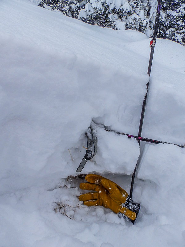
About 7" of 2mm loose facets sitting on the ground capped by a weak crust (rain?). The overlying storm snow (HST=16") is divided by ski pole into the basal 6" 4 finger density early portion of the storm (last night) and the upper 10" fist density portion which fell this morning.
Of interest is a reminder that at the high elevations of the Tushers, snow also facets on sunny aspects.
Photo below is a profile on a wind exposed road cut directly above a 40' wide series of natural cracks that did not run. facets are obvious....Storm snow is about 10-12" here, northwest aspect at 9,800'
Big Flat Snotel HS=27 at 2 pm.
2 photos below of cracking in the new snow.
Snowfall was impressive and will settle out to a great early season base. Drive down Beaver Canyon was exciting with a foot of snow on the road! Photo below is at the pass (10,000') 4 hours after the road was plowed, deep driving but a heck of a lot safer than the drive back to Fillmore on I-15!
I would expect a natural cycle in the alpine where there is enough snow. Things looked pretty scoured yesterday.
Overall a considerable hazard. Any avalanche will likley run to the ground.
Snowpack
- Instability Comment
- <p>I stayed mostly in sheltered areas, the primary hazard will be in the new snow. Storm slab is up to 18" thick as of 1-2 pm today.</p> <p>Considerable hazard.</p> <p>This wold have been #1 if I was in wind exposed areas,</p> <p>Considerable hazard. Increasing as the wind and snow continues.</p> <p>I would also add normal caution for a thin snow pack.</p>
18" seems about right, snotel confirms this. There was close to a foot when I arrived at Puffer Lake and an honest 8" in my tire tracks when I left 3 hours later. About a foot on the road while leaving. 2' on the road when I arrived and it had been plowed less than an hour before that.
A combination of rimed dendrites, dendrites, pellets, needles and graupel, all of the above. Right side up, storm started dense.