
Quick report
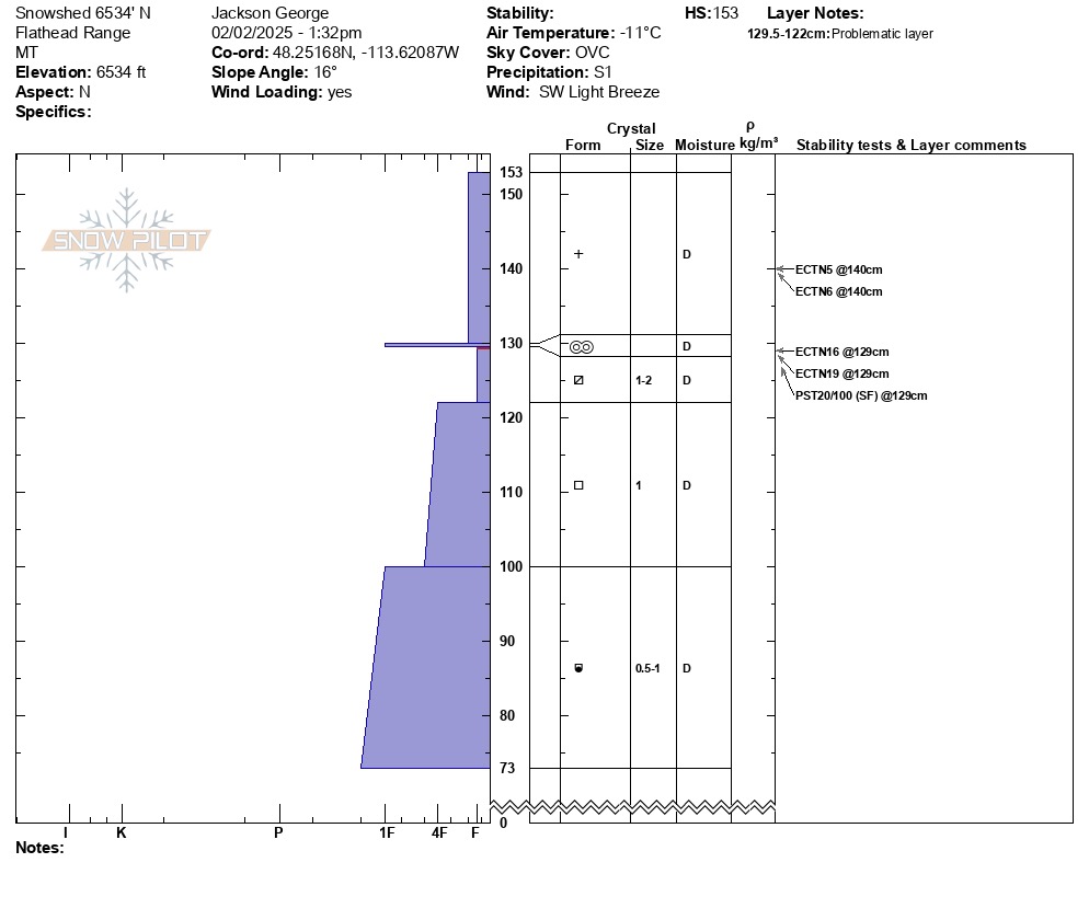
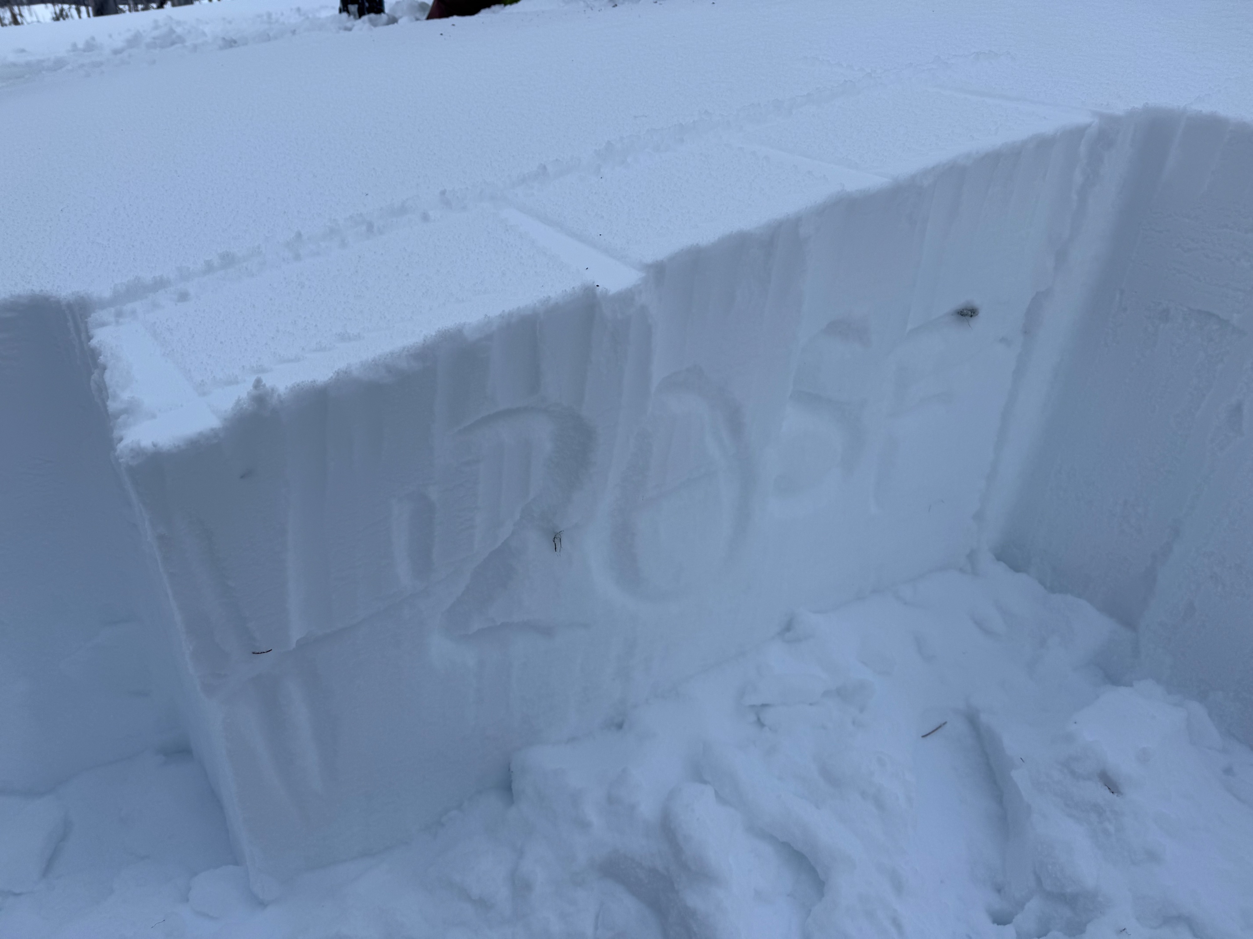
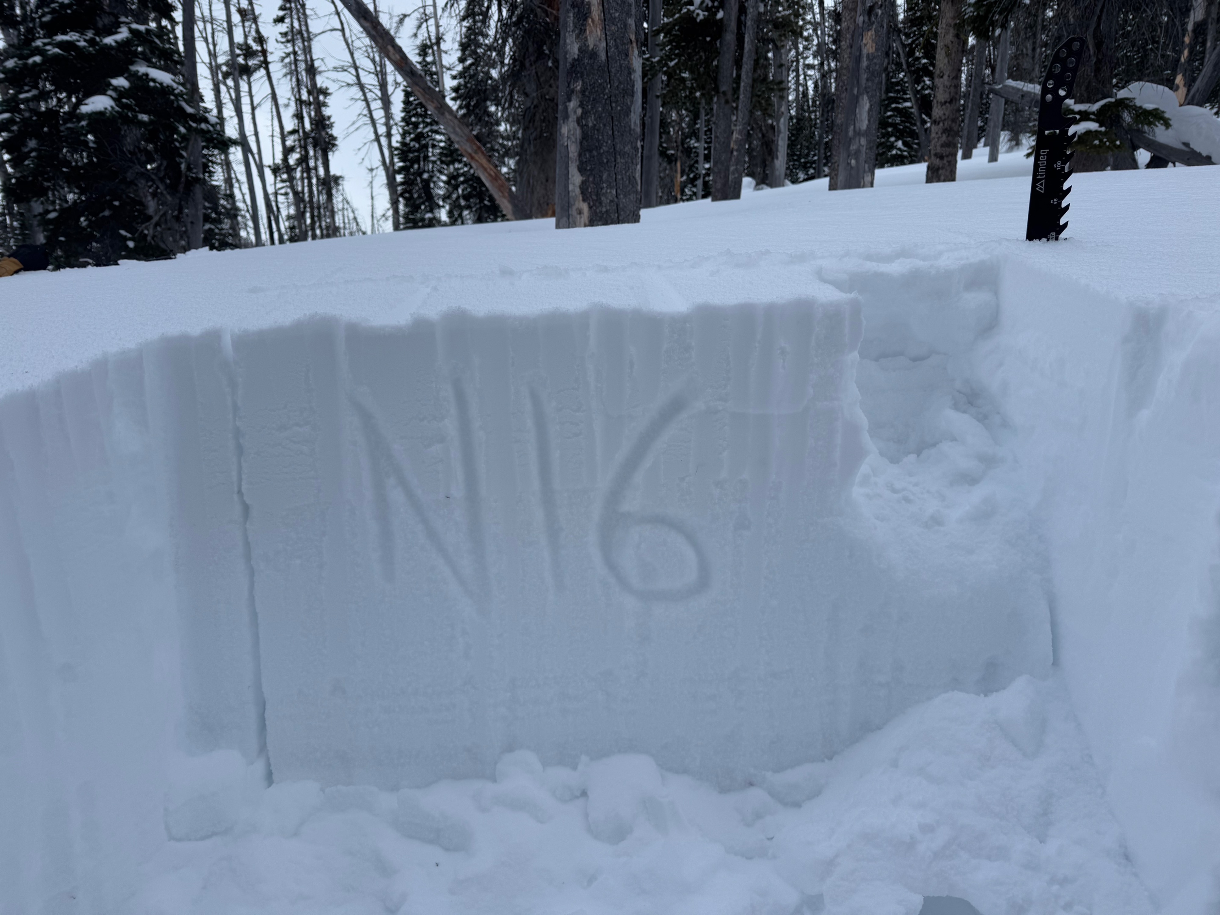
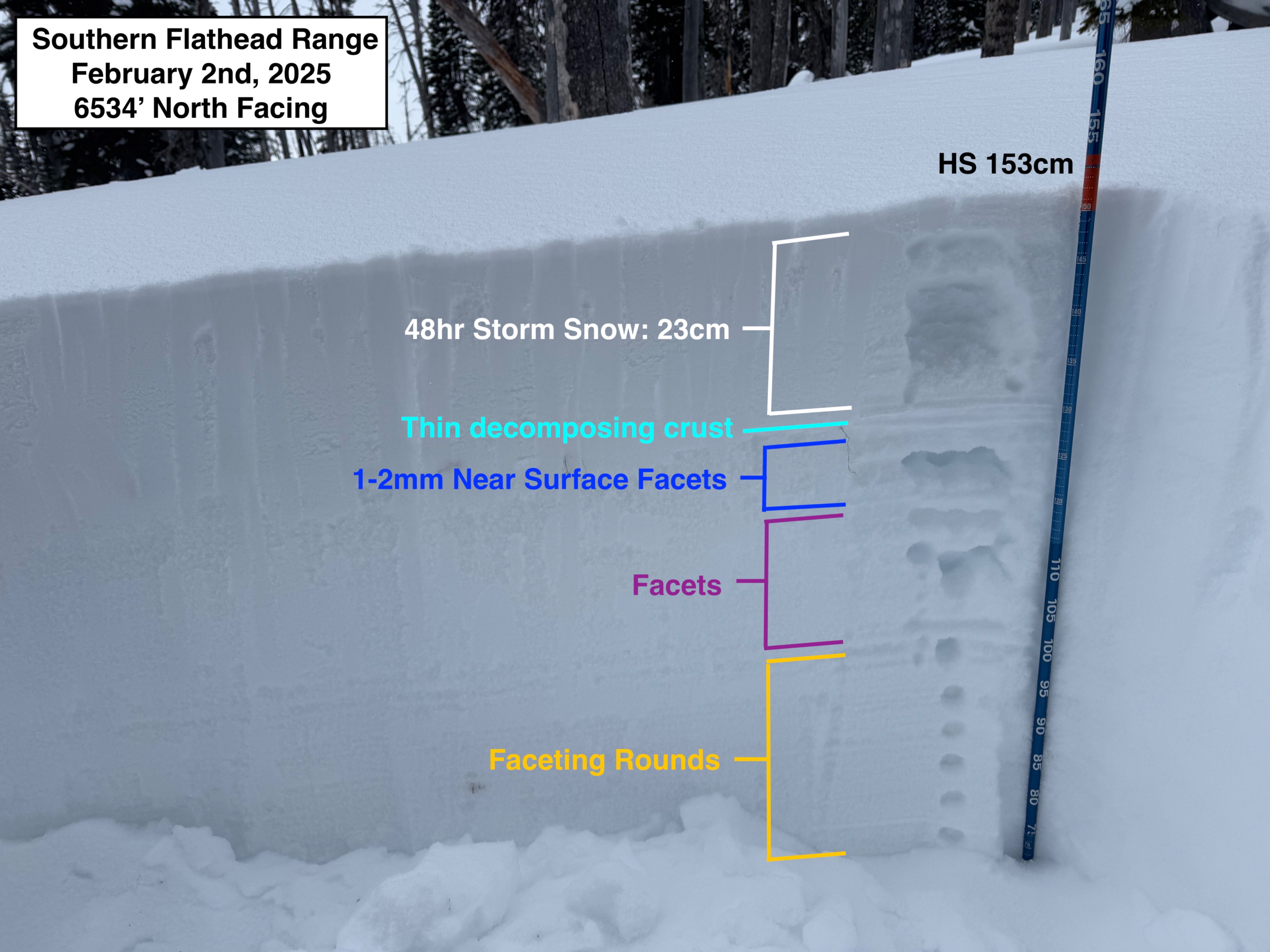
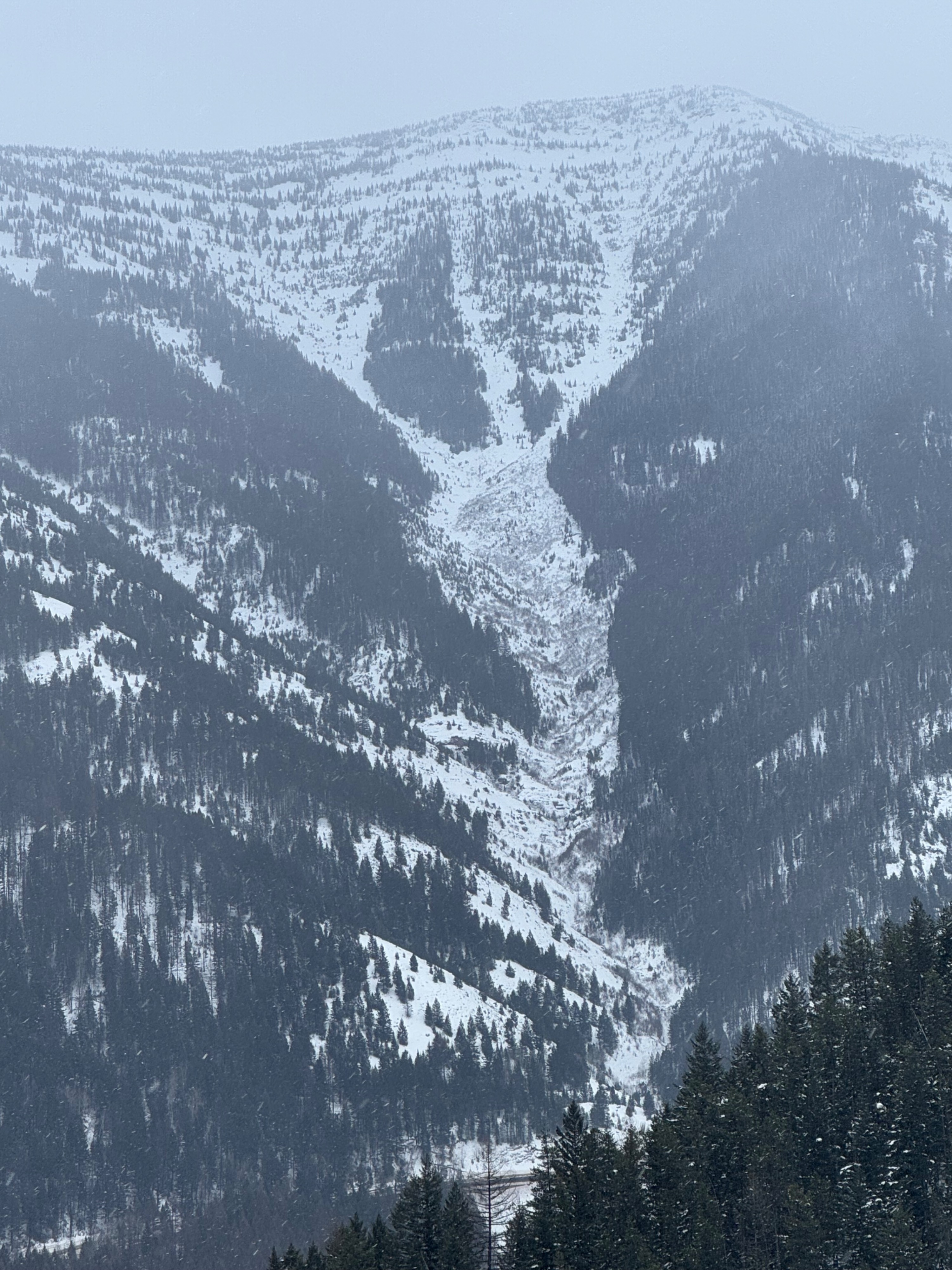
Got out in the field ahead of our next arctic. Objective was to look for avalanche activity, and to see how well the recent storm snow had bonded with our previously weak and faceted upper snowpack. • Observed debris from one wet loose slide late last week at the BNSF Shed 12. (See Avalanche Tab). • Did not observe any signs of instability or recent activity associated the with storm snow. • Moderately good visibility allowed us to scan the upper reaches of the Goat Lick and I-Beam paths on Running Rabbit Mountain. Could not make out any recent crowns or debris in the start zones of these two prominent paths. • Below 4500', there was a thin breakable crust to manage from warm temps and possibly a brief bought of freezing rain Saturday morning. • Between 4500' and 5500', conditions were dramatically upside down and a bit treacherous. 5"+ of medium density powder, resting on top of bottomless quicksand and trap doors. • 5500' to 6500' (our days high point) Was the best quality riding, with semi supportable old snow surfaces beneath up to 10" of recent snowfall. Overall the upper pack was still noticeably upside down due to the heavily faceted old snow surfaces. • No cracking/collapsing observed during our tour. • We dug a pit in a sheltered north facing location. This was intentional as we believe that sheltered northerlies harbored the weakest snow surfaces prior to the beginning of the storm Friday afternoon. • The poor snowpack structure is obvious and widespread, however multiple long column tests produced non propagating results at our pit site and a PST yielded PST20/100 (SF) @ 9 inches below the surface. Out of curiosity, we continued the PST saw cut along the weak layer, which resulted in three additional SF failures after short cutting increments. One older loose wet avalanche observed. Otherwise no signs of instability.
Weather
- Air Temp
- -11
- Cloud Cover
- overcast
- Wind Loading
- light
- Recent Snowfall
- 5
- Snow Avail For Transport
- moderate amounts
• Steady light snowfall throughout our tour. About 1 inch fell on the canyon floor and maybe twice that up high during the day. •9-10 inches of settled storm snow observed at upper elevations. (~48 hour total since Friday afternoon) • Light-Moderate winds were drifting snow into leeward fetches above about 6200'. • Arctic air reached the Essex Area late afternoon. We traveled eastbound through the canyon after 4:30pm and encountered moderate-heavy snowfall rates with areas of blowing snow and poor visibility. Stormy conditions moderated substantially east of Hungry Horse.
Snowpack
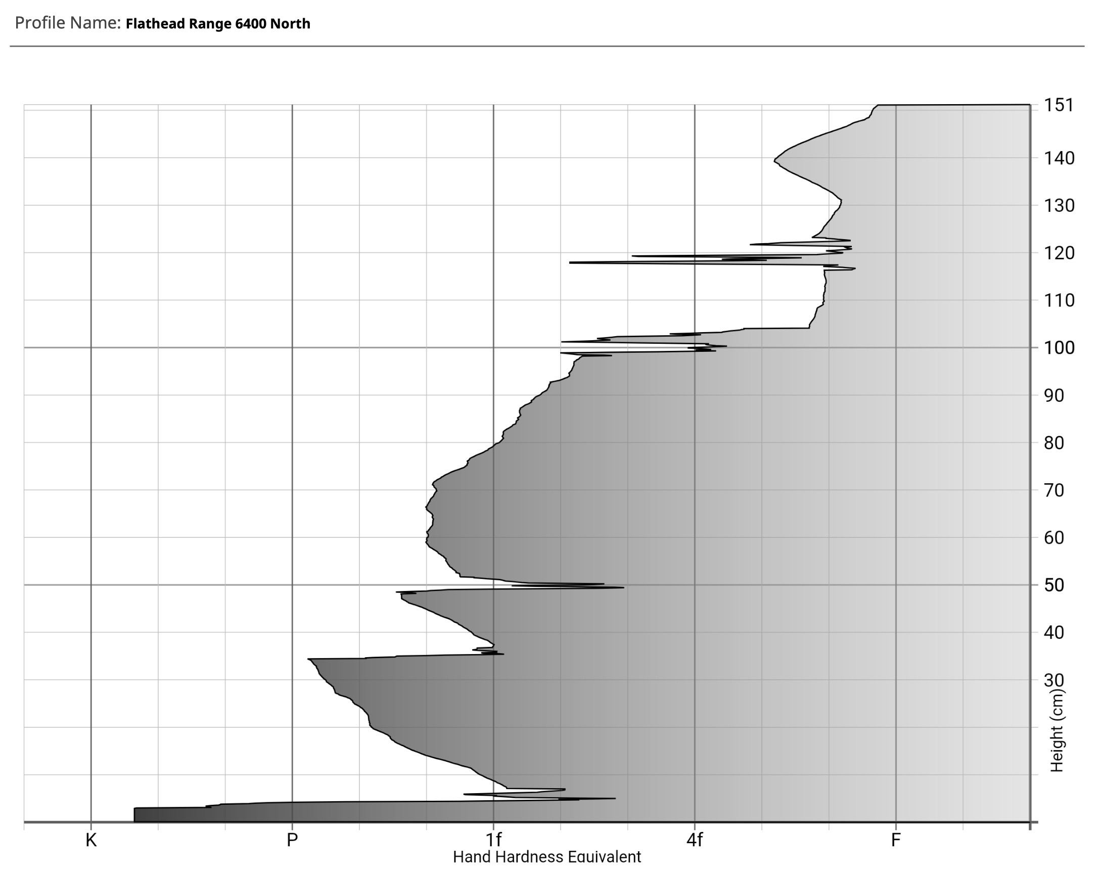
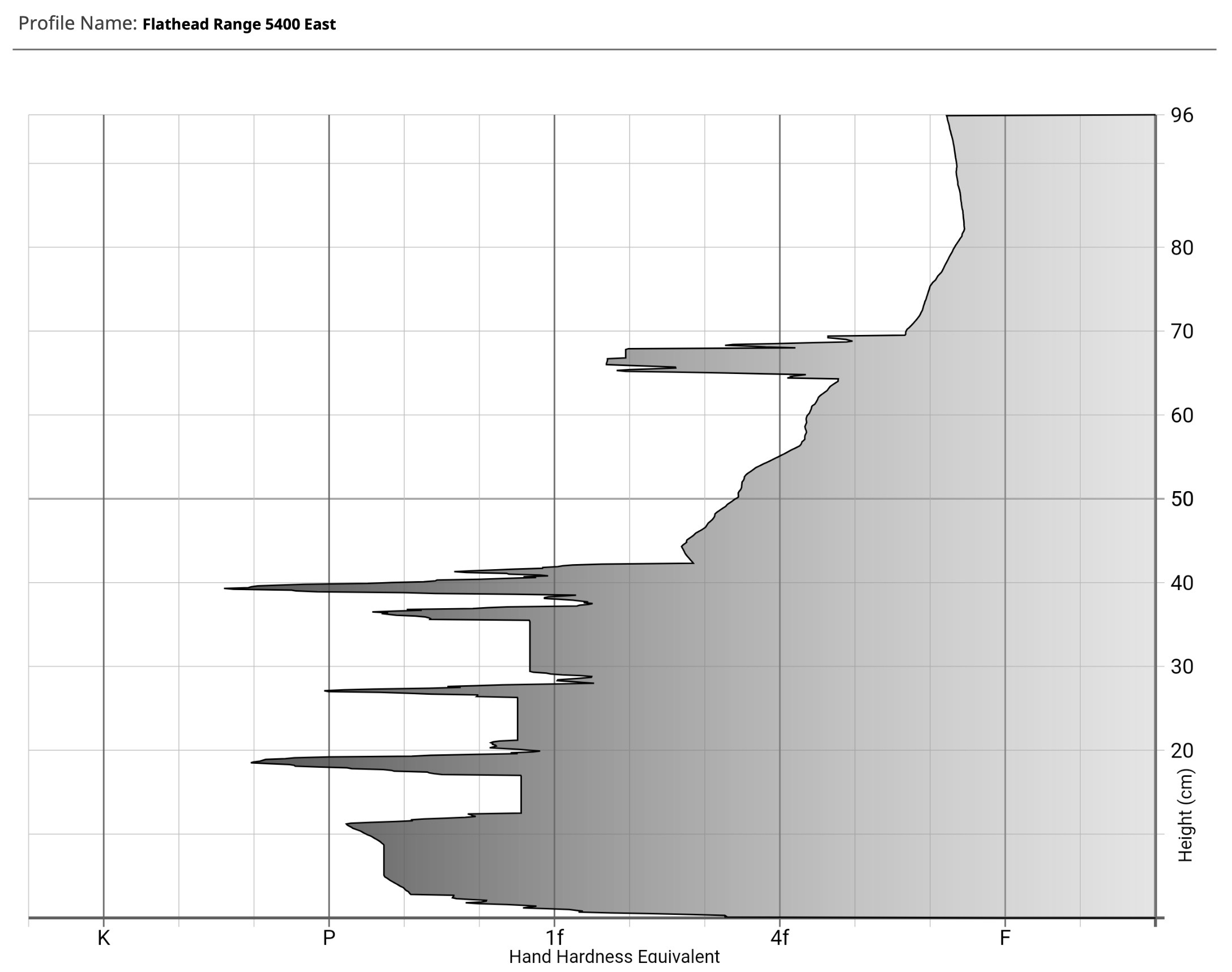
• A very weak snowpack structure is evident above 4500'. It seems likely for us to see a persistent slab problem develop on all aspects above that elevation in the coming days. • Below about 4500', warms temps prior to and at the start of the weekend storm have helped consolidate and heal the weak snow in the upper pack. •See Snowpilot Profile and Snow Scope Hardness Profiles Attached for more details.
Avalanche
- Size
- D2
- Type
- WL
- Aspect
- E
- Trigger
- N
- Elevation
- 4100 ft
See Avalanche Tab