
Quick report
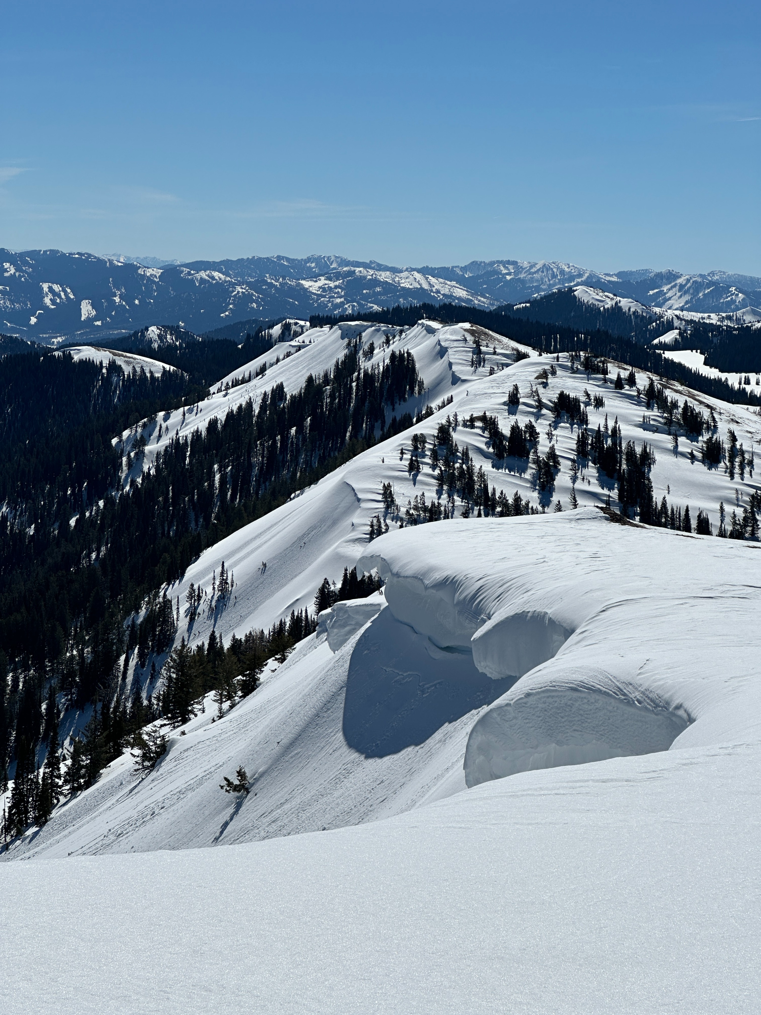
We had the pleasure of traveling through the Big Holes today with Don Sharaf to familiarize ourselves with the terrain and gain a better understanding of the current snowpack. Current above-average temperatures limited the snowpack to a superficial freeze last night. On low elevation and solar aspects, the snowpack was softening by mid-morning and becoming unsupportable in various locations. By mid day, all aspects and elevations had softened. The top 12 inches of snow on all aspects was wet to moist by the afternoon. The snow is especially unsupportable near exposed rocks, plants, or logs. Pretty much any dark object has created soft wet snow - be careful when traveling near these objects as you may sink further than expected. Temperatures increased quickly throughout the day with a high of 50 F in the afternoon. We saw natural roller balling on east and south slopes, as well as large cornice formations along ridge lines. While these cornices have not fallen yet, warm temperatures are likely increasing the chances of a cornice break. While the snowpack is thin and near isothermal at lower elevations (7000'), elevations closer to 9000' still hold a deep snowpack. See the snowpack summary.
Weather
- Air Temp
- 46
- Cloud Cover
- clear
- Wind Loading
- previous
Clear skies all day. Warm weather. At 1:00 PM, temperatures at 8200' were 46 F. At 3:00 PM, the temperature had risen to 50 F. Winds were calm with light gusts from the west at 8800'.
Snowpack
Above 8000', the average depth of the snowpack in protected areas is ~200 cm (6.5 feet). Closer to the ridgelines, we found the snow pack was shallower where strong winds and sun have maintained a shallower snowpack. Exposed west-facing and south-facing slopes are stripped, and the ground is exposed in some locations. On north and east-facing aspects, the snowpack is deeper where winds have previously loaded leeward slopes.
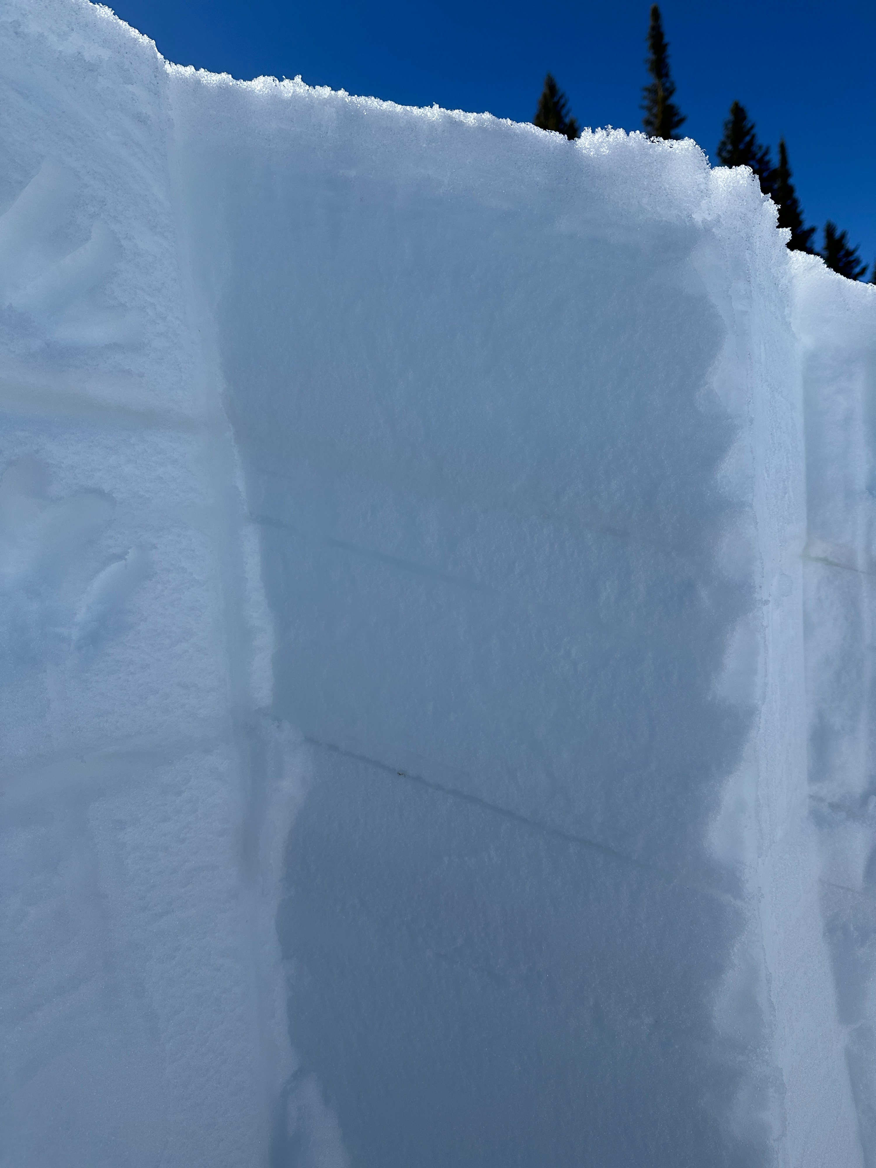
We dug onto a NE-facing aspect at 8600' near Realy Ridge and found a generally stable snowpack (for now). The total height of the snowpack in this area was 222cm (~7 feet). The upper 22 inches of the snowpack have several distinct layers from recent snowfall and - referencing winds in the neighboring ranges - strong winds. As temperatures warmed today (up to 50F!), the top 3 inches of the snow was becoming wet and unsupportable. Below, various layers of moist snow were present down to a layer of preserved near-surface facets ~18 inches down. Our extended column test (ECTX) did not propagate or collapse on this NSF layer, but when we pulled the block off with our shovels, it easily sheared on the NSF layer. There have been multiple recent avalanches in the neighboring Teton Range that have failed on these deeper layers; while temperatures warm, these preserved weaker layers could become more reactive.