
Quick report
Small rollerballs releasing on steep slopes near tree line and below.
Weather
- Air Temp
- 30
- Cloud Cover
- overcast
- Rain Elevation
- 4500-5000
- Recent Snowfall
- 12
- Snow Avail For Transport
- small smounts
Warm and wet. Precipitation lasted all day, but let off a bit around 1-2pm. Rain below 4500' and up to as high as 5000'. S1 snowfall above the rain line, with periods of short bursts of heavier snowfall. I stayed below the ridgeline, but could see strong wind gusts swaying large trees higher in elevation.
Snowpack
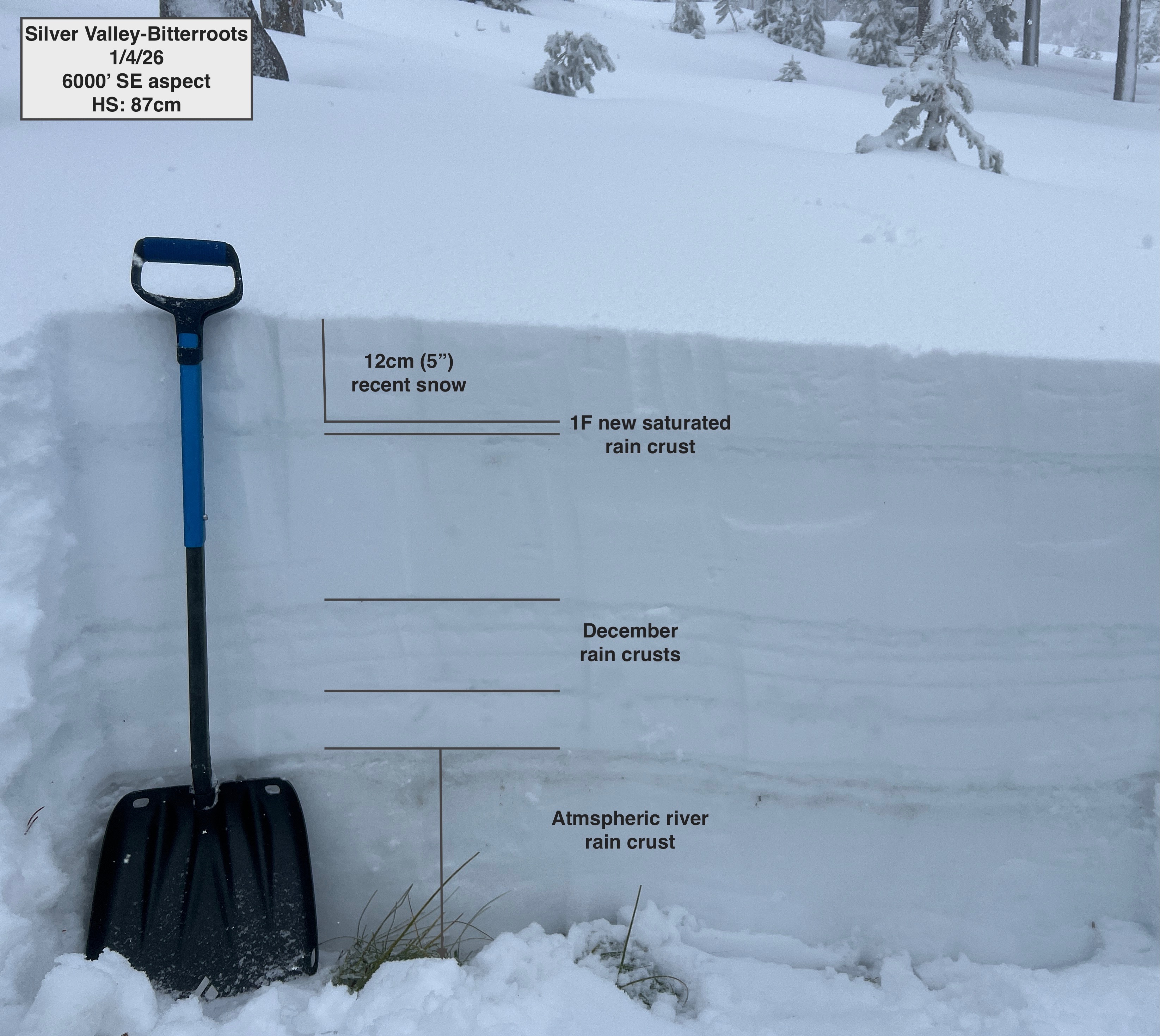
After several days of warm temperatures, rain, and wet snow, the snowpack at 6000' was saturated all the way to the ground. We observed a new rain crust at that same elevation, which was buried about 5 inches below the surface. The recent rain crust was 1F and has not refrozen yet, and we easily punched through it with our boots. The most notable result from two compression tests was a progressive collapse with 11 taps below this new layer. Below that, the snowpack was fairly similar in hardness, mostly 4F-1F moist and wet grains.
The snowpack has taken on an impressive amount of rain and meltwater. Below tree line has suffered considerable damage as a result, and bare ground is peppering the slopes again.
Avalanche
None observed.