
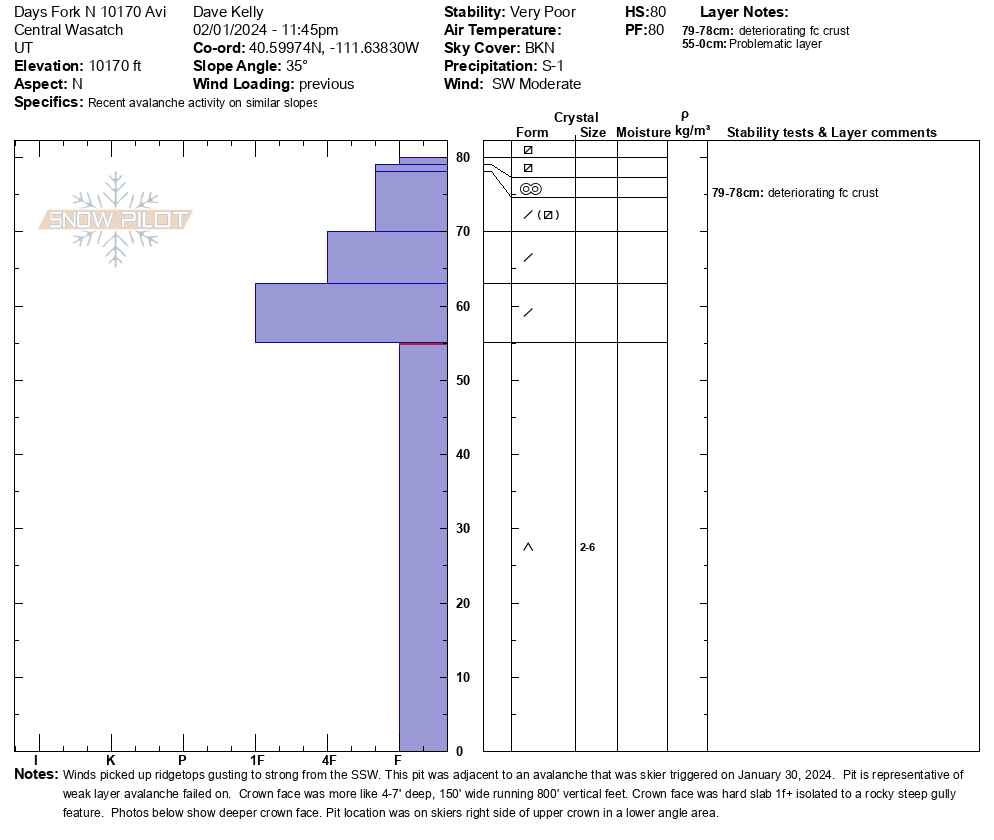
Quick report
- Aspect
- North
- Red Flags
- Recent Avalanches, Poor Snowpack Structure
- Elevation
- 3109 m
- Slope Angle
- 35°
- Red Flags Comment
- <p>Poor snowpack structure is particularly an issue in steep, rocky terrain with a thin snowpack.</p>
We went to look at a skier triggered slide in Days Fork. This avalanche was triggered on January 30, 2024 and you can read more about it HERE. This structure matches what Andy and I found in Cardiff on January 30th. This snowpack structure is poor and there are still weak dry facets under a slab of snow. In some areas like what G.Kazickas/Babbitt found on Toledo, the facets near the ground are healing (moist with rounded edges) but without knowing what I am traveling on I am continuing to assess steep terrain before committing to a slope. It's the tale of two snowpacks: one could avalanche and the other may not.
It's always a good idea to map the snow surface ahead of an incoming storm. The only areas we were finding weak snow at the surface was on north aspects at the upper elevations - above about 9,500'. Elsewhere, the snow surface was damp or crusted. With sustained southerly winds, fresh wind drifts at the upper elevations on Friday may be reactive as they'll be forming on top of this weak snow.
Snowpack
- Instability Comment
- <p>The PWL remains an issue on slopes with a thin snowpack. With more snow on the way, the trend for this problem is now increasing.</p> <p> </p>
Southerly facing (solar) aspects were a stout melt-freeze crust on the ascent and softened up below 9600' on the descent. Northerly facing slopes had a layer of NSF on the surface that was drier above 9600'. Below that elevation, the surface was damper. Travel was still soft on lower-angle north-facing slopes. There was just under an 1/2" of new snow that fell throughout the day.