
Quick report
- Red Flags
- Recent Avalanches, Wind Loading, Poor Snowpack Structure
- Red Flags Comment
- <p>Many slopes around the Murdock and Bald Mt. area had recent new snow sluffing with a few breaking into some older snow as they moved down hill. Winds on the ridge lines were moving the new snow, but generally light winds elsewhere until early afternoon when the southeast winds picked up.</p>
Beautiful winter like day up on the pass with a foot of new snow.
Noticed these recent slides on the north side of Murdock Peak today. Mainly storm snow sluffs that started as shallow wind slabs or minor slufing that entrained the new snow as they moved downhill. One of these did appear to brake into some deeper weaker snow leaving a nice debris pile.
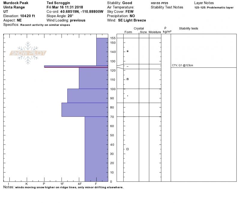
A quick snow pit in the Murdock area shows the recent snow with two distinct weak layers marked with the saw and card. Maybe not enough weight from the past storm to stress these weak layers, but wet heavy snow is forecasted and could tip the scales??
Snowpack
- Instability Comment
- <p>No recent avalanche activity that involved the weak layers buried in the snow pack, but many slopes are thin and have a weak snow pack structure in the Bald Mt. area. The stability was generally good today, but it is a thin snow pack winter and with another storm on the way more weight and stress is added increasing the avalanche danger. </p> <p>Winds today were blowing the new snow into shallow and generally manageable wind slabs, but the winds were picking up this afternoon and these wind slabs will likely be deeper and wider with the approaching storm.</p>
Only an inch or so overnight, but up near Bald Mt. a nice foot of new medium density snow to freshen things up from Wednesdays storm.