
Quick report
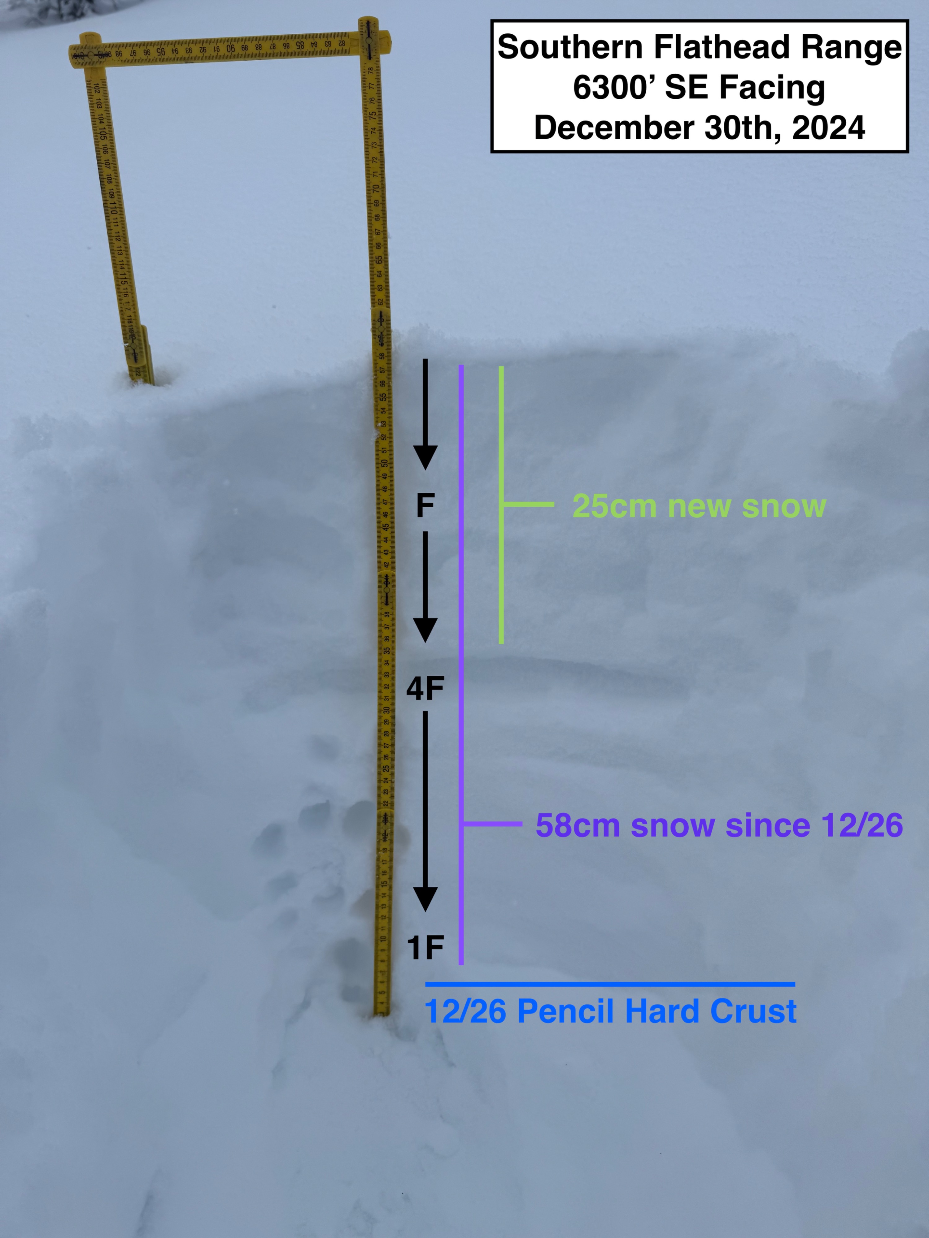
We enjoyed a serene storm day in the Middle Fork today. • Lots of new snow out there. About 35cm at upper elevations and 15cm on the canyon floor since this morning. • Winds were absent. And there was little to no sign of any wind effect in the last 24 hours. • No signs of instability or recent avalanches, however we did not get many opportunities to look a steep terrain capable of natural slides. • Recent snow since 12/26 has fallen rightside up (Hand hardness increases with depth) • Below 5000' the recent snow has fallen on an old moist/wet surface. It is mostly supportable while skinning uphill, but proved to be a bit challenging during our descent. No signs of instability observed.
Weather
- Cloud Cover
- overcast
- Wind Loading
- none
- Recent Snowfall
- 35
- Snow Avail For Transport
- moderate amounts
Calm and cloudy day. Light snowfall all day until about 130pm, when snowfall intensity ramped up to S5 for the last few hours of our tour. Temperatures were near and possibly above freezing on the canyon floor (did not measure).
Snowpack
We opted for conservative terrain today and did not dig a full pit. We did dig some quick hand pits though to get a general sense of the upper snowpack. Handpit at 6300' SE facing (1230pm): • HS 140cm • HN24 25cm • 58cm of recent snow since Dec 26th. 12/26 is marked by a pencil hard crust on this southerly aspect (wind and warm temps). Above this layer we found rightside up snow toward the surface. • This handpit info was collected around 1230pm. Around 130pm, snowfall intensity increased dramatically. An additional 10cm of new snow accumulated by 4pm. • By days end, we measured 15cm of new snow resting on our truck at 3800'