
Quick report
- Aspect
- Northeast
- Red Flags
- Heavy Snowfall, Wind Loading, Poor Snowpack Structure
- Elevation
- 2774 m
- Slope Angle
- 30°
- Red Flags Comment
- <p>A lot of new snow available for transport and obvious signs of wind loading at the upper ridgelines, such as growing cornices and pillow-shaped loaded snow. </p>
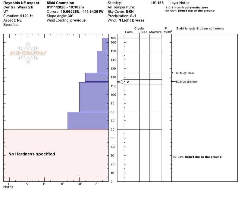
Hoped to head out and continue investigating the persistent weak layer of new surface facets that has begun giving us results in our tests on aspects other than Southwest through Southeast. This interface is about 2 feet down, dependent on elevation and likely formed between Christmas and New Years when we had really cold temperatures. This is an interesting layer because it does not revolve around a crust, as the south aspects do, but is showing propagation in our pits.
Today I was able to find that layer, and produce consistent propagation in the 20s.
This layer is now consistently showing results in our snowpits, we still have not seen and human or natural triggered avalanches on this layer. While it baffles me a bit, as we continue to add more snow and wind to this layer I am interested to see if we begin producing human trigger and natural avalanches - or if we no longer see results on this interface. All we can keep doing is digging down to that layer, and seeing what type of results we get on it throughout the next few storm systems.
Photo of snowpit with full propagation on NE aspect - Reynolds
Photo of incoming dark clouds
Snowpack
Great surface conditions.