
Quick report
- Cracking
- widespread
- Collapsing
- widespread
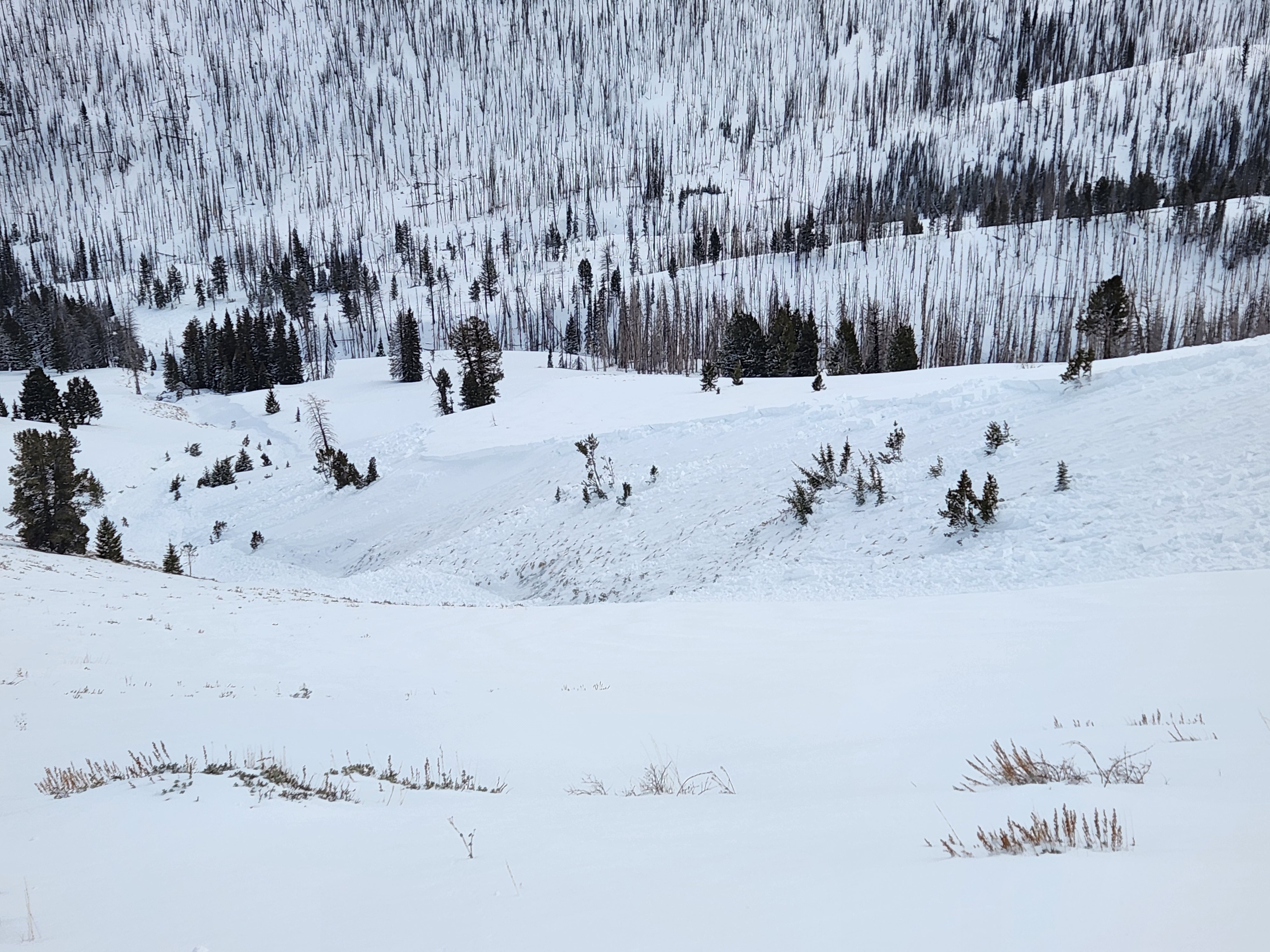
I remotely triggered 3 avalanches, from safe locations, in wind-loaded terrain. The slides occurred in cross-loaded gullies and all spanned at least 500 feet. I haven't seen these locations slide in the 12 years I've been working here. Some relatively small natural avalanches released this afternoon in W-NW facing, sheltered low elevation terrain.
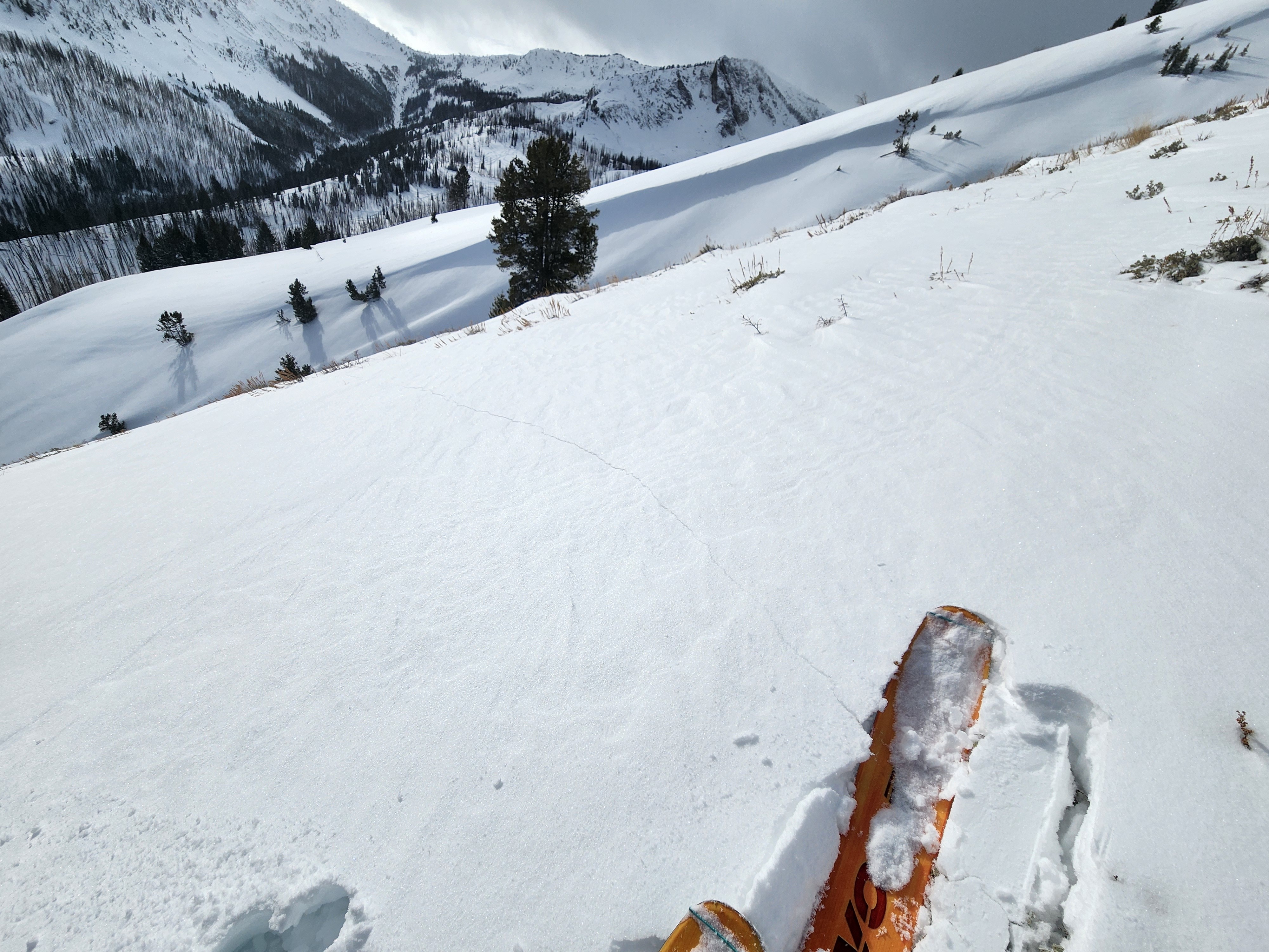
Four separate collapses/cracks traveled at least 700' (3 remotely triggered avalanches, 1 long running collapse E-SE at 9100' near ridgeline), all in obviously wind-loaded terrain, all collapsing on the 1/6 persistent weak layer(s). One other slope cracked, extending about 50': S-SW aspect near 9000' where there was about 15cm of dense, moist new snow (direct sunlight) above 10-15cm of crusts and facets.Weather
- Air Temp
- Low 20s at noon at parking lot, mid 30s on return: 20s at 9000'
- Cloud Cover
- broken
- Wind Loading
- previous
- Rain Elevation
- N/A
- Recent Snowfall
- 6" (15cm) at parking lot, 8" (20cm) at summer trailhead, 10-12" (25-30cm) above 8300'
- Snow Avail For Transport
- small smounts
Skies started CLR to PC, became overcast to obscured by 3 PM. Winds were moving a little snow on alpine ridgelines in the Boulders in the morning, decreased to light wind at Brodie/Baker ridgeline 3 PM.
Snowpack
Extermely variable snowdepths and structure due to wind in the exposed middle elevation terrain where I traveled. Snow depths ranged from 20-30cm on winded solars to 170cm in hard wind whales near ridgelines - it's difficult to determine "representative" locations in this area.
50-70cm on sun exposed S-SW around 8000-8500' with moist new snow, with a density change half way down in recent storm snow. New snow did not get moist/wet enough to cause wet loose issues - the afternoon cloud cover kept this at bay. Then 1cm crust from Tues 1/16 - the new snow was bonding to the crust fairly well. Below the crust, some DF from last week's storm and then the crust and FC mess.
See Avalanche entries for snowpack data on E-NE 8100-8400' and E-SE 8700-9100'. The collapse that triggered the D2 slide near 9000' cracked for hundreds of feet through heavily wind-loaded starting zones in the Brodie drainage (N-NE 9000-9200' = 100-170cm) but, surprisingly, did not release any slides on that side of the ridge.
Avalanche
- Size
- D1.5
- Type
- SS
- Count
- 5
- Aspect
- NE
- Trigger
- AS
- Elevation
- 8200 ft
Two remotey triggered slides: one at 8100' from about 100' away, one at 8300' from about 10' away. Both slides were in cross-loaded slopes above a small seasonal creek. The slabs ranged from 1.5-2.5 feet thick. The slides failed at the top of a thick layer of well developed facets (1/6).