
Quick report
- Aspect
- North
- Red Flags
- Wind Loading, Cracking, Poor Snowpack Structure
- Elevation
- 3170 m
- Slope Angle
- 30°
Photos are:
1: Cracking in the new snow
2: Ice formations on trees
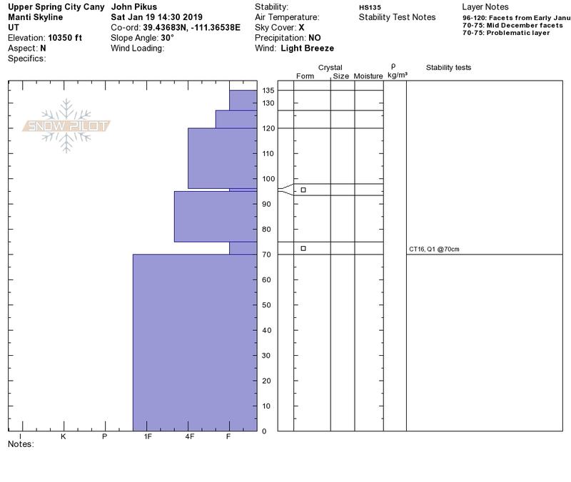
3: Snowpit photo
Covered quite a bit of ground in the central Skyline area, traveling over slopes of all aspects. I was in Pleasant Creek Canyon yesterday and there was generally a couple more inches there than I found in Spring City Canyon. As I mentioned above I think the relatively small snow totals from the storm in this part of the Skyline resulted in fewer instabilities. I was able to locate two faceted layers in the snowpack. I still would not trust these layers on steeper slopes especially in light of yesterday's accident at Electric Lake. My condolences to the victim's family and friends.
Snowpack
Generally 4-8 inches of new snow from this week in the terrain I covered. Exposed south and west facing slopes were mostly scoured while north and east facing slopes were windloaded, although many south and west facing slopes did have about 2 inches of low density snow (I'm guessing from late in the storm yesterday when winds died down.) Overall the snow seemed well bonded in most sheltered areas. Experienced one incident of cracking at about 9,000 feet on a NW facing slope but this was an isolated incident (aside from cracking in shallow wind drifts on ridgelines.) Seems like this area of the Skyline didn't receive enough new snow to create widespread instability. That being said, I avoided traveling in steeper wind loaded areas and since visibility was poor I was unable to get good views of windloading or avalanche activity on these types of slopes.