
Quick report
- Aspect
- Northeast
- Elevation
- 2499 m
The Christmas and New Year rain events sealed up the snowpack making it supportable, and the Jan 4/5 storm finally put down some snow at low elevations making travel easier. Below 7,500' it is still a challenge, but things change quite a bit above that elevation with a snowpack generally about a meter deep (3-4 feet) on a very supportable base which makes for easy travel and riding.
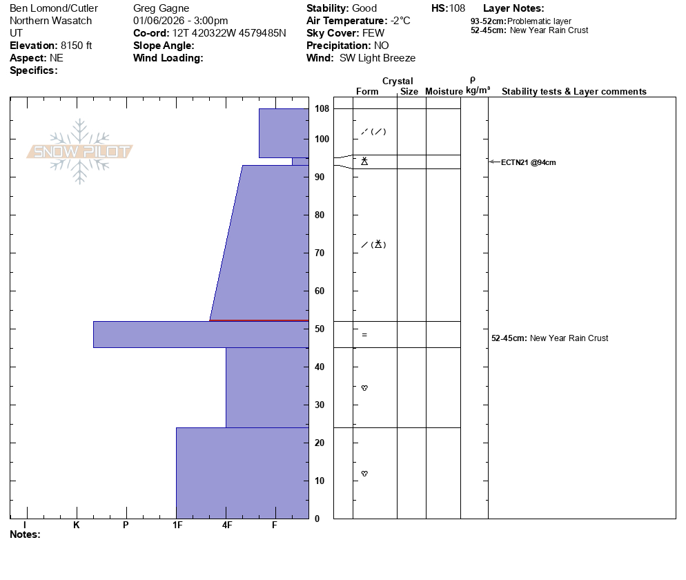
Between 7,500 and 8,500' the New Years Rain Crust (NYRC) has a layer of graupel and I was able to get some clean shears right above the NYRC, but I also saw some evidence of weaker crystals and will watch for possible faceting above this crust.
Overall, I saw a strong snowpack with no discernable weak layers other than some graupel layers that fell during recent storms. Graupel is not a PWL and will heal more quickly. Going forward, I'll focus on:
- possible faceting above NYRC layer
- PWL above 8,500'
Photos:
- Road conditions at North Fork Park TH
- Snowpits as I gained elevation
- Toward Willard
- Bailey Springs Trees
And a video showing the Ben Lomond headwall toward Willard
Snowpack
- Instability Comment
- <p>There are recent and new wind drifts above 7,000' although they were mostly unreactive to ski cuts and other stability tests. The only interesting result I got was on a wind-loaded slope above the weather station at 7,800' with ECTP21 x2 failing on a layer of graupel down 35 cms.</p> <p>With increasing winds, the trend for this problem is also increasing.</p> <p>I only made it to 8,500' where the faceted snow down near the ground was damp, 1F-hard and continuing to gain strength. But I'm unsure of upper elevations where some weaker facets and depth hoar may still be present.</p>
The Ben Lomond region did quite well in the Jan 4/5 storm with 60 cms (2') of settled storm snow and nearly 3" of water. The road and low elevations are passable with 5-10 cms depth near the trailhead, 30 cms depth at 7,000', and once you reach 7,500' depths quickly increase with 60 cms at 7,500' and over a 100 cms above 8,000'. On a wind-loaded slope above the weather station at 7,800' I measured snow depths of 160 cms.
Above 7,500' there is generally 60 cms of storm snow above the New Years Rain Crust