
Quick report
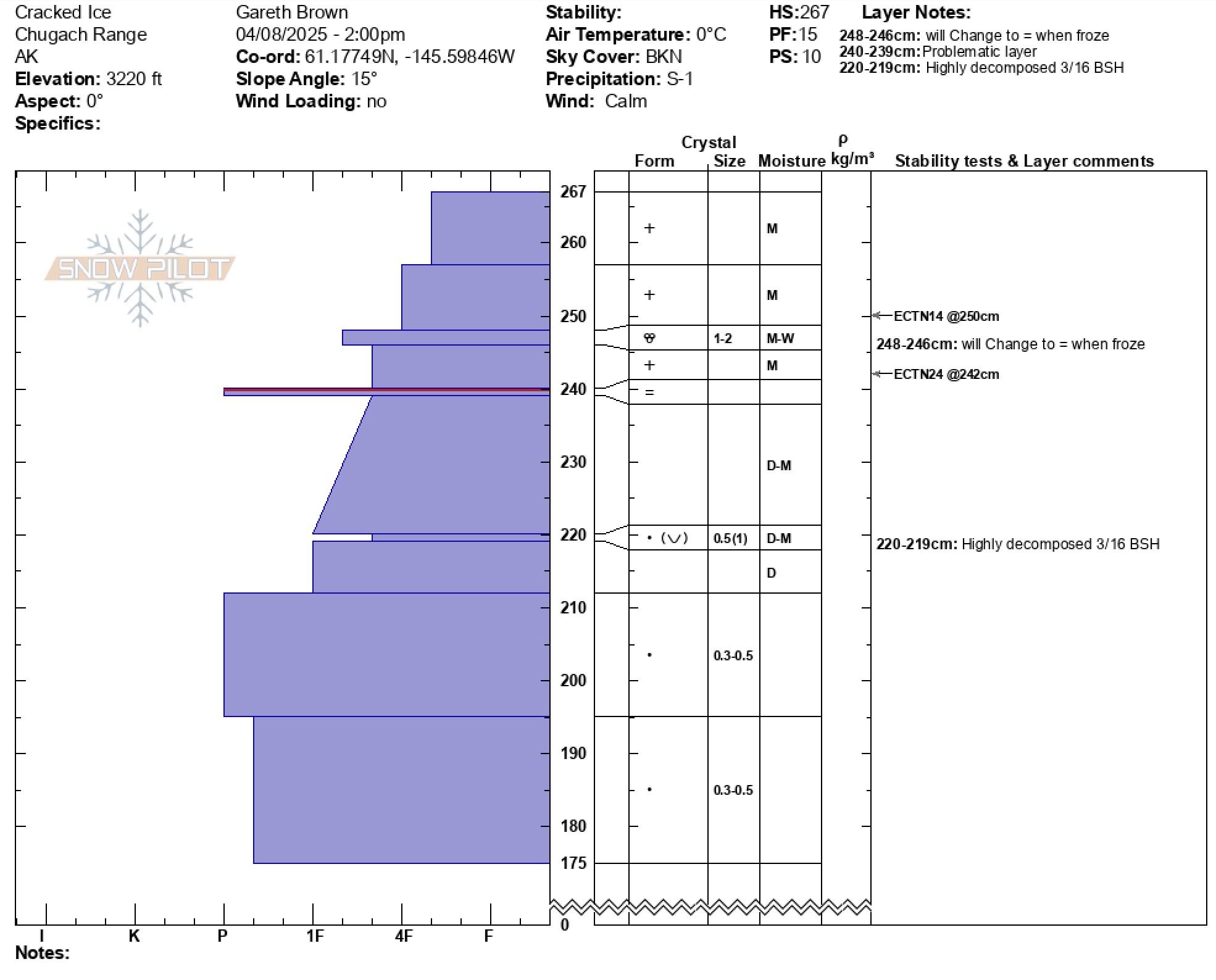
At the road (1800') there was 2 inches of moist new snow atop a supportable moist upper snowpack. New snow depths gradually increased with elevation and were 10 inches by 3200' with a crust at the interface from the 4/2-3 Clear weather warmup and a moist -wet layer of snow in the bottom of the storm slab from peak storm freezing line that will turn to a crust once refrozen. Hand shear tests produced moderate- hard results and Pit results @3200' produced ECTN14 down 20 cms and ECTN 24 at the 4/4 interface crust.
Upper snowpack was right side with structure and moisture content indicating that strength will be increasing as temperatures decrease in this location.
No signs of instability, natural avalanche activity observations were limited by poor visibilityWeather
- Air Temp
- 32
- Cloud Cover
- broken
- Wind Loading
- none
- Rain Elevation
- above 3200' at begining of storm
- Recent Snowfall
- 2-10 inches
- Snow Avail For Transport
- small smounts
Near freezing temps with sucker holes leading to light snowfall.
Snowpack
Above freezing temps and rain has transitioned the top 2 feet of the snowpack from dry to moist over the last 4 days. The mid snowpack shows high strength and good structure. The 3/16 BSH was identified and is highly deformed (rounded), laying flat, and mixed with rounded grains, indicating a low likelihood to act as a failure plane.