
Quick report
- Collapsing
- isolated
Several inches of very light density powder overnight. HS ranged from 45 inches (115 cm ) to 65 inches (165 cm) between 9,400 and 10,400 feet. Exposed ridges were also stripped bare in places. Some new wind slab forming on exposed upper elevation terrain but still very soft with no cracking observed.
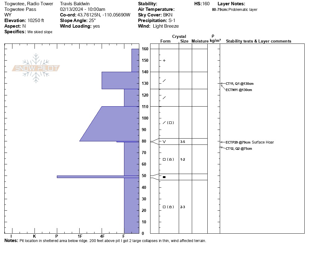
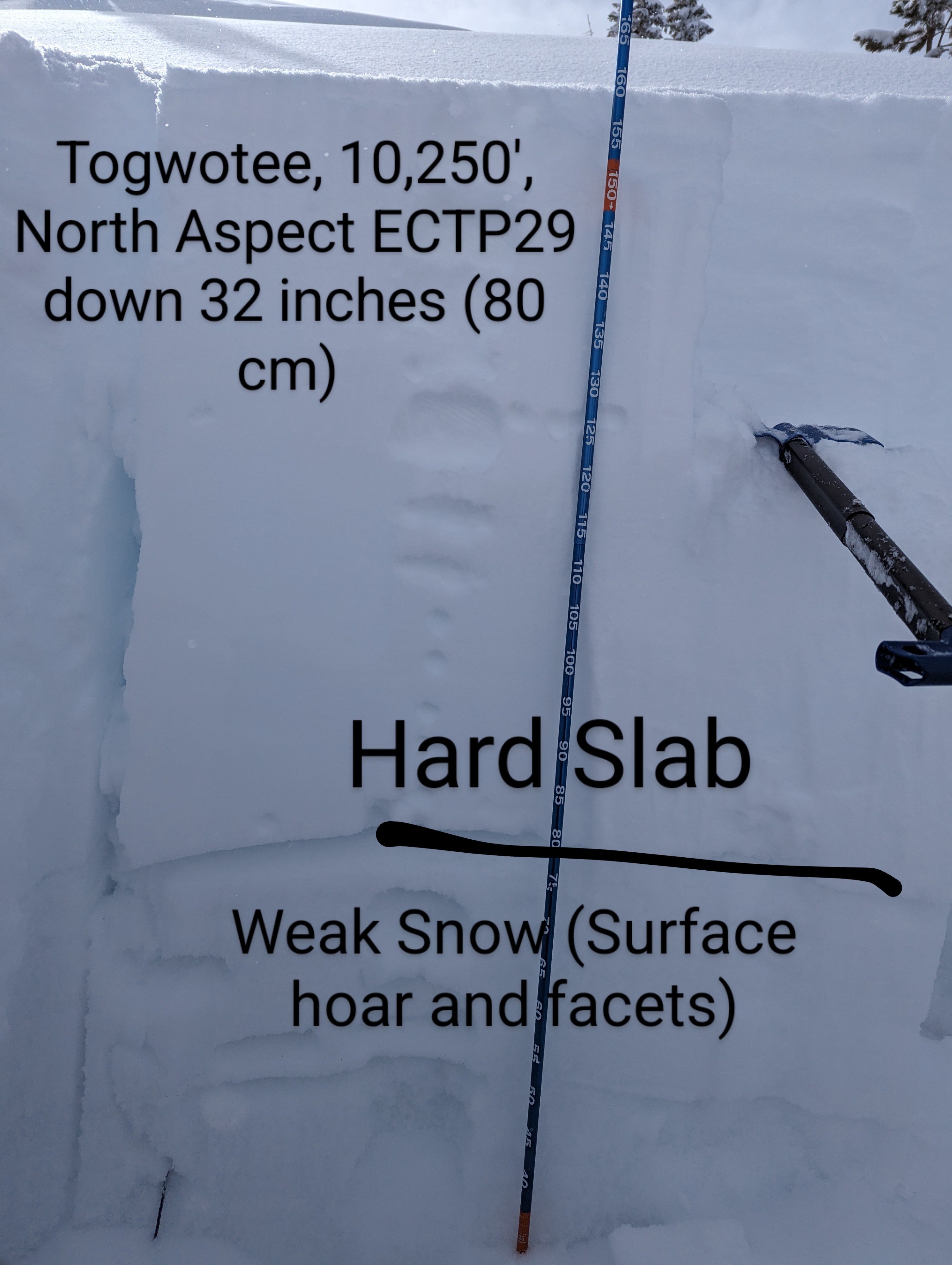
Dug at 10,250 feet on a north aspect:
CT11 Q2 1 foot (30 cm) down in a mid storm interface
CT12 Q1 3 feet (90 cm) down in December facets
ECTN11 down 1 foot (30cm)
ECTP29 at the January 4th interface on preserved surface hoar (down 90 cm)
Testing thoughts... The persistant weak layer buried on Jan 4 was the problematic layer in this pit. Although showing increasing strength and buried 3 ft, it still propagated. At middle elevations and thinner spots in the snowpack, this layer is not as deep and will be more easily triggered by a single rider.
The Togwotee snowpack remains relatively thin. Up to an inch of SWE is forecasted for parts of the zone by the end of the week, which will continue to stress this weak snowpack. I had no collapsing in sheltered, deeper areas on the skin up to the ridge and then very predictable collapsing in thin, wind affected terrain. Continue to be conservative with decisions around steep, wind affected terrain!
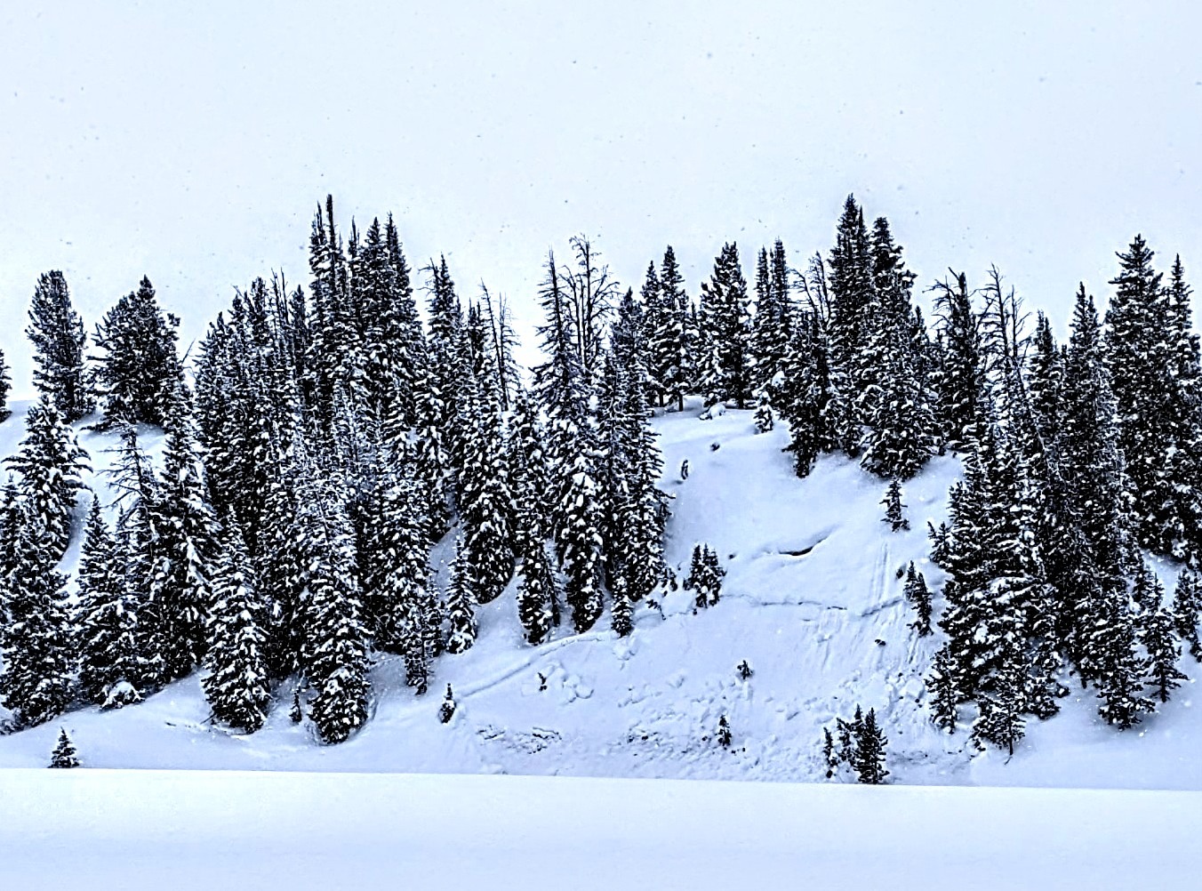
D1 observed at 9100 feet, north aspect on the drive up in the usual wind loaded, steep terrain trap feature just south of the road. Looked to be a couple days old.
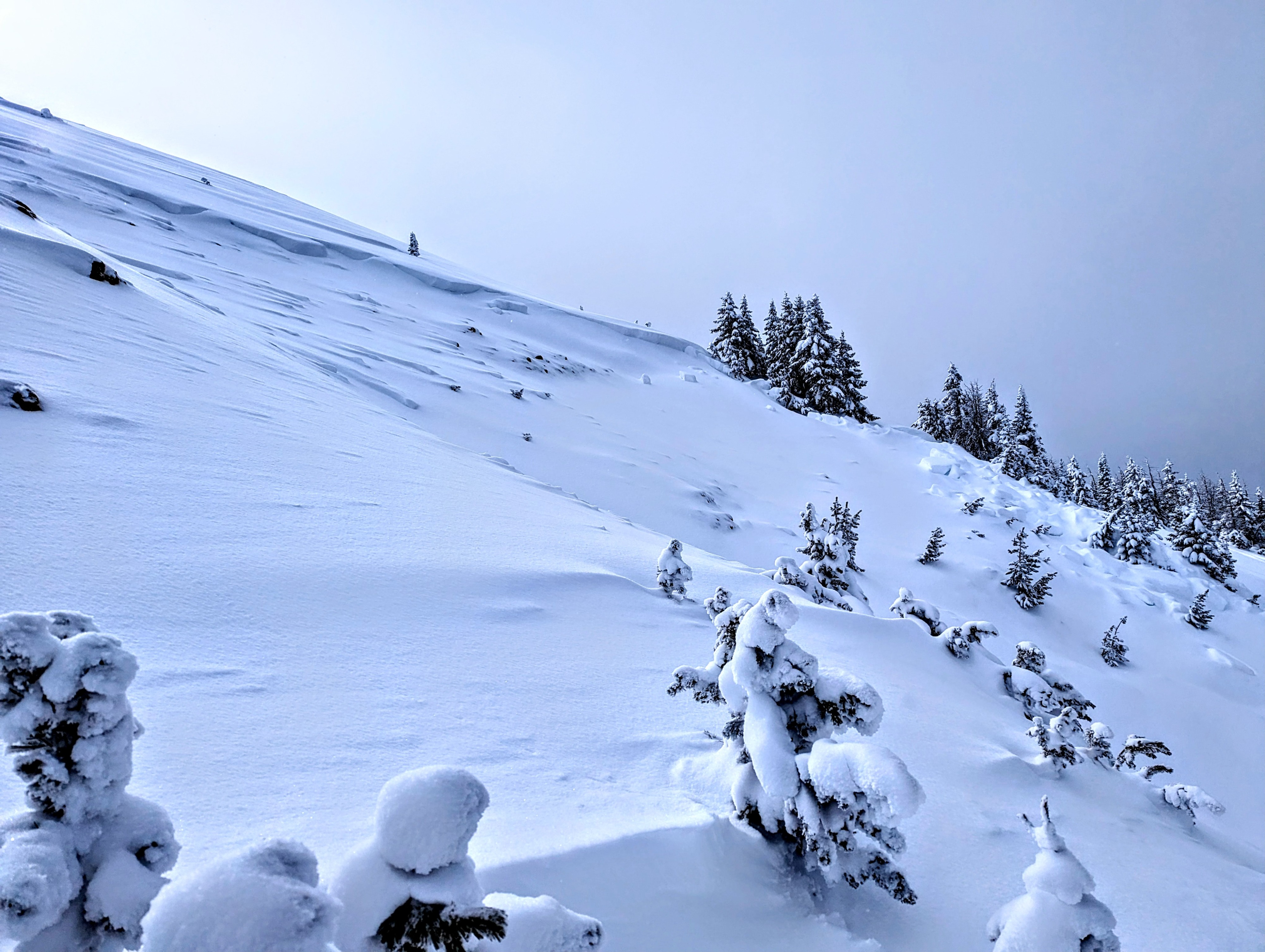
2 Large collapes in upper elevation, thin, wind affected terrain. Collapeses were adjacent to an old D2 natural avalanche.Weather
- Cloud Cover
- broken
- Wind Loading
- light
- Recent Snowfall
- 8
- Snow Avail For Transport
- moderate amounts
Weather ranged from periods of S2 snow to sunshine and partly cloudy skies. Light wind out of the west.
Avalanche
- Size
- D2 R3
- Aspect
- NW
- Trigger
- N
- Elevation
- 10300 ft
Several days old, looks to have stepped down to December facets.