
Quick report
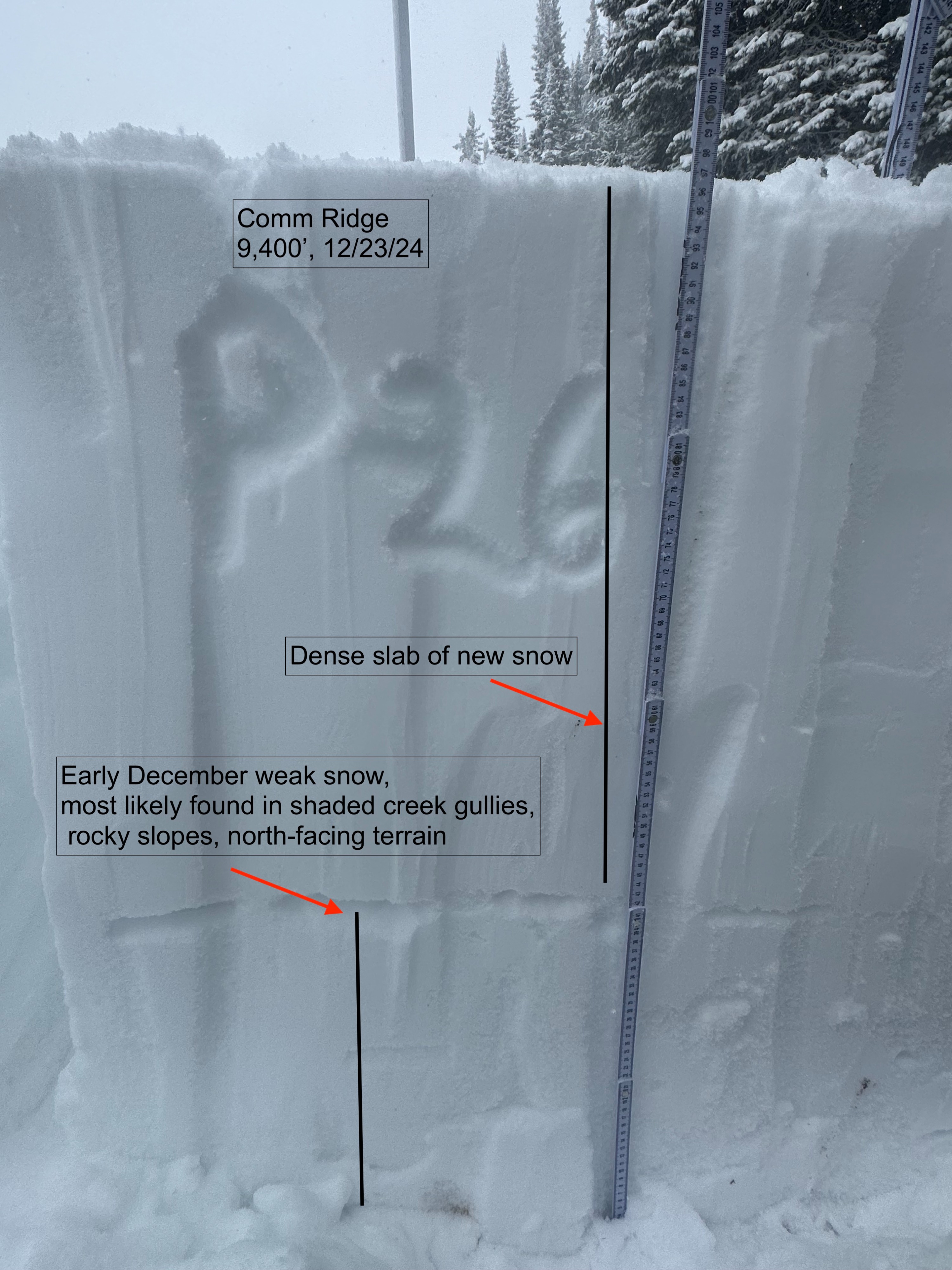
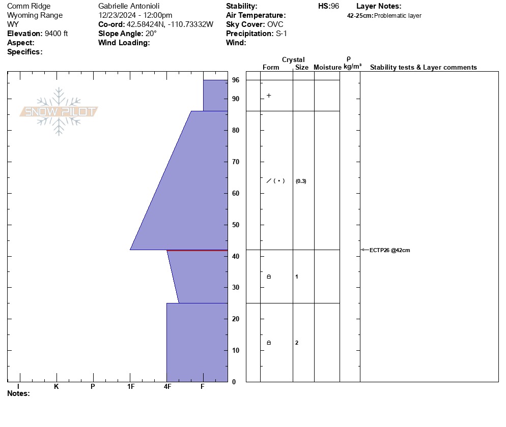
Rode out to the Commissary Ridge weather station. Lightly snowing most of the day with periods of moderate snowfall. About 4" of new snow had fallen by 2pm. It appeared that the new snow was bonding well to the old snow, but we did not get a chance to check any wind-loaded areas. Snow depths increased from about 1 foot at 7,500' to 3.3 feet (100cm) deep above 9,000'. Dug a pit on an East facing slope at 9,000'. Here, a 21" (55cm) slab of dense (4F-1F) snow is sitting above 1mm facets that are showing signs of rounding. This snowpack structure is fairly similar to what we have been observing in the Tetons recently. We still observed propagation in our test pit despite relative high strength (ECTP 27).
Weather
- Air Temp
- 29
- Cloud Cover
- overcast
- Wind Loading
- previous
- Rain Elevation
- 7,800
- Recent Snowfall
- 10
- Snow Avail For Transport
- small smounts
Mixed rain/snow throughout the day, tapering into the afternoon. Snowfall favored the western portion of Salt/Snake/Tetons.
Avalanche
We noticed several old avalanches (D1-1.5) on steep slopes mostly facing E-N.