
Quick report
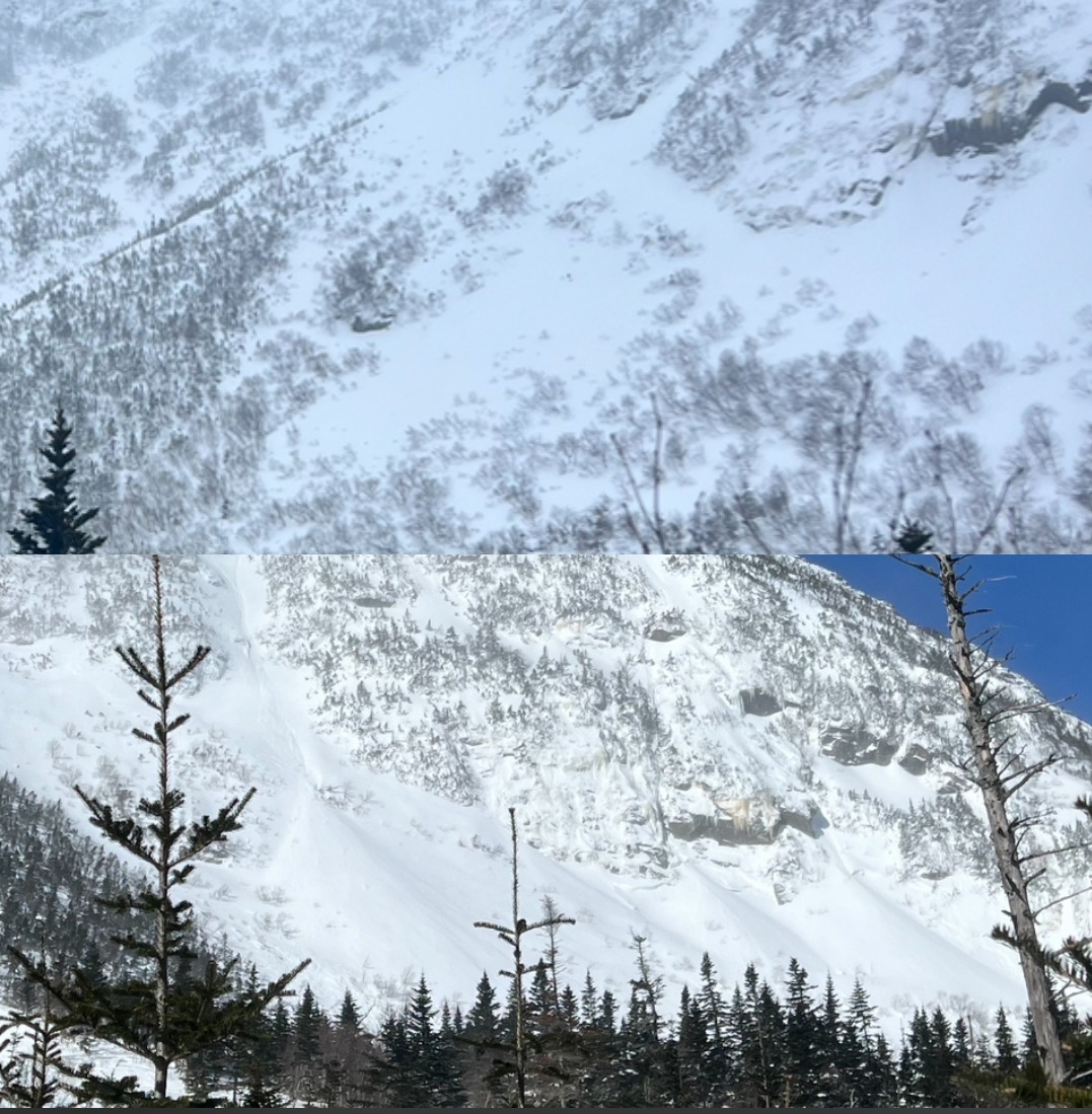
Observed new avalanche activity that likely happened yesterday after extreme winds and new snow elevated the avalanche hazard. The avalanche in Hillman’s jumped the ridge and over into the historic runout. Now that this path has been established it is very likely that if this runs in the new storm cycle starting tomorrow that it will go into the historic runout in a significant way.
This is terrain that has not seen avalanche activity in years, but in the coming days this is terrain that could carry significant overhead hazard.
The Lower Snowfields also ran and we discussed that they had not looked that filled in in years. I have included a photo (from a different angle sorry!) from Wednesday that shows the change.
Weather
- Air Temp
- 7
- Cloud Cover
- clear
- Wind Loading
- light
- Recent Snowfall
- 10
- Snow Avail For Transport
- small smounts
Windy conditions and cold, but warming, temperatures were observed with sunny bluebird conditions. Snow was seen moving and loading Boot Spur Ridge around 9:45 AM this morning.
Snowpack
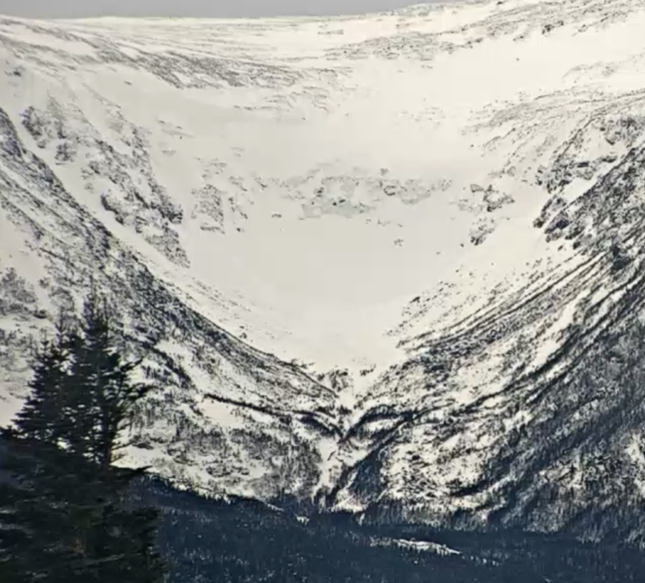
Thinking about expanded paths, another one that comes to mind is Tuckerman Ravine. We often think that once you are past Connection Cache that you are in avalanche terrain. But the huge avalanche that was observed on Wednesday ran beyond the cache, fully burying it with 50cm of snow on the roof and debris depths exceeding my 330 cm probe.
Since this path is large and established, there is the potential the future avalanches could run as far or further.
I want to share some of my thoughts on the size of this avalanche. This has created quite the debate, so if any of you are so inclined, this is a conversation that I would be happy to continue having so please reach out.
I agree with a D4 because the debris deposit was significant and the snowscape of the ravine was fully changed. Now looking to SWAG, I also previously would have argued against this and would have settled on a D3.5 rating citing that the typical path length for a D4 is 2000 m and is something our terrain cannot produce.
New research, presented at ISSW and includes Bruce Jamieson, talks about inaccurately sized and often undersized avalanches and seeks to find better and more reproducible criteria to size them. It uses depth and size of debris. The polygon of debris that we mapped on caltopo using GPS was over 4 acres in size. A hockey rink is 0.39 acers so over 10 hockey rinks could fit in the debris field.
I had a 330 cm probe and the debris depth was well beyond that in areas that seemed like they could be more shallow, so 4 hockey rinks and 4 m deep fits a D4 with this criteria. But it falls short on path length and this certainly opens up the conversation for debate.
This has created a debate amongst professionals who are using SWAG, as that is the current standard, and some are in the 3.5 camp. Our field is constantly evolving and some new research and practice become widely accepted and some not. Regardless this was a very large and very destructive avalanche, I just wanted to expand on my thoughts a bit here.
Avalanche
- Size
- D2.5
- Aspect
- E
- Trigger
- N
- Elevation
- 4800 ft
Hillman's had run a large avalanche cycle previously observed on March 20th. We had discussed that the next large avalanche could jump the dogleg and that debris could jump the ridge into the historic runout, which we saw today! This has not been seen in the last few years and with a well defined path and new snow tomorrow it is likely that if Hillman’s slides in this next cycle that it will run into the historic runout, which is really cool to see. This is also a good time to remember that the historic runout is a runout, and while there hasn't been enough snow to effect this, tomorrow that will be terrain that has significant overhead hazard.