
Upper Flying Dutchman/Skier's Left
Weather
- Air Temp
- 26
- Cloud Cover
- clear
- Wind Loading
- light
- Recent Snowfall
- 3 cms
- Snow Avail For Transport
- small smounts
Cold and blustery conditions. Downslope and north winds with gusts into the 40s. Clear skies and adequate sunshine.
Snowpack
The objective of this tour was educational, and hence, the mindset was assessment-oriented.
Conditions: The abrupt shift to cold and blustery conditions put a quick stop to the melt-freeze cycle of last week. Surfaces were solidly frozen, and winds were transporting what little snow had precipitated the night before. Plumes of several hundred feet were observed blowing from the inner basin. The Humphreys trail in most places was crystal blue ice, the surface was postholed and highly uneven. Later in the day, surfaces began to melt, but this mostly affected the new 1/2" to 1" of snow. Underneath this veneer was a highly uneven, grabby, and very firm surface. The trail was burnt out in a few south-oriented locations, but the majority was skinnable. I made a few mid-day turns, and while the new snow was soft the underlying layer was uneven and rock hard.
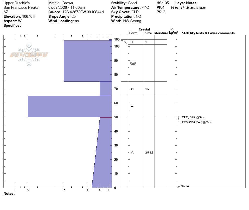
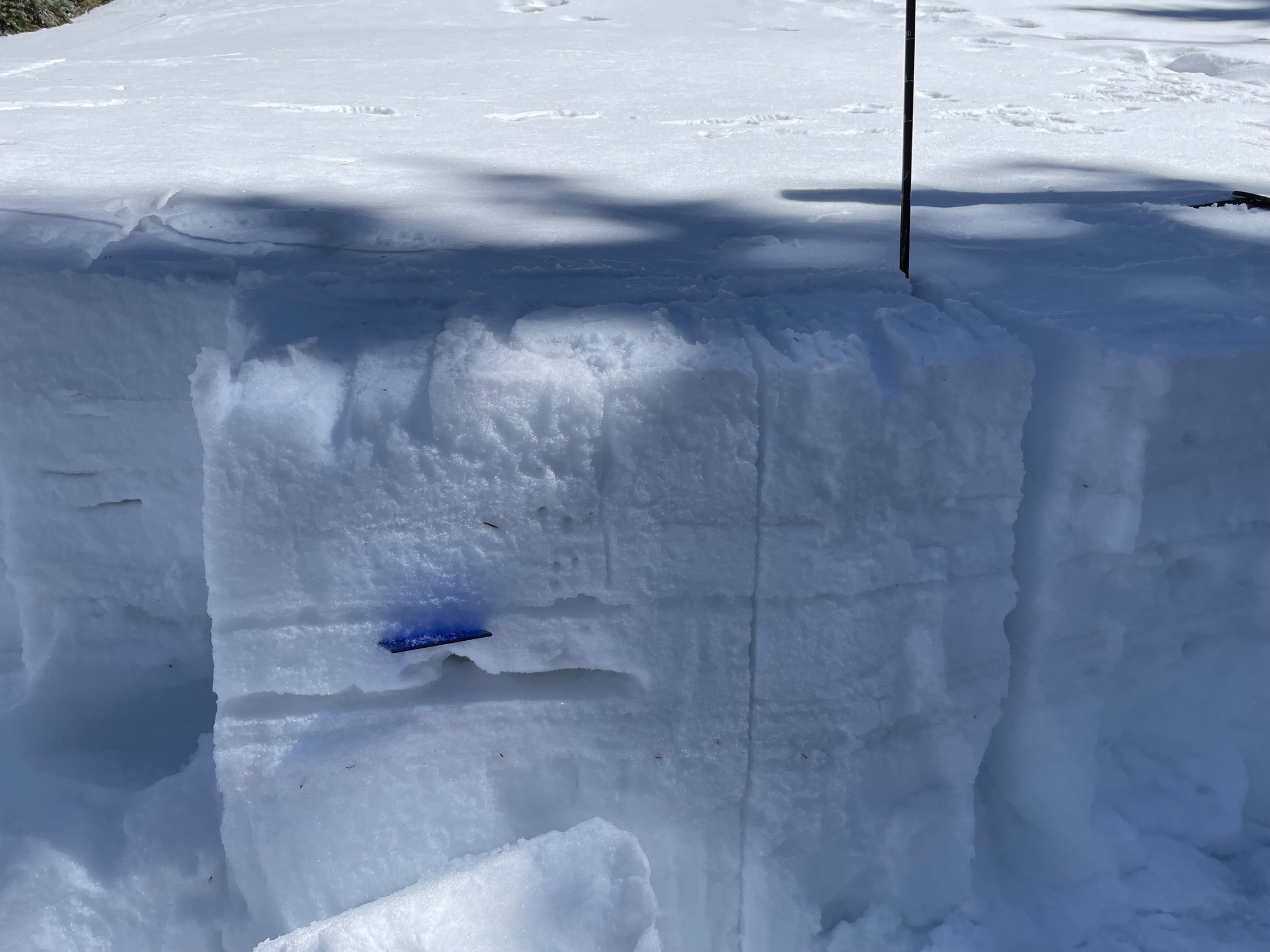
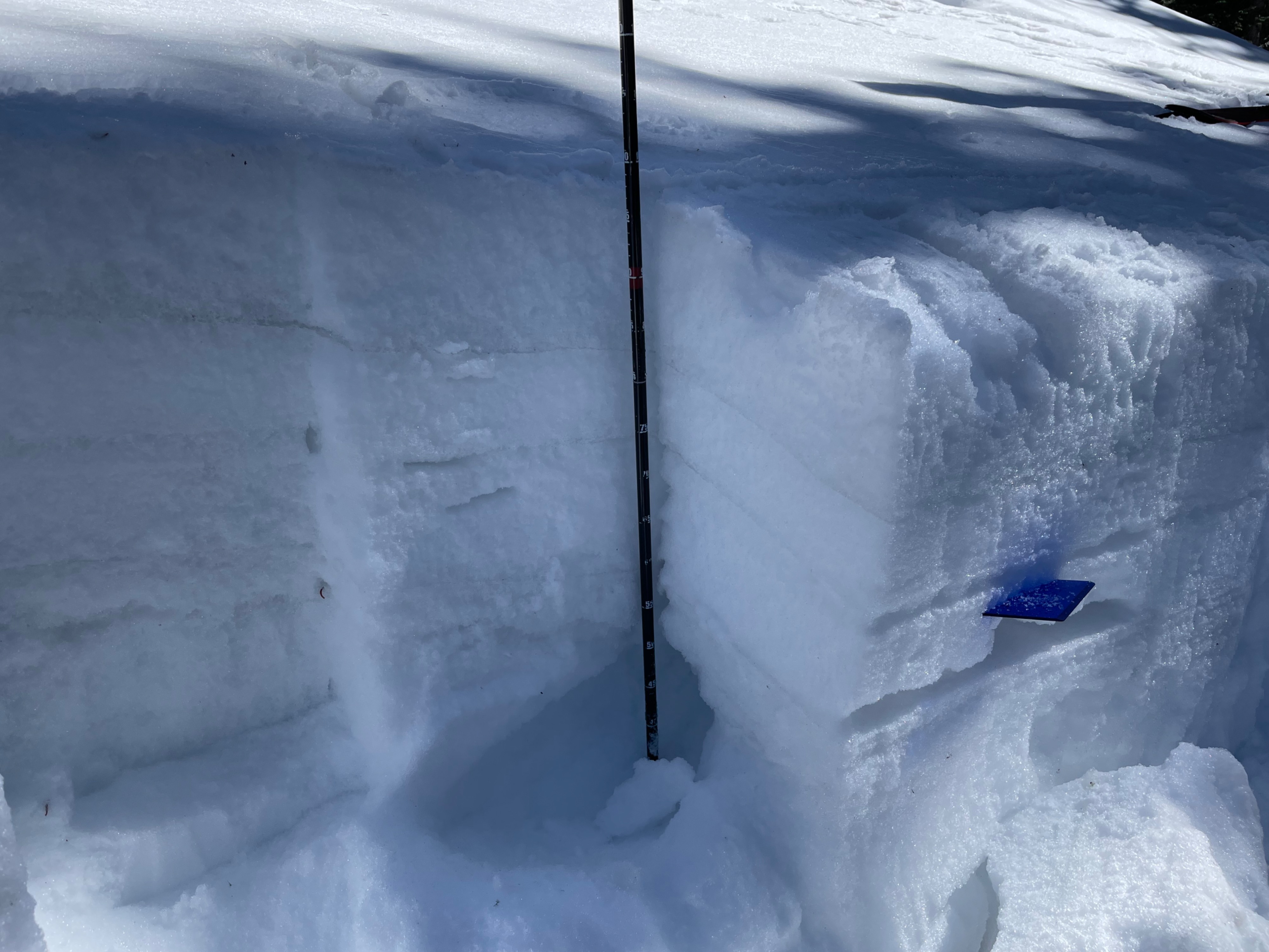
Snowpack: Snowpack was in an All Freeze, No Melt stage. Last week's summer time temperatures saturated the upper snowpack, creating one of the thickest melt/freeze crusts I've ever witnessed. We dug on a west-facing slope at 10,600 ft, just to skier's left of the upper 2/3rds of Dutchman. The snow depth was 105 cms. The upper 30 cms of the snowpack was pencil hard, melt-freeze grains. This aligns with reports from last week that skiers were sinking knee-deep into backcountry snow. Below the 30 cm of melt-freeze was a layer of 1F facets from the January 9-12th storm cycles. These NSFs have yet to metamorphose. Below these facets is the dreaded Holiday Ice Layer (HIL), which has fortunately softened to a mere knife hardness. Finally, there were 4F facets from below the crust to the ground. The facets near the bottom of the snowpack were moist and less than 3 cm in size with no enchainment or cupping.
Stability tests: Layers of instability remain in the snowpack. These PWLs tend to only show reactivity when isolated. Compression test results were CT 25 @ the basal facet-HIL interface Q3. PST 45/100 End on the basal facet/HIL interface. An ECT resulted in an ECTX--no propagation. These layers seem to be more reactive when isolated spatially from the connectivity of the greater slope. Hard layers, such as frozen surfaces and the HIL, likely reduced reactivity today. As temperatures begin to rewarm and slabs soften, these PWLs may become more reactive.
Overall: If you encounter solid frozen surfaces on a cold-weather high-wind day, consider moving to a more enjoyable slope, such as the red dirt trails at 4,360 ft. While the suboptimal conditions of today could have been a real spoiler, the valley turned mountain crew took the conditions in stride and turned in a high-performance on some of the most bullet-proof conditions this year . . . that is, bullet-proof aside from the glacial ice cap!