
Quick report
On the drive up from Valdez rain switched to snow at the hairpin turn (2200'). On the North side of the pass the snow was mixing with rain up to 2700'. 10 cms of new snow was found that was unevenly distributed by moderate SE wind above 3000'. Below 2700' surface rain crust was broken down by above freezing temps and moisture continues to saturate the thin low elevation snowpack. Above 3000' no signs of instability were present, however my travel was limited by very poor visibility. Shallow wind loaded pockets likely exist along high elevation ridges and on the lee side of terrain features.
No signs of instability were presentWeather
- Cloud Cover
- overcast
- Wind Loading
- light
- Rain Elevation
- 2700
- Recent Snowfall
- 10 cm
- Snow Avail For Transport
- moderate amounts
Temperatures were above freezing at the trailhead ~2500' with mixed precip. At 2700' precip turned all snow with moderate SE wind above 3000'. Snowfall rate was S1-S2.
Snowpack
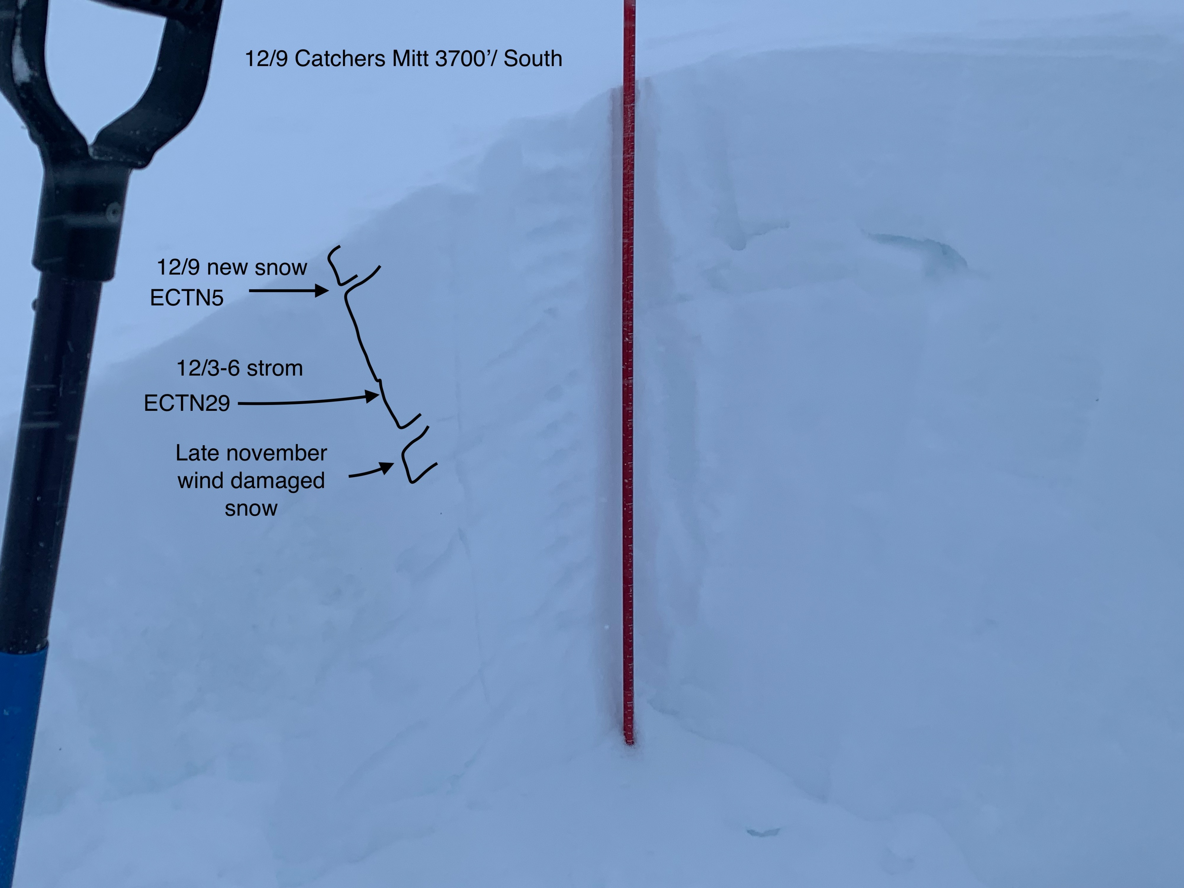
The rain crust from the 12/3-6 cycle that previously existed at the surface below 3000' was broken down due to above freezing temps. Above 2700' 4" of dry but heavy snow had been deposited on top of the 12/3-6 storm snow. Pit results at 3700' produced no propagation on ECT with a total snowpack height of 120 cms on a south aspect. The 12/3-6 storm snow had settled to 40 cms and was well bonded to the late November wind damaged snow. ECTN6 down 10cm (new/old interface) and ECTN29 down 30cm (mid storm slab density change).
Avalanche
Poor visibility prevented the ability to look for recent avalanche activity.