
Quick report
- Cracking
- isolated
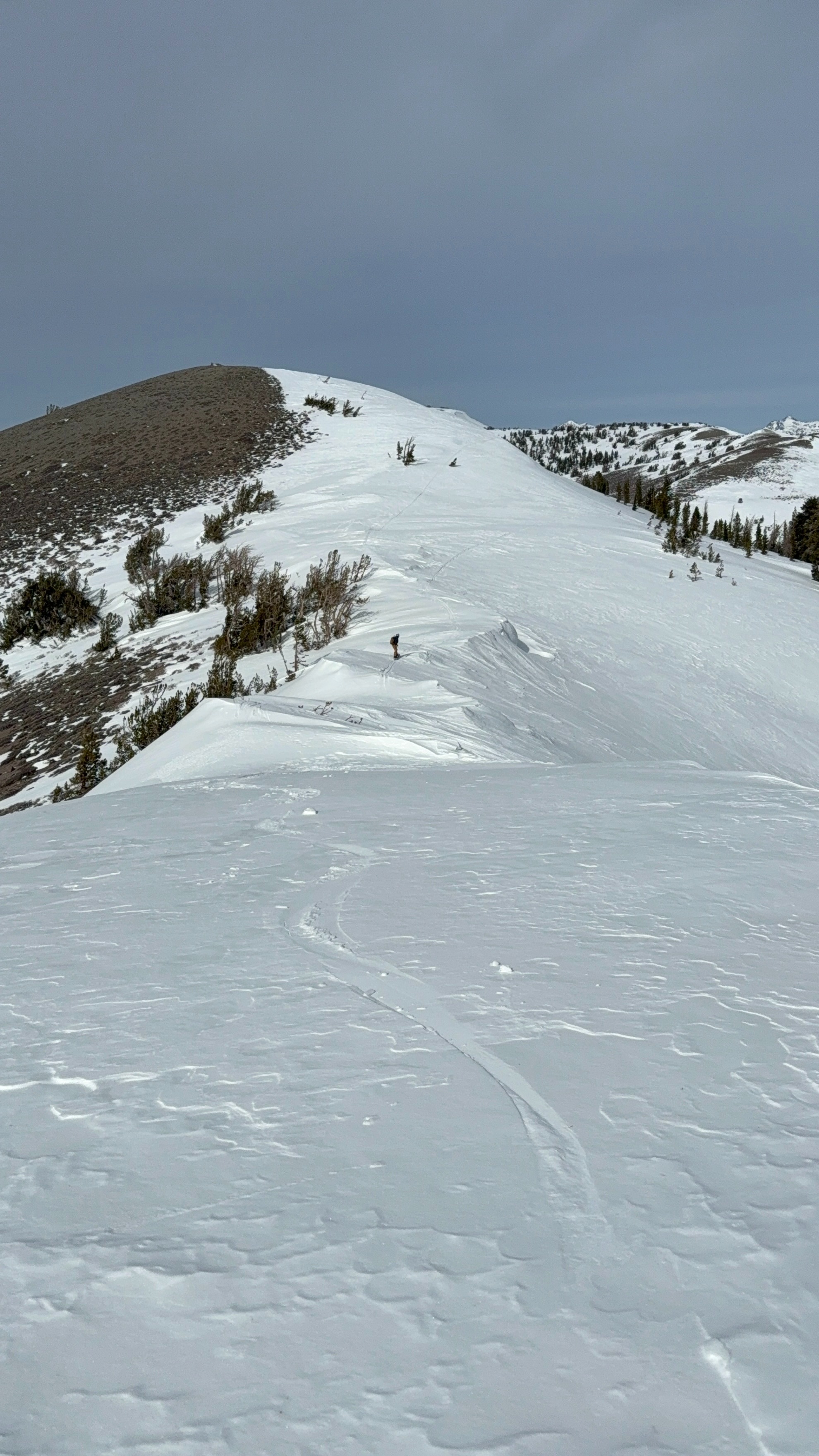
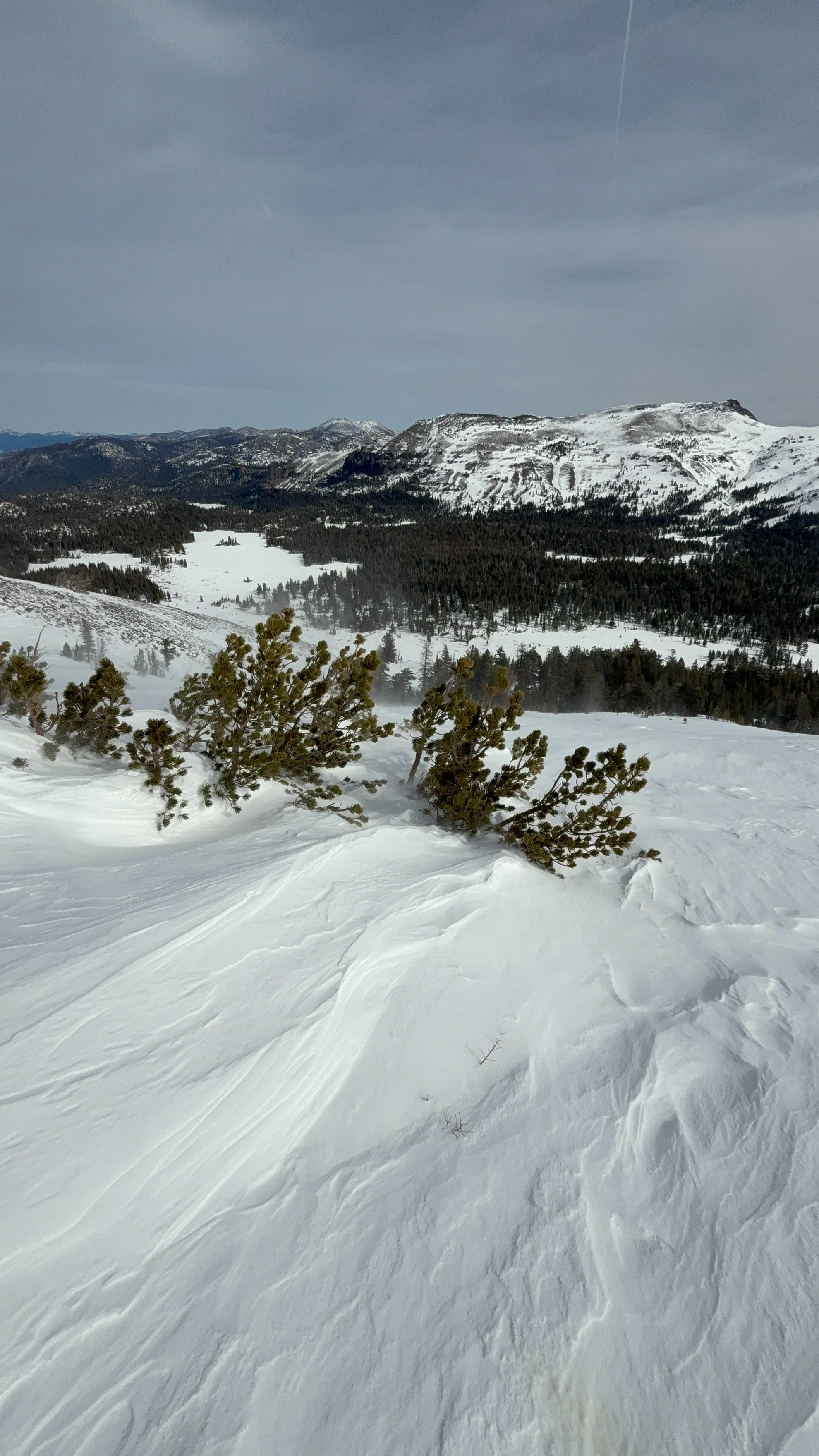
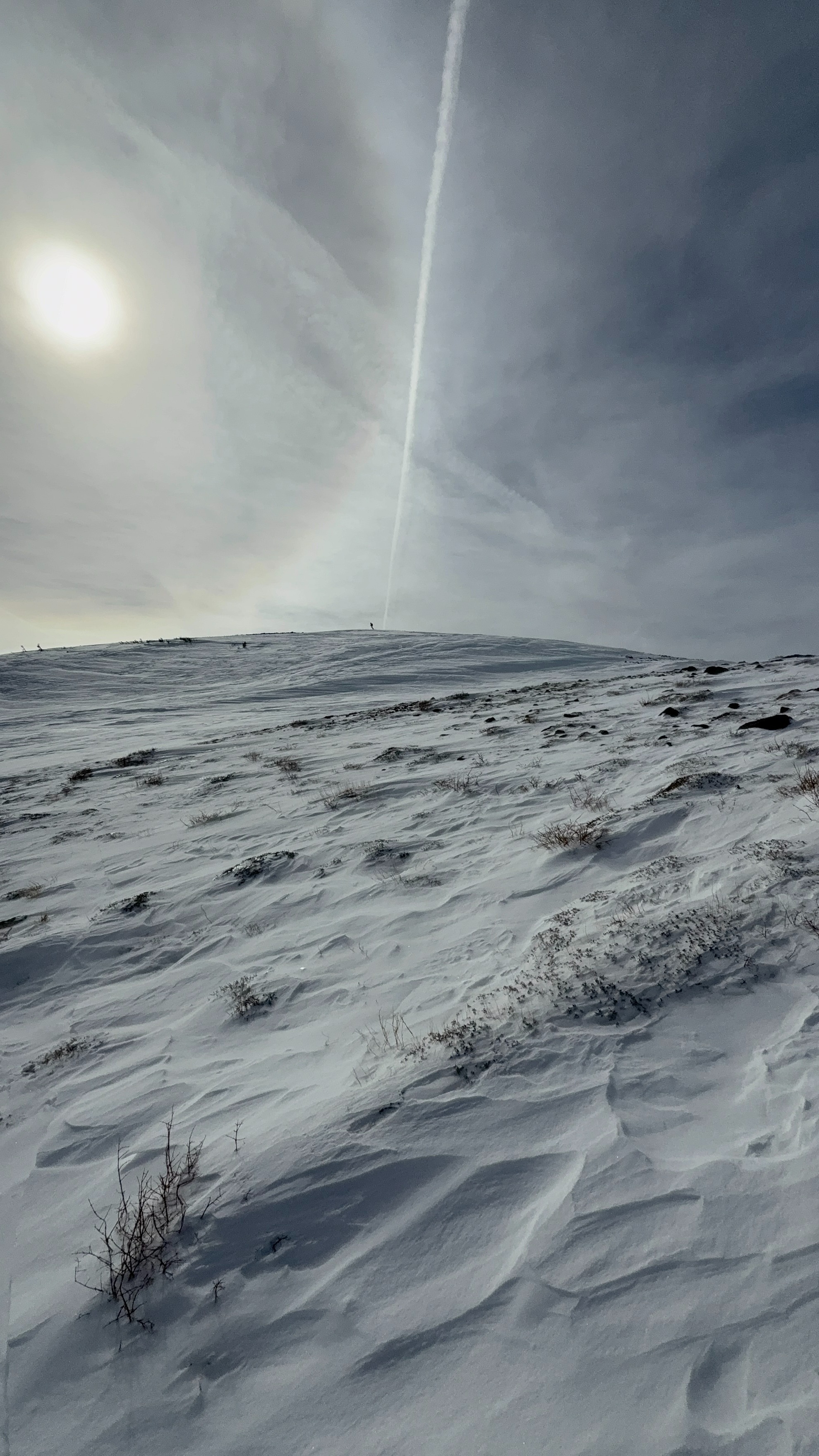
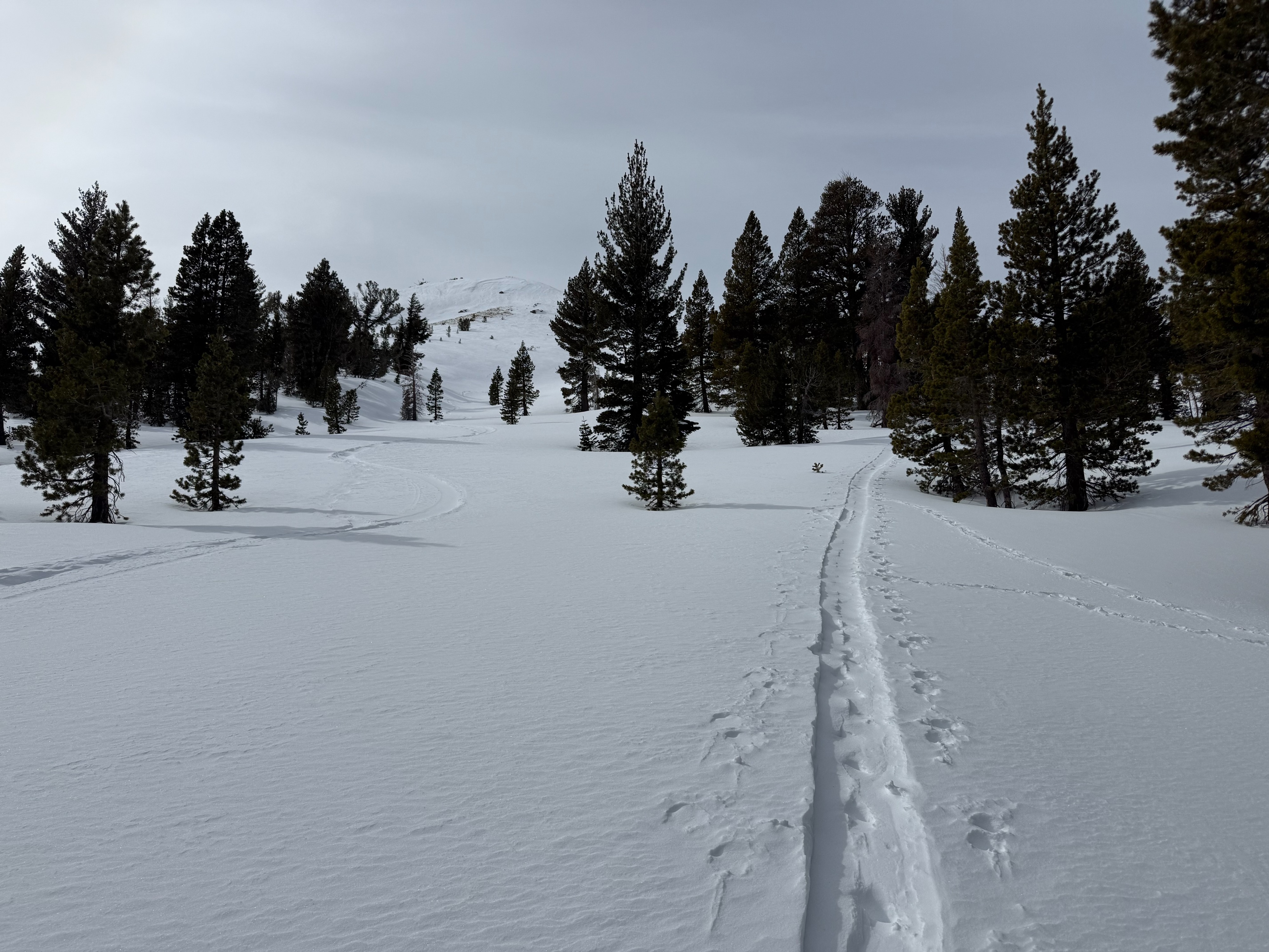
We went to Meiss Meadow to find cold snow (Saturday, Feb 14th). The wind on the ridges was strong to gale force (40mph+) from the SW. It was blowing and transporting snow on the ridge. It was almost too windy to stand properly. There were wind banners on Elephants Back in the distance. We observed minor cracking in the wind deposited zones; 1-3 inches deep. In sheltered areas, non-formal obs showed a fist soft snow surface above a 4 finger rain crust within the cold snow on NW-E aspects. The Feb 10th facets were below the rain crust down 18cm. A quick pit below tree line showed a weak and faceted snow structure within the top 30cm. HS 125cm. The alpine terrain was heavily wind affected; compacted, scoured, actively loading on the leeward side.
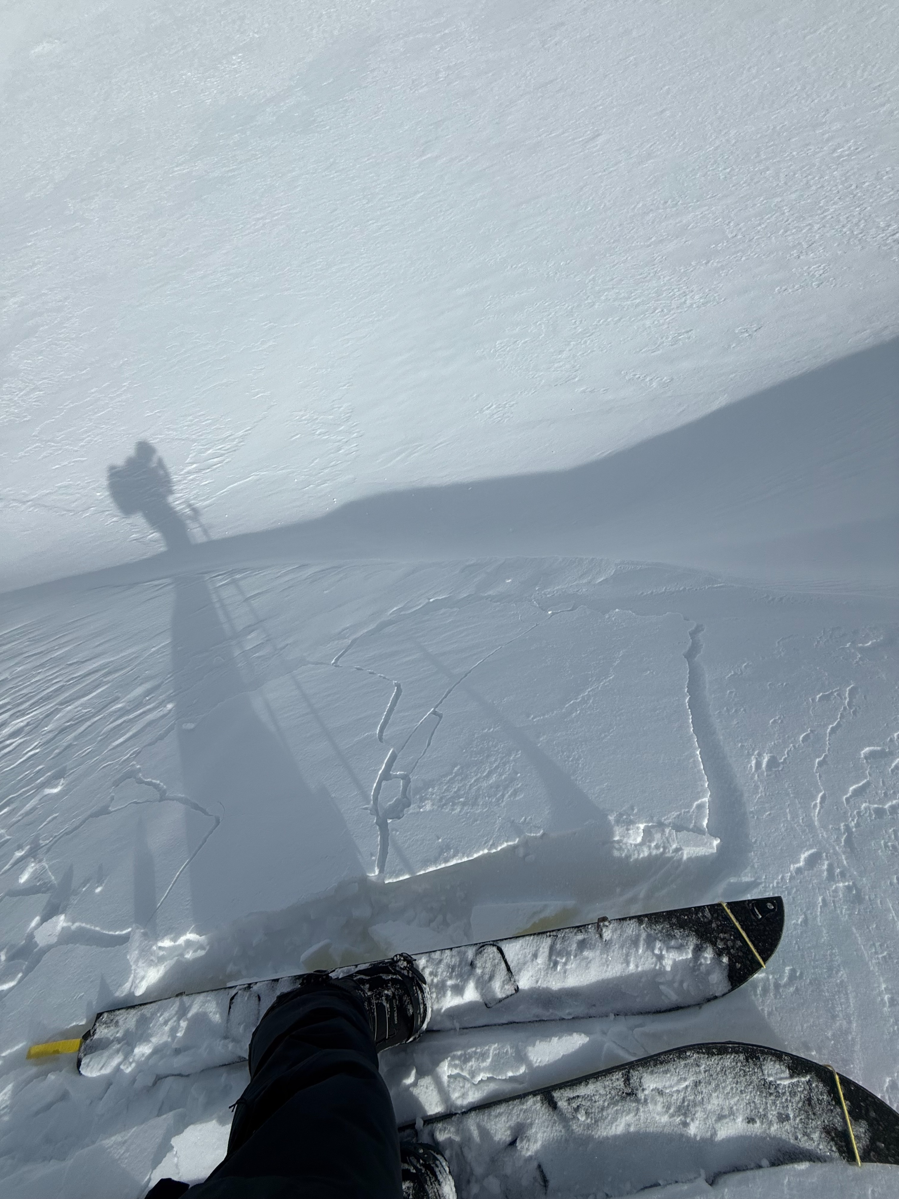
We while descending a gully feature we had a small wind slab release. It was roughly 20'x20' and 1 foot deep; D 0.5. It was in an area that was suspect for wind affect and matched the forecast advisery for small isolated wind slabs. I could feel the firmness of the slab under my feet before it released. This wind slab felt stiffer than the rest of the cold snow on that run. I believe this wind slab was remnants from the snow and wind event on Wednesday Feb 11th, and was not from the active wind loading today. I was not given the opportunity to inspect this instability more. It was the only one we saw.
Exiting this zone proved challenging due to a 2 inch thick breakable crust, widespread on E, S and W aspects. The wind kept the air temps cool, and most snow surfaces frozen. There was minor melting on S-W aspects in sheltered areas.
I popped off a small D 0.5 wind slab, 1 foot deep, 20 x 20. It was on the wall of a gully, steep 40+ degrees. The terrain looked wind loaded from the snow/wind event earlier in the week. There was active wind loading today, however this wind pocket was not from today; it was older. The location was at 8,700 feet, on a north east facing aspect, mid slope, Near Tree Line. This isolated wind slab matched the terrain advisery for the day.
Weather
- Air Temp
- 40
- Cloud Cover
- broken
- Wind Loading
- moderate
- Rain Elevation
- Not Observed
- Recent Snowfall
- 0
- Snow Avail For Transport
- moderate amounts
The wind was blowing strong from the SW, 40+ mph gusts. There was a high altitude cloud layer trapping the heat below, however the wind kept temps cool. The sun was in and out behind the upper elevation cloud layer.