
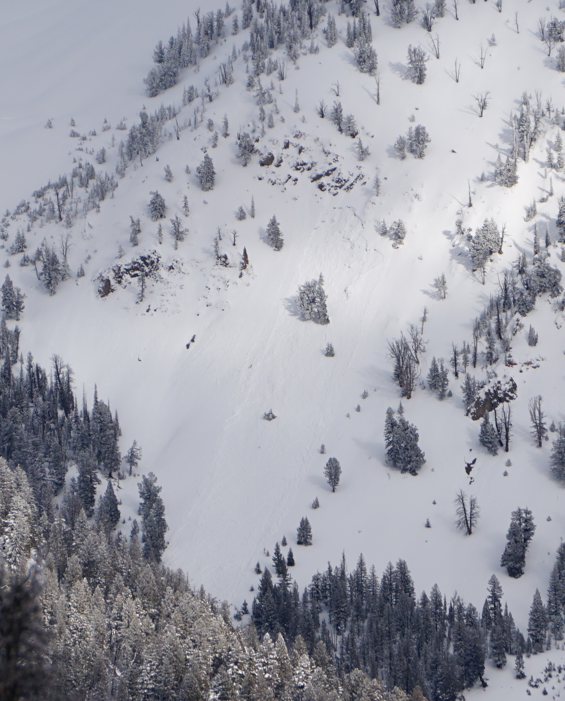
Quick report
Recent natural avalanches observed in middle elevation terrain, continuing the trend of obvious instability in recent days.
I'm not positive about the timing, but I noted a few avalanches that have not been reported. They looked pretty fresh (past 12-36 hrs).Weather
- Air Temp
- 30s
- Cloud Cover
- broken
- Wind Loading
- light
- Rain Elevation
- Below 6000'
- Recent Snowfall
- Trace
- Snow Avail For Transport
- moderate amounts
Mix of low and mid level clouds and blue sky. Biggest "donut hole" was Phantom Hill to Galena Lodge while I was out. Wind loading was a typical pattern: lots of recent snow available for transport in the Smokys (W Fork Prairie, Saviers, Salmon River Headwaters were observed) and Boulders from Galena Peak north, and much less available for transport in the Boulders south of Galena Peak and in the Pios.
Snowpack
Direct snowpack observations were focused on near surface layers (upper 20cm/8") to get information about potential surficial problems with less cloud cover tomorrow.
Lower elevations north of Ketchum had a skiff of PP above about 4-5cm of moist/damp snow (with some crusts depending on aspect) - this may freeze tonight with forecasted sky conditions and temperatures?
Middle elevations 7500-8700': Some rollerballs/snails on W-S-E and a razor crust forming at the surface. On shadier aspects, razor crust was there or forming 1-2cm below the surface, and surface snow was dry.
Upper elevations (glassing): Lots of fluff sitting around in W Fork Prairie and Owl Ck (decent vis). Much less low density snow that had not been wind-transported in the Boulders south of Galena Peak ( usual pattern). Potential thin, fresh wind slabs in Boulders south of Galena Peak.
Avalanche
- Size
- D1.5
- Count
- 2
- Aspect
- SW
- Trigger
- NO
- Elevation
- 9300 ft
High confidence that all reported slides are persistent slab avalanches, based on crowns and location. The Gladiator slide may have been triggered by wet loose rollerballs from above.