
Quick report
The last couple of weeks and our extended period of cold and sunny weather has faceted and weakened the top 20-30cm of our snowpack and has created several new crusts and interfaces. While this doesn't change the avalanche danger right now, we should anticipate that when we do get new snow and start loading this weak upper structure that we could see a marked increase in avalanche danger.
Weather
- Air Temp
- 39
- Cloud Cover
- clear
- Recent Snowfall
- 0
By 10am air temps were above freezing and we recorded 39F by 11:30am. Sky was clear all day. Winds were calm to light from the W/SW.
Snowpack
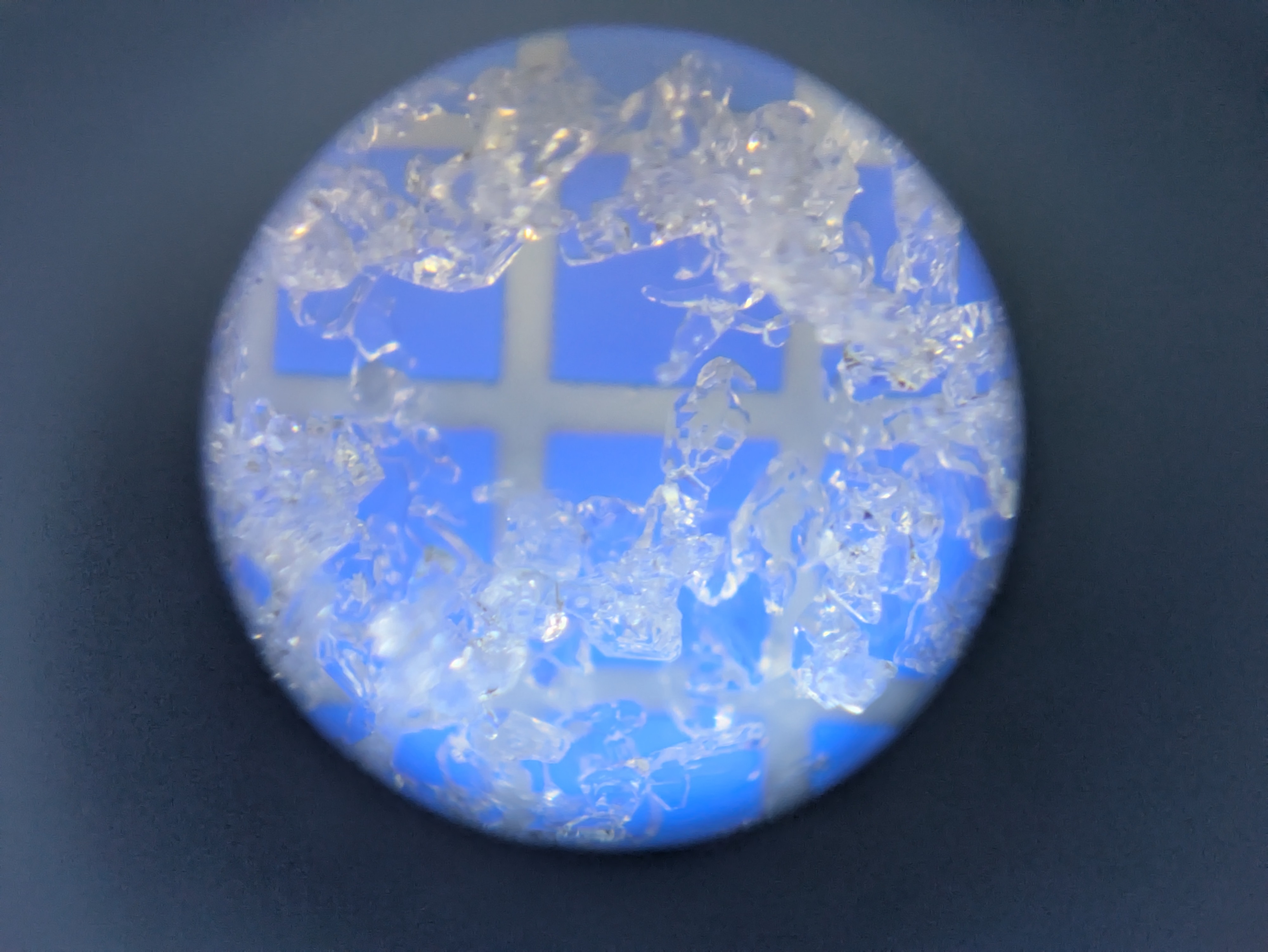
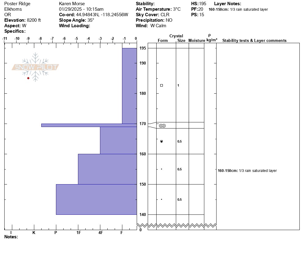
We focused our observations on the top 1.5-2 ft of the snowpack to determine what kind of foundation we will have for the new snow forecasted to come this weekend. We dug a mini pit on the West side of Poster Ridge at 8200' and found about 25cm of well formed facets (weak, sugary snow), on top of a melt freeze crust that we estimated to be from Jan 8-9. Beneath that melt-feeze crust we found another 5-10cm of smaller, less defined facets, sitting on top of our Jan 3rd rain crust.
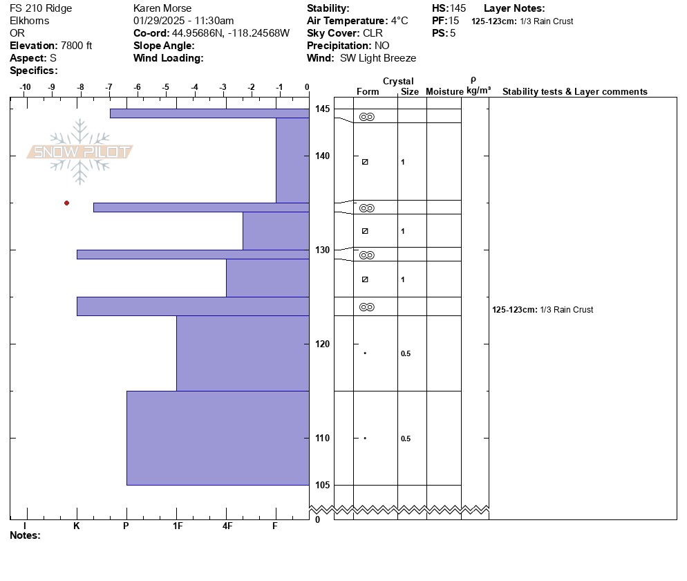
We dug a second mini pit on a Southern aspect at 7800' and found an alarming sandwich of mutiple melt-freeze crusts with facet layers in between that all sit on our well consolidated Jan 3 rain crust.