
Eighty Peak
Quick report
We found 4 to 6 inches of snowfall from Sunday night's storm. It was generally well-bonded at the new/ old interface. Little evidence of recent wind-drifting, although this area is not void of strong winds thorughout the sesason. While this area has seen less snowfall since the February 23 rain event as our northern zones, total snow height is closer to what we've been finding in the West Cabinet Mountains, and deeper than in the Silver Valley at similar elevations.
Weather
- Wind Loading
- none
- Recent Snowfall
- 5 to 10
- Snow Avail For Transport
- small smounts
Mix of fog, obscured, and overcast skies till around 1 pm. Then, skies were more broken providing long-distance viewing. Generally mild temperatures but the subtle breeze along ridges made it feel a bit cooler.
Snowpack
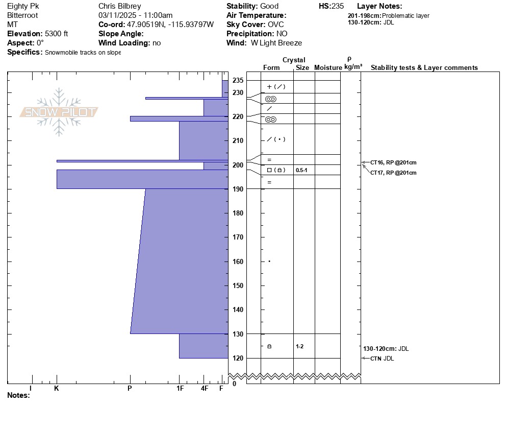
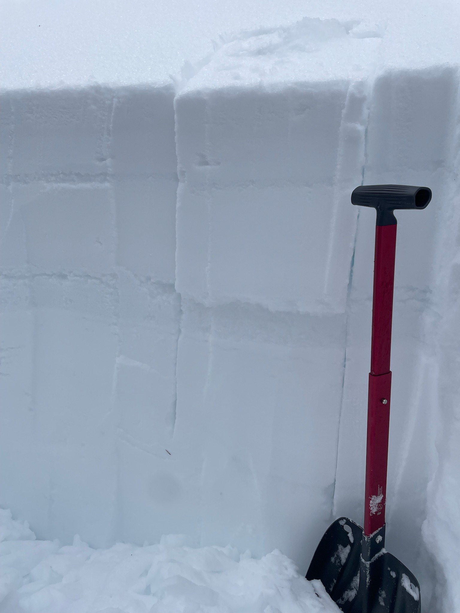
Upper snowpack layers are a mish-mesh of recent snowfall and sun crust. The crust are generally thin and don't show lots of evidence of faceting. The February 23 rain crust ranged 1 to 2 feet below the surface and is K hard. It is anywhere from 12 to 15 cm thick. The slab below this and above the JDL interface is extremely stout - generally pencil hardness. The JDL FC where we dug are still identifiable with angular edges, although most of the grains are rounding under a meter plus deep slab. It seems like triggering a slide in these deeper persistent grains is unlikely and fits the danger ratings/ likelihood of neighboring areas within our forecast zones. The most notable difference here was the visual rain-shadow affect at lower elevations as you descend toward the Trout Creek side of the range. Looking west toward the Silver Valley, the lower terminus of the snow line was much lower in elevation compared to east and north of the crest.
Avalanche
- Size
- D2.5
- Type
- HS
- Count
- 2
- Aspect
- E
- Trigger
- N
- Elevation
- 5300 ft
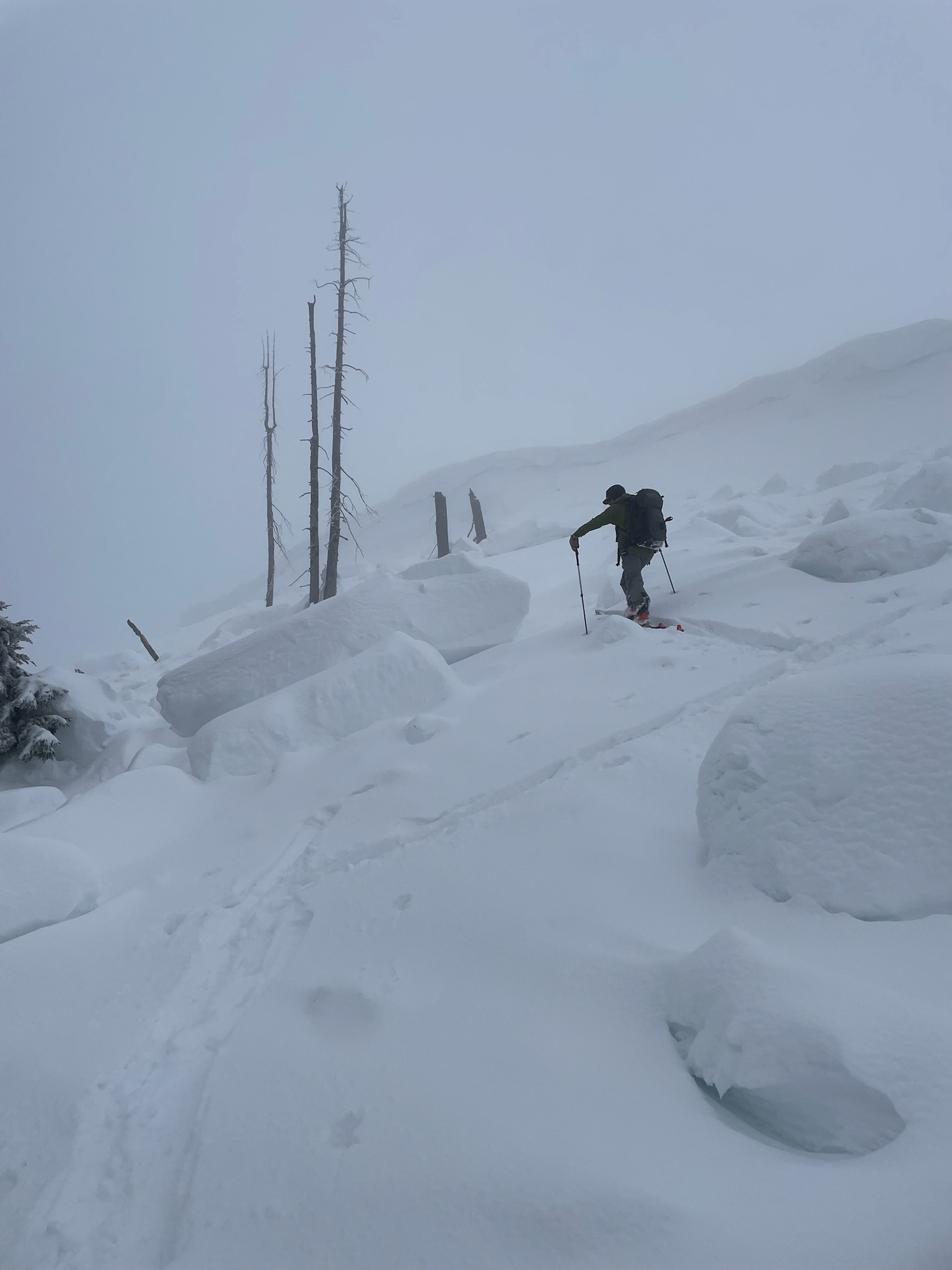
We observed lots of evidence of wide-breaking slides that likely ran around February 23 and those crowns were mostly filled in. Several large cornice chunks caving off more recently triggered a few large avalanches that broke above the February 23 rain crust. These were on east-facing slopes.