
Quick report
- Aspect
- North
- Red Flags
- Cracking, Collapsing, Poor Snowpack Structure
- Elevation
- 2926 m
- Slope Angle
- 27°
- Red Flags Comment
- <p>Cracking observed on buried surface hoar layer. A localized collapse also observed in wind feature. </p>
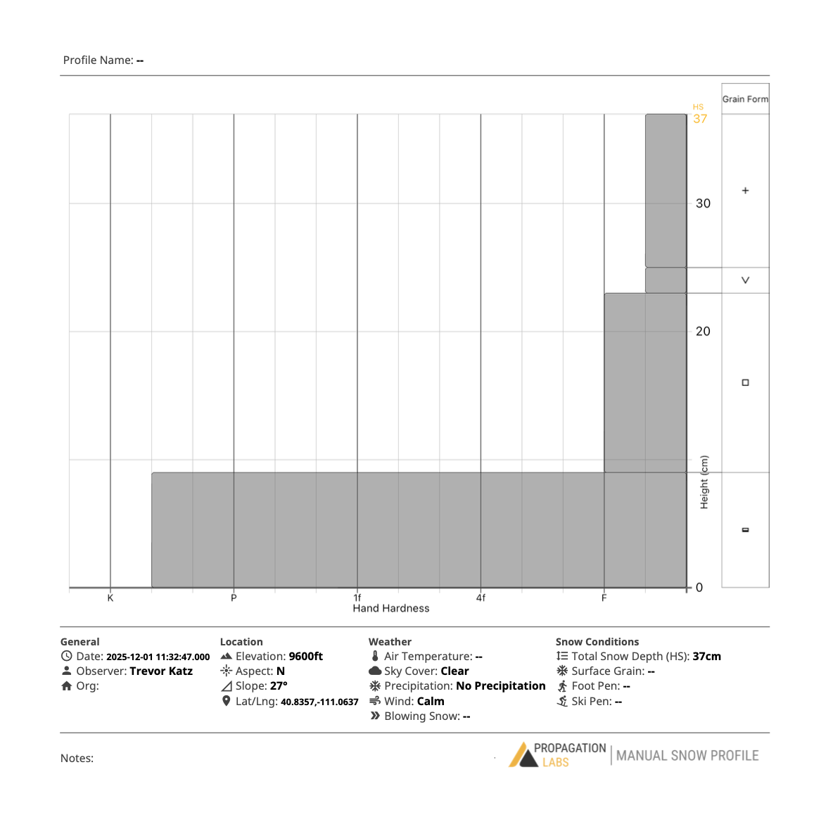
Rocky travels in Upper Weber Canyon corroborate Ted's story of the north slope. Though the snowpack is certainly elevation dependent, it seems a fair amount of water entered the snowpack, likely during or before 20251120, even as high as 9600'. A snow profile on N at 9600' features 9cm of stout basal ice. Additionally, arial overage photos of upper weber canyon clearly show: all but the highest ridges are dirt or bushy. On a less dreary note, preserved surface hoar 10-20mm in size was observed below yesterday's (20251130) snow. This layer was uniform and found anywhere from sheltered terrain to just below an exposed ridge.