
Quick report
- Aspect
- Northwest
- Elevation
- 2835 m
Snowpack
- Instability Comment
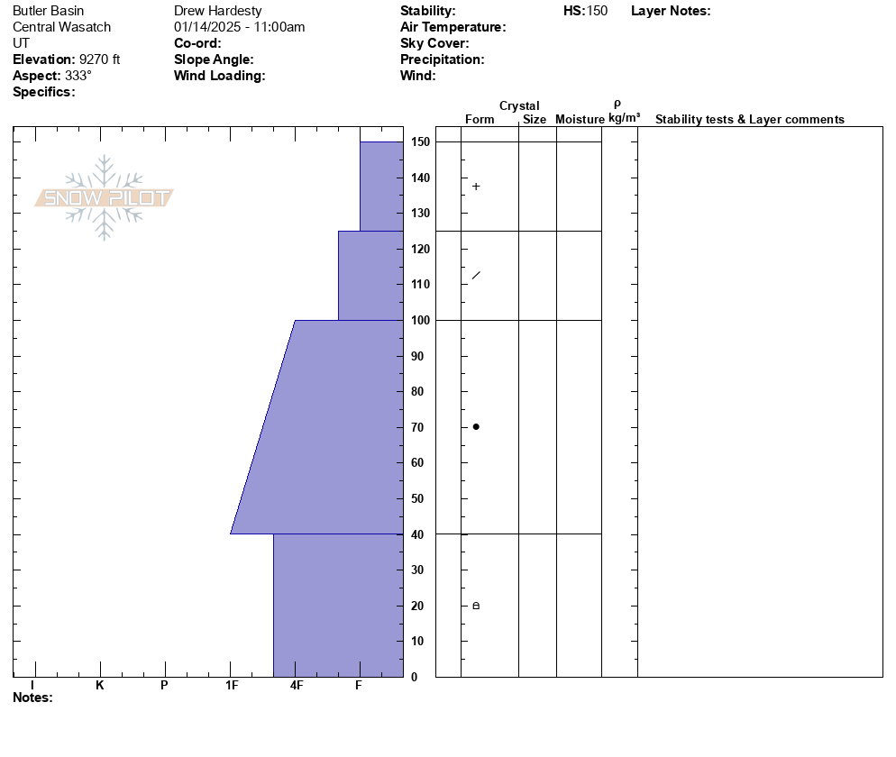
- <p> Travel was up into upper Butler Basin to look at the <a href="https://utahavalanchecenter.org/avalanche/91443">avalanche involvement</a> from Sunday. On route we did not see any new avalanches or experience any cracking or collapsing. </p> <p>Snow profile is below. Average HS in these mid-elevations was 140-170cm with 4F/4F+ basal facets. It would be unlikely that this would be a trigger point on the slope; instead one would need a much thinner or rockier zone as we saw with this accident or a repeater slope that did not take out the facets the first time. </p> <p> It's really a tale of two snowpacks: Solars (first photo) that hold no uniform and/or unstable snow and polars that do. Worse yet, the polar stability (second/third photos) is increasing but is not yet stable. What this means of course is that parties will not see signs of instability and may ride a few slopes before they find a trigger spot. This is a dangerous setup...and low angle with nothing steep above is the only path for riding on polar aspects. Sorry for the soap box. </p> <p>Tomorrow's 700mb temps rise toward +1C with mostly clear skies and light wind. Even though the steep solar aspects have been kissed by the sun the last two days, this will be a dramatic warm up: Wet loose and pockety "wet slabs" likely in steep sun-drenched terrain. </p> <p>*There is a LOT of cold low density snow that will see a lot of heat tomorrow. I would imagine impressive debris piles under steep sustained slide paths on the sunny aspects. </p>
Excellent right-side-up storm snow. Warm enough for many solars to have a zipper crust Wednesday morning. This crust may become an RR crust; the subsurface snow a cm below the surface cold snow was still damp and had not yet frozen. With the phase change, facets may form this afternoon/eve. Take a look.