
Quick report
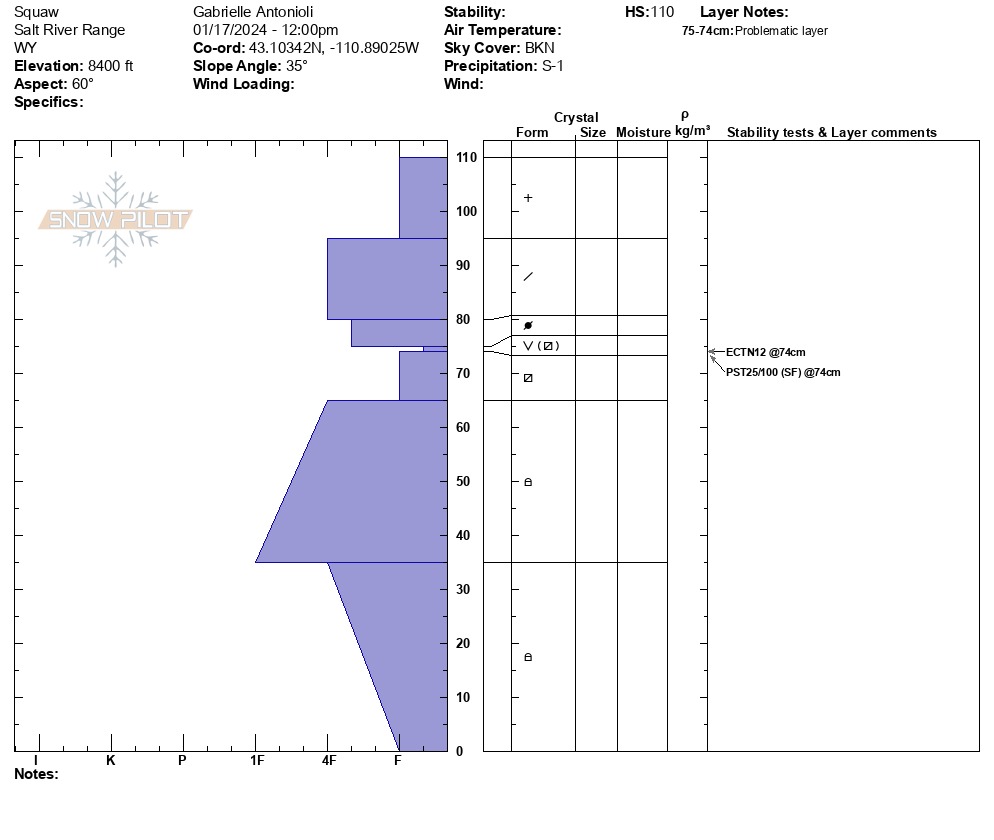
We found an average new snow height (from Jan. 4 onward) around 1.5-2 feet up to 8,500 feet. Snow heights in the Smith Fork yesterday were slightly greater. December drought snow (buried Jan. 4) exists here as a thick (5-6 inches) layer of near-surface facets capped with surface hoar 1.5 feet deep. We noted multiple avalanches on aspects ranging NE-E-SE from the recent natural avalanche cycle around January 12th/13th. In our snowpit, the slab of snow fractured but did not propagate (ECTN12), likely due to the fact that the slab has not necessarily "set up." Additional wind and warm snowfall this evening and into tomorrow will change this picture, and I expect a larger avalanche cycle to occur here over the next week. Conditions will be especially hazardous tomorrow due to the intense snowfall rate in the early hours of tomorrow morning. Expect the newest snowfall to avalanche to move on the snow surface we are currently burying (i.e., avalanches of just new snow are nearly certain). Still, the larger concern remains the weak snow highlighted above that can produce larger, more destructive, and connected avalanches. Additionally, expect areas that have avalanched to refill with new snow and possibly avalanche again.
Weather
- Cloud Cover
- broken
- Wind Loading
- previous
- Snow Avail For Transport
- small smounts
Overcast with the beginnings of the next storm system pushing through.
Avalanche
- Size
- D1.5 R1
- Aspect
- E
- Trigger
- N
- Elevation
- 8400 ft