
Quick report
Dangerous day in the mountains. We stayed safe and had a great time at middle elevations by choosing to travel on slopes less than 30 degrees and not exposing ourselves to hazardous slopes overhead. Below 5000' we were faced with slopes that exceeded 30 degrees, but we felt that danger was lower at these elevations due to thin overall coverage and lesser recent snow totals. We observed one natural storm slab avalanche and remotely triggered another from the ridgeline. Details included within this observation. Significant snowfall in the last 48 hours is beginning to tip the scale. New and recent snowfall has amounted to a 50cm+ slab resting on top of faceted snow above the 2/3 crust. We did not observe feedback in the form of cracking or whumpfs, however we found straightforward feedback in our snowpit stability tests as well as in observed natural and human triggered avalanches.
Weather
- Air Temp
- -10
- Cloud Cover
- overcast
- Wind Loading
- none
- Recent Snowfall
- 56
- Snow Avail For Transport
- large amounts
Overcast skies and light snowfall all day long. Snowfall rates were mostly 1cm/hour, but 2cm/hour at times. Mostly calm below ridgetop and light NE winds on ridgetop. Winds were not strong enough to transport snow. Snow surfaces at ridgetop appeared undisturbed by wind overnight as well. At least this is true up to our high point of 6500'. -10C air temp around noon at 6200',
Snowpack
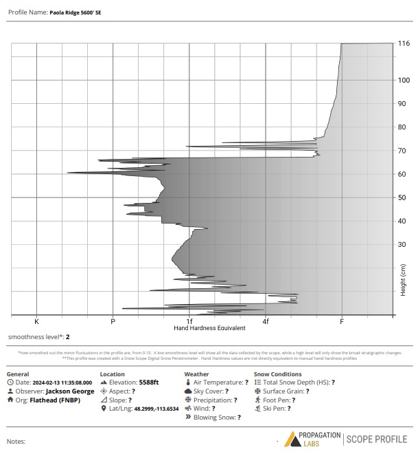
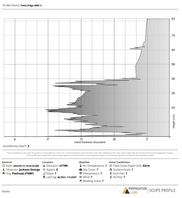
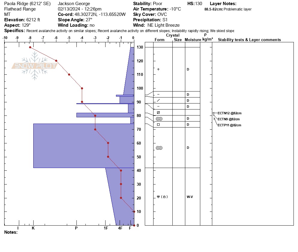
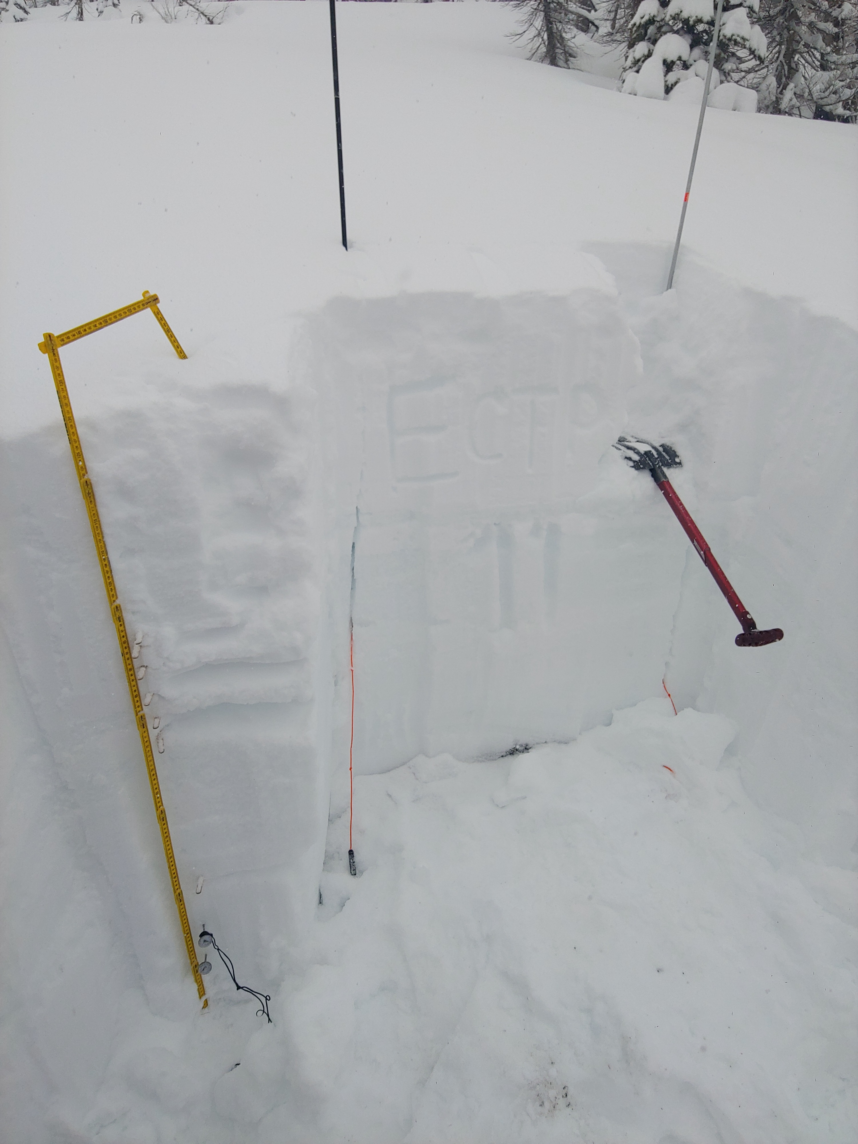
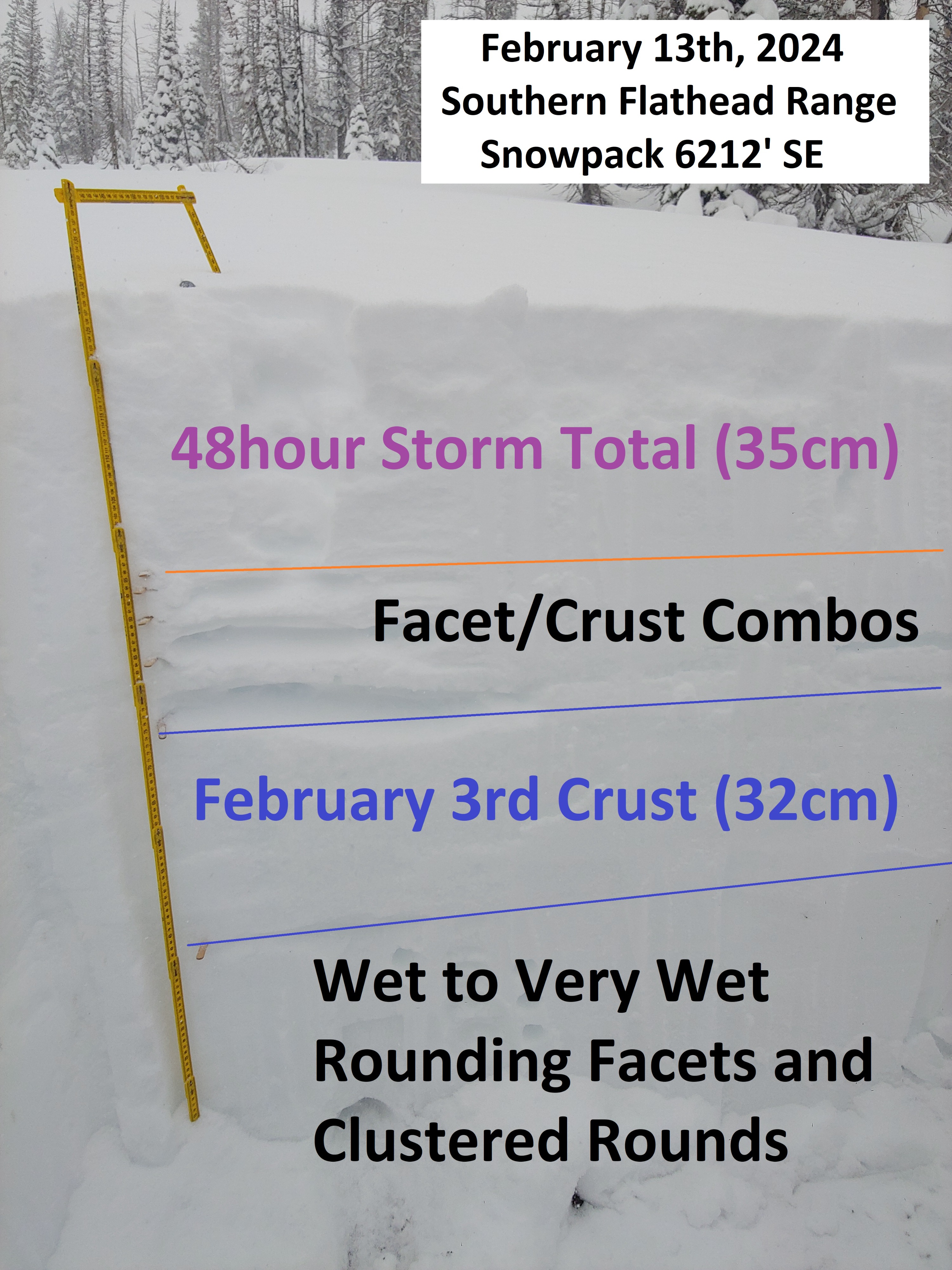
Collected snowpack data from three locations today. Two digital poke-pits (4800' E & 5600' SE). And one manual observation from 6200' SE. Pit profiles attached to this observation. • 4800' SE: HS=80cm. Upper 40cm is right side up recent snow (F-F+). Lower pack is stout and well consolidated (1F-P). • 5600' SE: HS=115cm. Upper 40cm is right side up recent snow (F-F+). 2/3 crust is about 30cm thick. Thin layer of facets within the upper 5cm of the 2/3 crust. • 6200' SE: HS=130cm. 56cm of recent snow has fallen since the formation of the 2/3 crust. The most recent snow has deposited right side up, however closer to the 2/3 interface we observed multiple sun crust facet combo, which raised concerns in our group for stability of the upper pack. Stability test verified our worries (ECTN12, ECTN9, and ECTP11 @ 82cm). The 2/3 crust is STOUT and 32cm thick at this site. Finally, we were surprised and delighted to find our favorite kind of snow lurking at the bottom of the pack... 42cm of wet-very wet facets! Still wet after two weeks since the regions big warm up in late January. If you don't believe me, go dig a hole yourself. Refer to snowpilot pit graph for the details.
Avalanche
- Size
- D1 R1
- Type
- SS
- Count
- 2
- Aspect
- NE
- Trigger
- AS
- Elevation
- 6500 ft
• Today our party observed a large natural storm slab avalanche on a steep SE facing slope around 6600'. We estimate this slide to have occurred yesterday during heightened snowfall rates. The crown appeared to be approximately 300 feet wide, and we estimated the slab to be about 50cm deep based on our pit data from a site at 6,200'. We were unable to observe the vertical extent of this avalanche. • Additionally, our party triggered one small storm slab avalanche remotely from the ridge around 6,500'. This slab was thinner than the natural slide, involving an estimated 10cm of new snow. We guess that this slab was composed of the overnight snowfall. The slide was triggered from approximately 80 feet away and failed on a steep NE facing slope beneath a small rock outcropping.