
Quick report
- Aspect
- Northwest
- Red Flags
- Wind Loading
- Elevation
- 2804 m
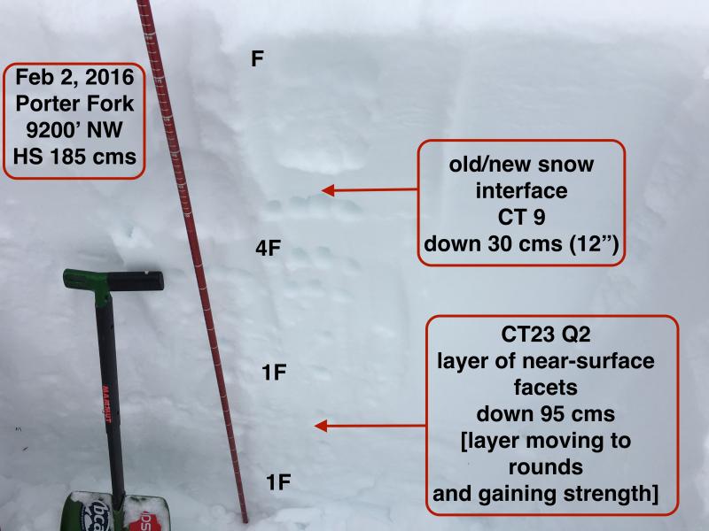
Have been away for the past several days, and haven't skied in the Wasatch for 8 days. Early morning tour up Main Porter Fork to look at the snowpack after this past weekend's warmth, rain, snow, and then wind. Outside of wind affected terrain am finding the snowpack to be as strong as I have seen all season. Above 8000' finding depths ranging from 1.5 - 2 meters, and the various persistent weak layers throughout the top meter of the snowpack seem to be continually gaining strength. (ECTX, CT23/Q2 down 95 cms.) Biggest concern seems to be wind drifted snow that formed from the easterly wind event over Sunday night and Monday. From what I noticed this morning, I am finding the structure where wind drifts are sitting on top of weaker faceted snow, especially in areas that have already slid this season (i.e. the "repeaters") to be our primary avalanche problem right now. (The tricky thing is that the new snow may be covering up these wind slabs.)
Am guessing hazard is Low at lower elevations, and Moderate at mid. Challenge to identify Moderate or Considerable at upper elevations. From what I observed today, and seeing Mark White's report of yet another repeater slide in No Name, I would call it Considerable at upper elevations as well, with the greatest risk of triggering a slide in a wind-loaded area on top of a thin snowpack.
This (poor quality) video demonstrates where we have a 1F/P-hard wind slab sitting on top of weaker snow. It is possible this slope had already slid this season. I was unable to isolate a column on this snowpack structure.
This also demonstrates spatial variability as this was on the same slope and adjacent to where I had dug a pit that showed a very strong snowpack.
This video shows a slope that had slid at least once this season, and was wind-loaded from the east winds.
Ski cut on a fresh wind drift producing a soft, shallow slab. These are the manageable type.
Snowpack
- Instability Comment
- <p>Was finding fresh, shallow wind drifts that were reactive to ski cuts. Also noting that some wind drifts that formed on Monday were sitting on top of weaker, faceted snow. Am guessing wind drifts will become less sensitive on Wednesday, however where the slabs formed on top of weaker snow, they may remain reactive to triggers.</p>
Appears to be 5-10 cms (2-4") of very light density snow that fell in Millcreek within the past 24 hours. This has covered up most of the wind drifts that formed Sunday night & Monday. Light density snow was sluffing easily on steep aspects.
- HS approaching 2 meters above 8500'
- Am finding weekend rain crust up to about 7800'
- Wind affected snow seems confined to elevations above about 8800' (although in open areas am guessing winds managed to get well down into drainages.)