

Quick report
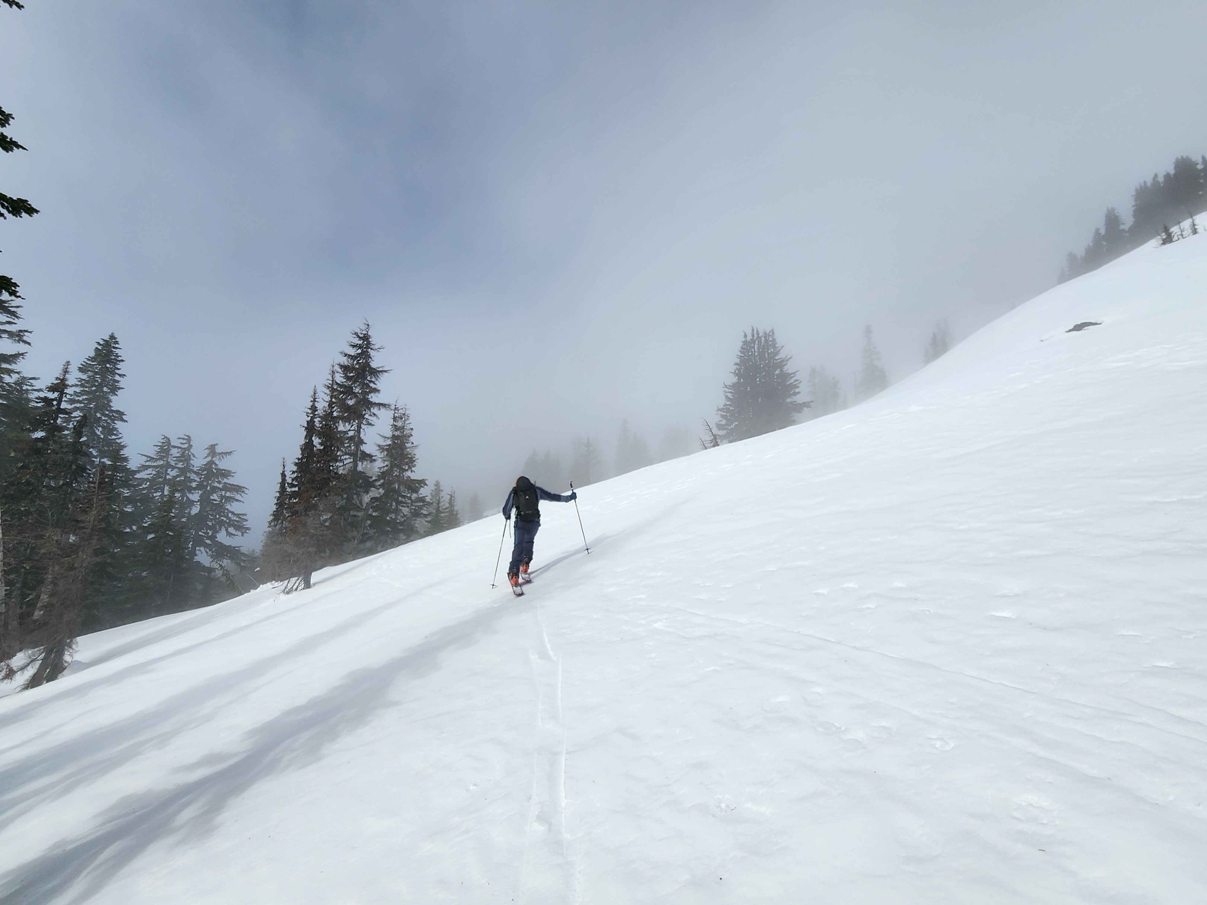
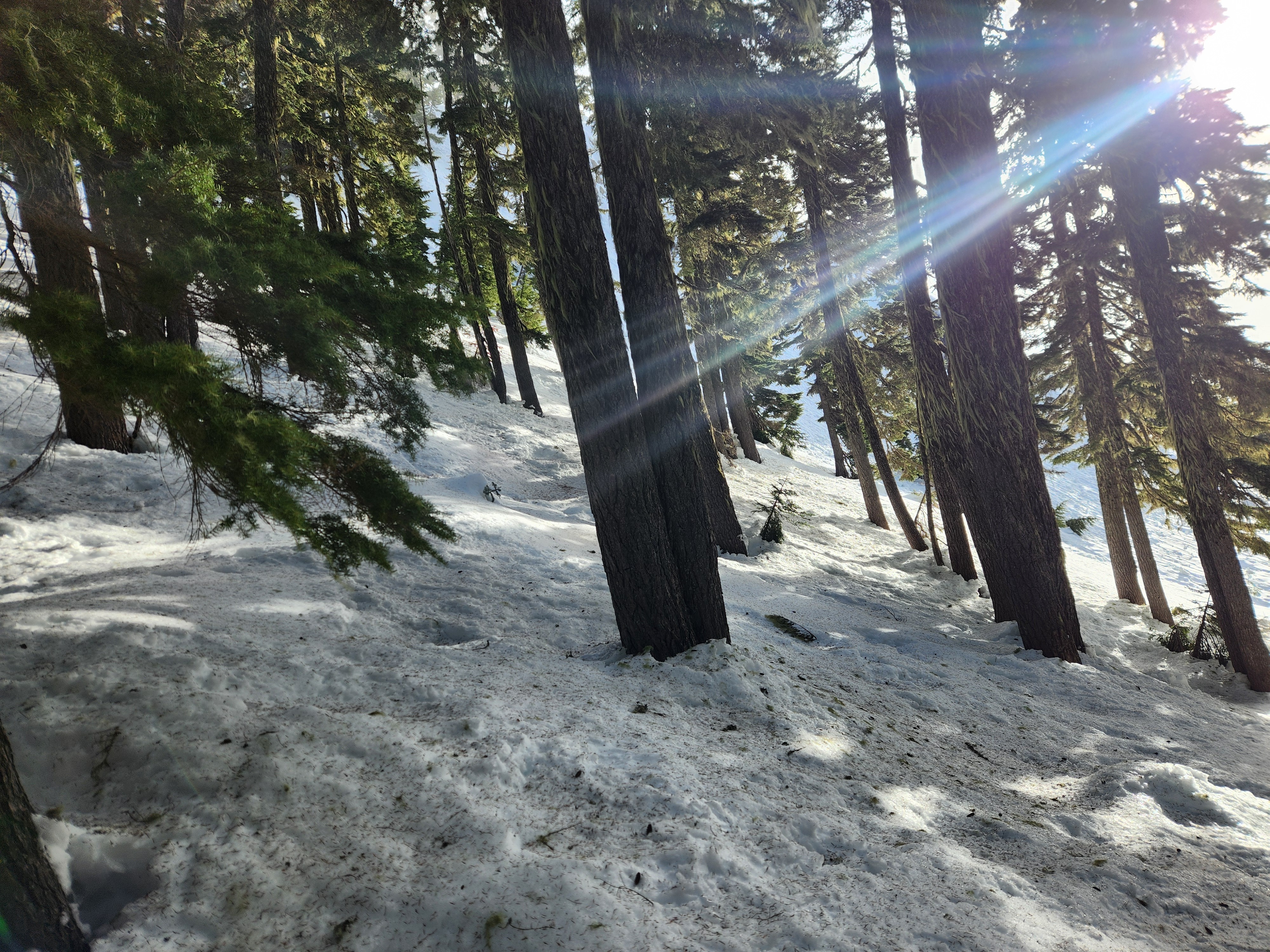
Well, folks, we go so you don't have to. On Thursday, we took to the hills of the Alpental Valley, and pretty quickly, we wondered why we did. There is no way to sugar coat how poor the travel conditions are right now. Our skis spent more time on our back than on our feet due to the nearly impossible travel below tree line. One step would be over rock hard coral reef (refrozen tree bombs), while the next step would sink into a breakable crust. It took nearly three hours to ascend 2000', and somehow, the downhill was nearly as slow. Gaping creeks closed off many planned descent routes, adding to the hazard. It requires a lot of caution and patience right now to avoid injury if your route takes you downhill through the forest without the benefit of a well-worn path.
Our main question going into the day was if we could still find any soft snow that hadn't been effected by the warmup this past week, with an eye towards any potential lingering instabilities in such a location on the 1/10 interface. On a steep north-facing test slope above 5000', we were able to find dense but soft surface snow. It wasn't unaffected by the week's weather, but it wasn't crusted. Though we were on a slope that generally sees wind loading, the slab was only about 5", likely due to snow settlement and perhaps less recent loading in this particular terrain. The 1/10 interface, though still stout, was beginning to degrade and decompose. An extended column tests did not propagate above the interface and the formerly 4F snow above the crust was 1F and showing signs of strengthening. We observed no obvious signs of instability. Of potential note down the line, the snow right at the base of the 1/10 is a bit weaker now than the snow just above the interface. The hardness of the crust is likely keeping any stress of that snow for now, but it is something we will monitor whenever we finally get another load!
Weather
- Cloud Cover
- overcast
- Wind Loading
- previous
- Snow Avail For Transport
- small smounts
Early morning hours were quite calm, with occasional sun breaks. Around 11 am the clouds thickened and light flurries began as winds increased on exposed ridgelines into the moderate range. No snow accumulation.
Snowpack
Surface crusts and refrozen tree bombs on southwest aspects between 3000 and 5100 feet. Very variable and uneven, sometimes rock hard, sometimes breakable. Minimal softening on open slopes during sun breaks in the AM. We popped over the ridge onto a steep north-facing test slope and found dense, but uncrusted surface snow. In this location, there was only about 5" of well-settled snow over the 1/10 crust complex. No propagating results in extended column tests and no signs of instability.
N @ 5080' - HS 300 cm
300 - 288 - 1F/P Slab
288 - 280 - 1/10 Crust, softer 1F snow above and 1F- below - CT11 Q2 and ECTN11 on softer snow above crust - failure plane is getting rougher and snow is getting stronger
The snow just below the 1/10 is a bit weaker than what is just above the crust.
Rightside up and strong below that.