
Quick report
Day off investigating the skiing on the other side of the river. Expectations were low today, but they were also exceeded. We rejoiced to find measurable amounts of new snow, cool temps, and a nice windless day in the Middle Fork. • If I worked for the Middle Fork marketing team, which I don't, I'd tell you tales of surfy pow and the deepest three inches we've ever seen. Instead, I'll tell it like it is. It's still pretty rugged out there; we've got a shallow snowpack and messy woods. The good news is that things don't look too far from normal up high. We've got almost two meters of snow on the ground above 6200'. • Today, we found a stout supportable crust that aided our travels through the brushy bottoms, and a skiff of new snow from the last 48 hours to gift us with a good day of skiing. No signs of instability aside from some minor sloughing experienced on slopes steeper than 35 degrees. Would expect more significant sloughing possible on slopes that are continuously 35+ degrees for long distances. Snowpack stability was good today. Manageable sloughing on upper elevation slopes steeper that 35 degrees.
Weather
- Cloud Cover
- overcast
- Wind Loading
- none
- Recent Snowfall
- 14
- Snow Avail For Transport
- small smounts
Very light snowfall prevailed all day, but only amounted to a trace. Cloud cover began to break up around 4:00pm. Calm winds all day. Even at our high points of ~6800 on the ridge. Not even a breath up there. Observed some recent small drifts in the new snow at ridgetop to suggest that light winds might have been present overnight.
Snowpack
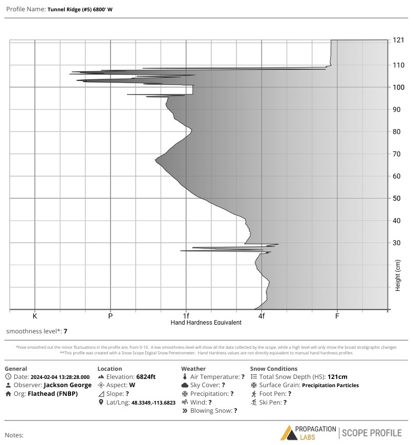
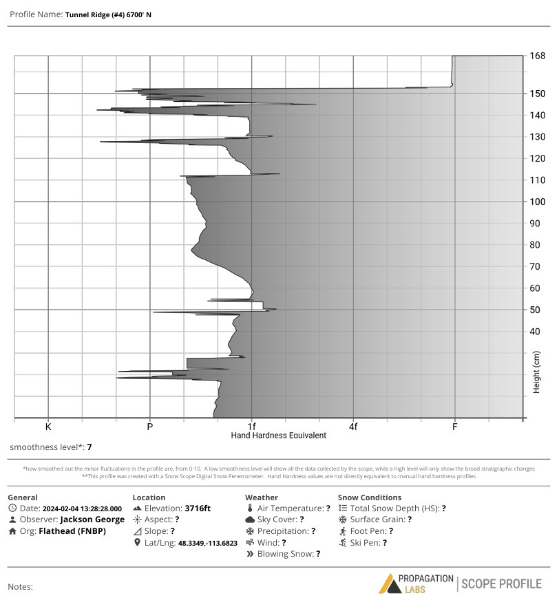
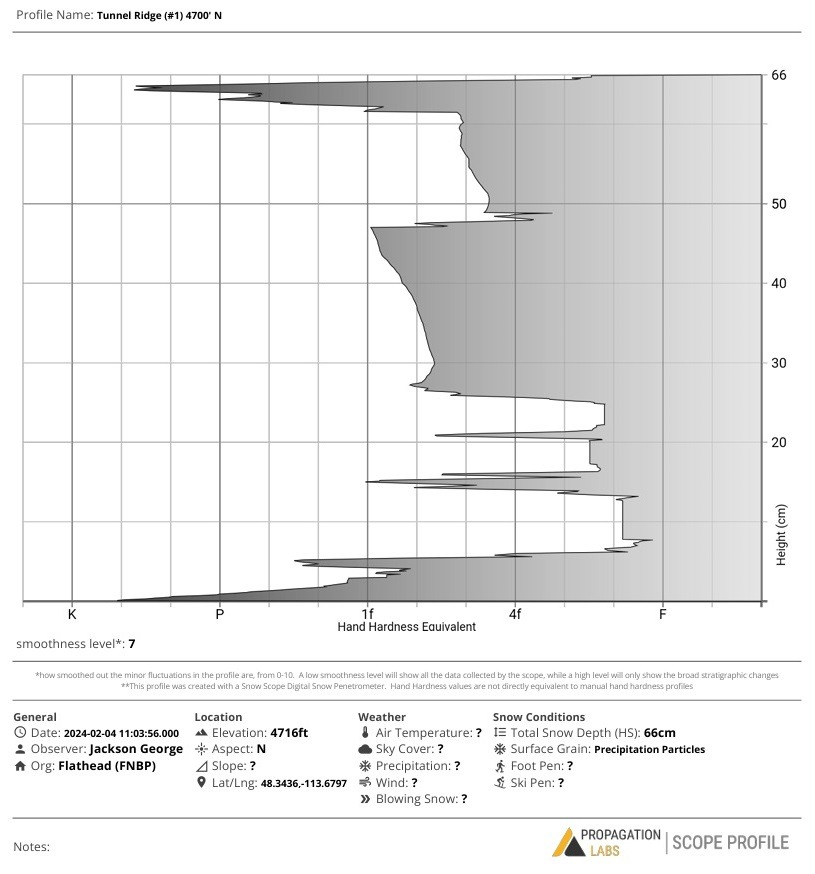
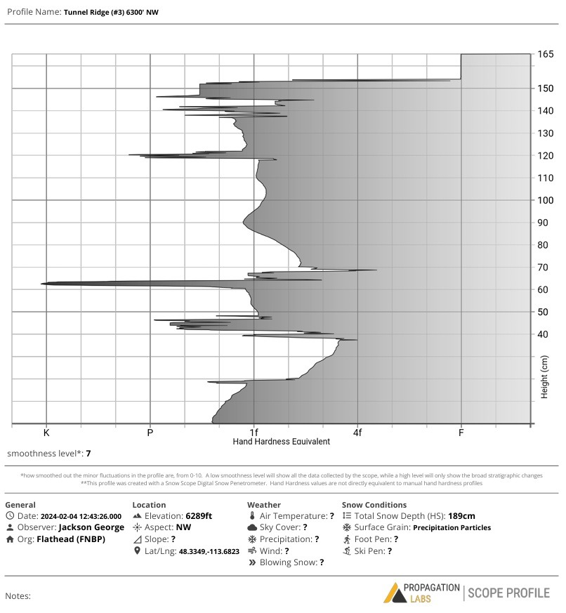
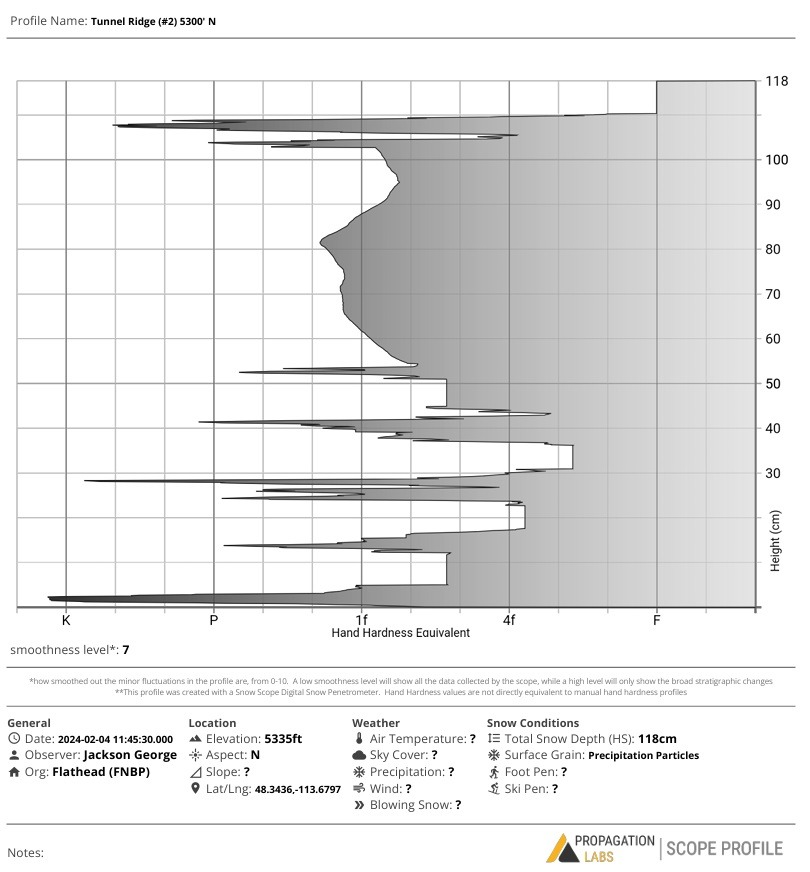
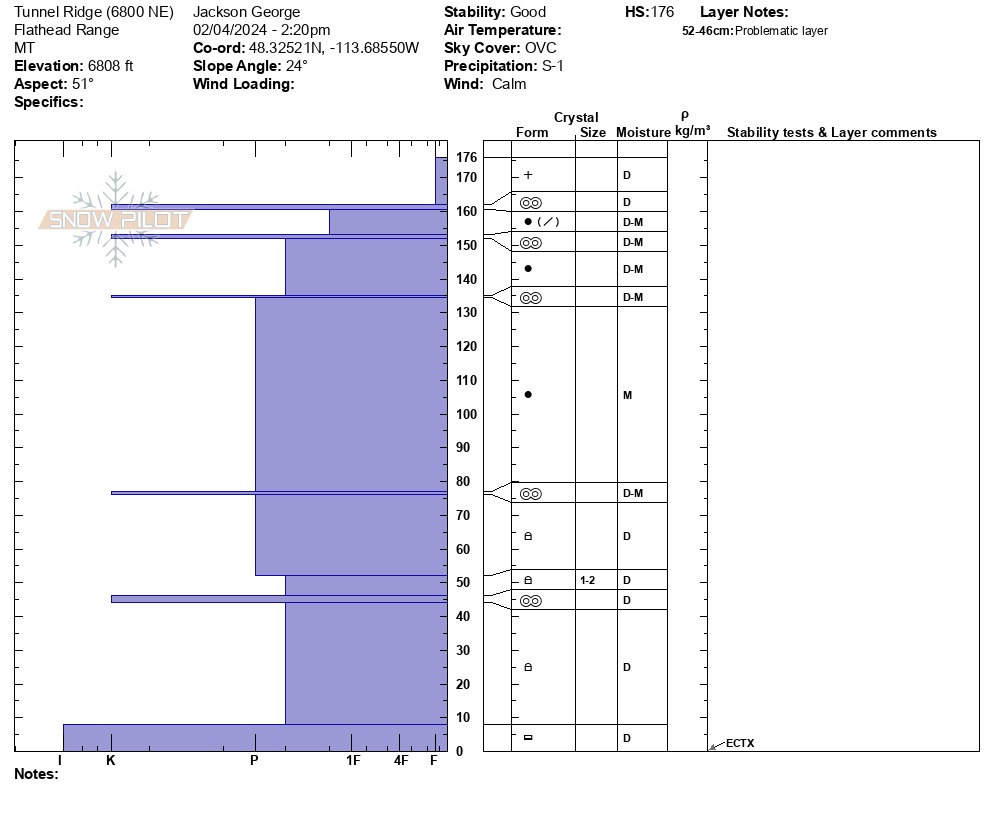
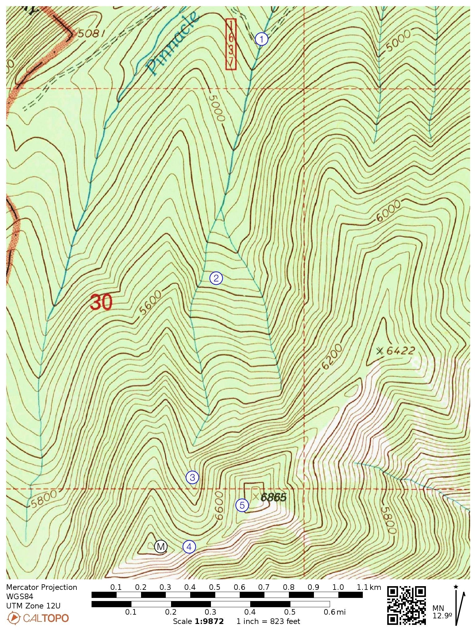
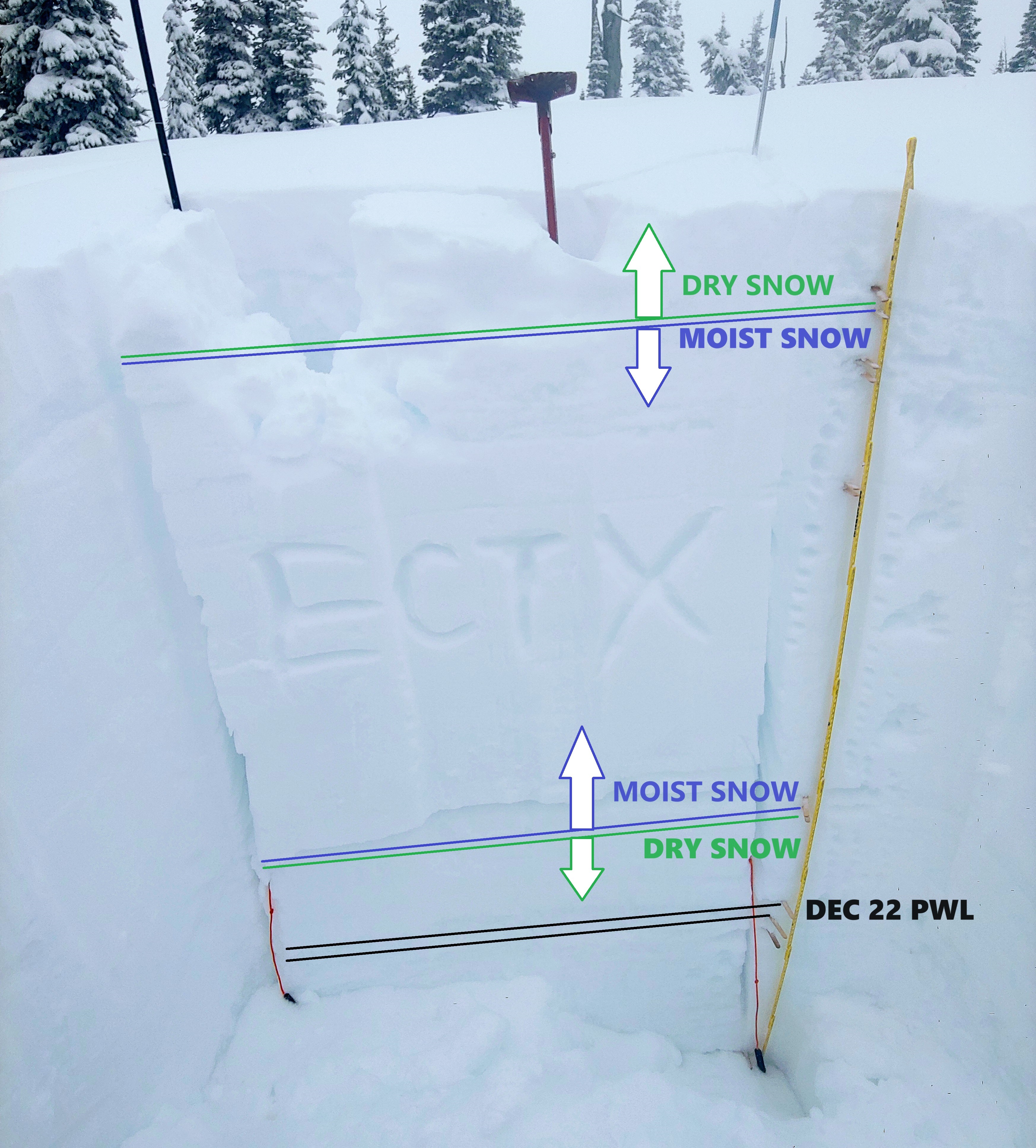
• Started our morning with a whopping 2cm of recent snow at highway elevation. By late afternoon, we measured 14cm of new snow at upper elevations. Snowfall remained light throughout the day so we expect at least 12cm fell yesterday/overnight. • At 4700', we began collecting snow scope "poke pits" at various intervals to help paint a picture of our snowpack at various elevations/aspects. We conducted one manual pit observation at 6800' on a northeast facing slope. Pit graphs attached and a map to show pit locations. • In our manual pit, we were curious to take a closer look at the structure and moisture content of an upper elevation northerly slope. We wanted to investigate and document the status of the Dec 22 PWL, and try to determine the extent of meltwater percolation last week. • Aside from the recent dry snow and underlying crust, we found the upper third of the snowpack to be dry/moist transitioning to moist 1 meter below the surface. Below that, the snow quickly transitioned back to dry grains, where we found rounded facets dominating the lower 77cm of the pack. We believe the Dec 22 PWL to exist 130cm below the surface at this location, where the rounding faceted crystals seem to have remained dry despite the balmy weather last week. Perhaps this explains the lack of activity on upper elevation northerlies during our recent cycle of large wet avalanches? •HS observed from 4700' to 6800' ranged from 60cm to 190cm.