
Quick report
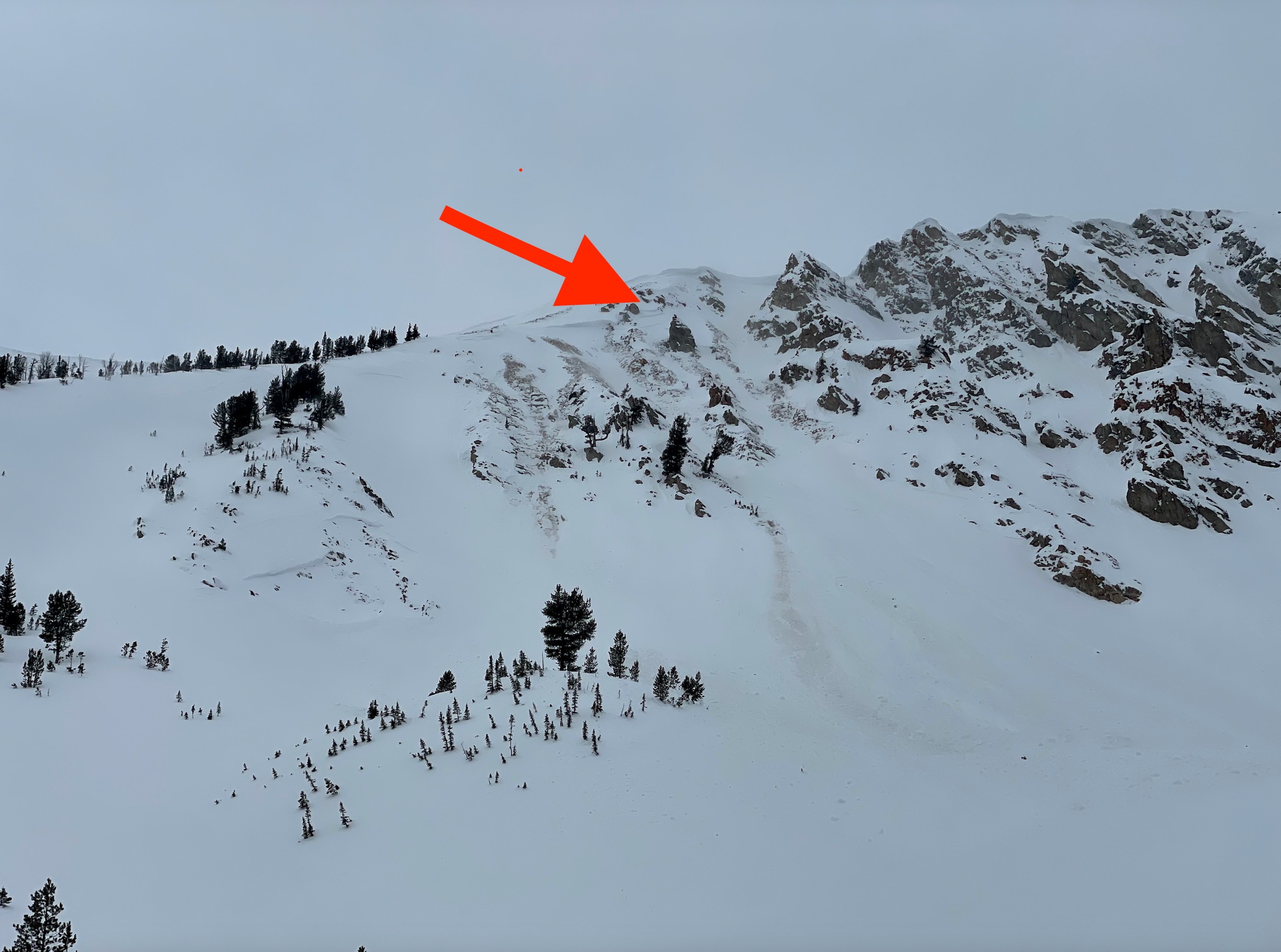
This was an off-duty ski tour to mostly collect observations on the very large McDonald Peak slides that ran earlier last week. This slide stepped down three times and turned out to be 2 separate very large avalanches that occured at different times. See Avalanches Section for more information.
We did not observe any cracking or collapsing in terrain that we traveled.Weather
- Cloud Cover
- broken
- Wind Loading
- previous
- Snow Avail For Transport
- small smounts
High, thin clouds covered the sky throughout the day directly overhead, with some blue sky visible to the northeast over the White Clouds. While winds were moderate to strong out of the SSW, there was very little snow available for transport (SAFT) on solars due to the crusts that formed during the sunny, warm, high days so new wind loading was minimal. Temperatures were significantly colder than in recent days, with well below freezing temps bringing in the low pressure system that was making its way into our area into the afternoon / evening.
Snowpack
Walking across the flats from the road, the sun and warm temperatures from our high-pressure period over the weekend had formed a thin crust on surfaces. Climbing higher in terrain, there was plenty soft snow available for transport on more sheltered northerlies, however due to wind direction (SSW) there was minimal blowing snow. While we stepped out into skiing avalanche terrain, we were selective with our terrain choices by avoiding wind-loaded areas, rocky/thin alpine terrain, and steep convexities. We skied slopes with nice even coverage, and clean runouts with no terrain traps at the bottom (trees, rocks, cliffs to be strained through). Previous wind-loading from earlier last week prior to the warm up that locked up snow on solars was evident on northerlies in the upper end of middle to lower end of upper elevations. However, slab formation was minimal and any wind deposits were trending toward unreactive in terrain we moved through.
As expected with the high pressure, we found a MFCr on solars that was not supportable to skis, and soft snow in northerlies and confined terrain. Expect these slick crusts to come into play as potential new weak layers (crust + facet combo) on solars with the next large storm. Sunny skies and and cooler temperatures in recent days began to build our newest weak layer of near-surface facets, however, these were only present in more sheltered terrain with less direct sunlight. The wind took care of these FC in more exposed, higher elevation terrain, where we found mostly DFs on surfaces.
Avalanche
- Size
- D2.5
- Aspect
- NE
- Trigger
- NC
- Elevation
- 9700 ft
The main avalanche that we went out into this zone to observe was the very large slide observed on McDonald Peak's NE face. Upon visiting the debris, there were two notable takeaways: (1) it became clear that there were two separate very large avalanches that ran, the main slide that broke on the southern side of the bowl and another slide that appeared to be cornice triggered just north of this. With the right lighting, you could see that the debris from the slide just to the N was fresher (change in color) than the debris that ran farther from the other slide. (2) The main slide to the S had a "triple crown" where the avalanche had stepped down three times. This denotes the many weak layers that are still living within our snowpack besides becoming more stubborn to trigger. More media will be uploaded as time allows.