
Quick report
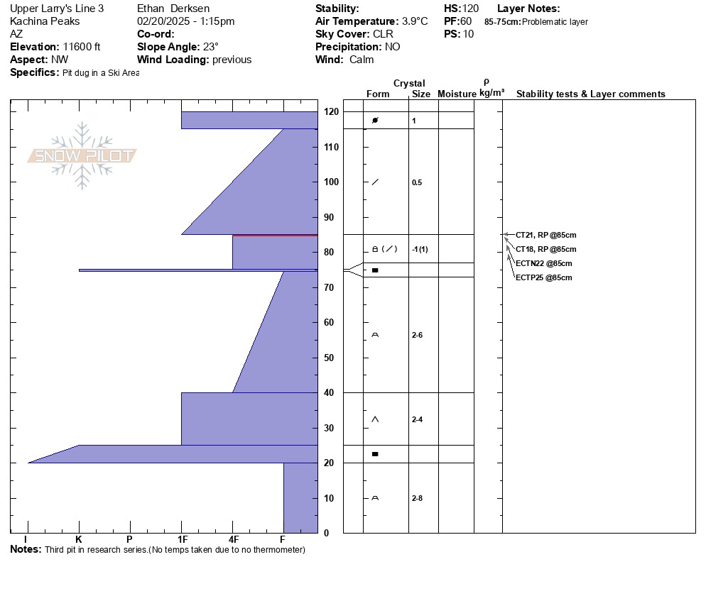
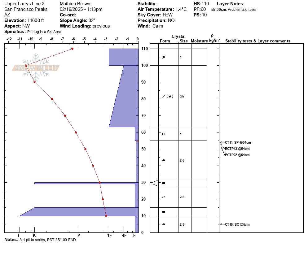
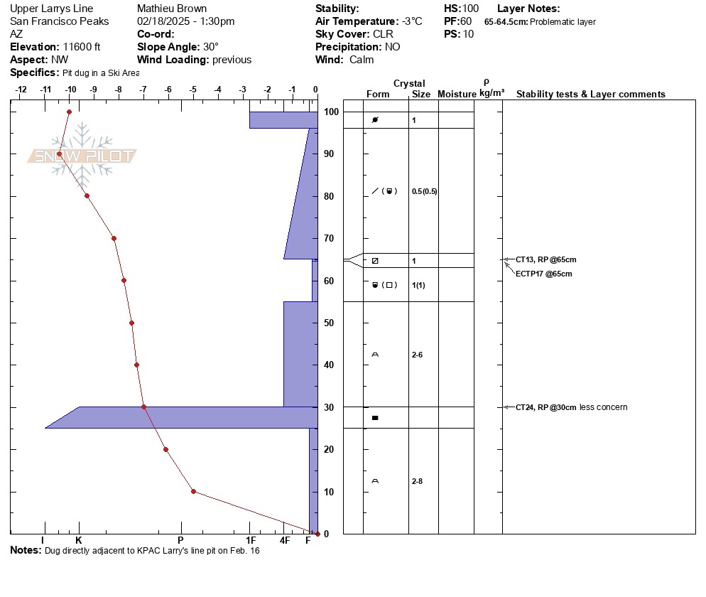
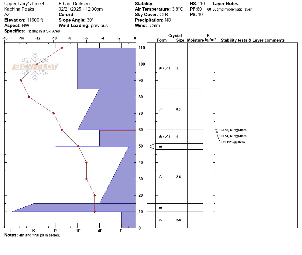
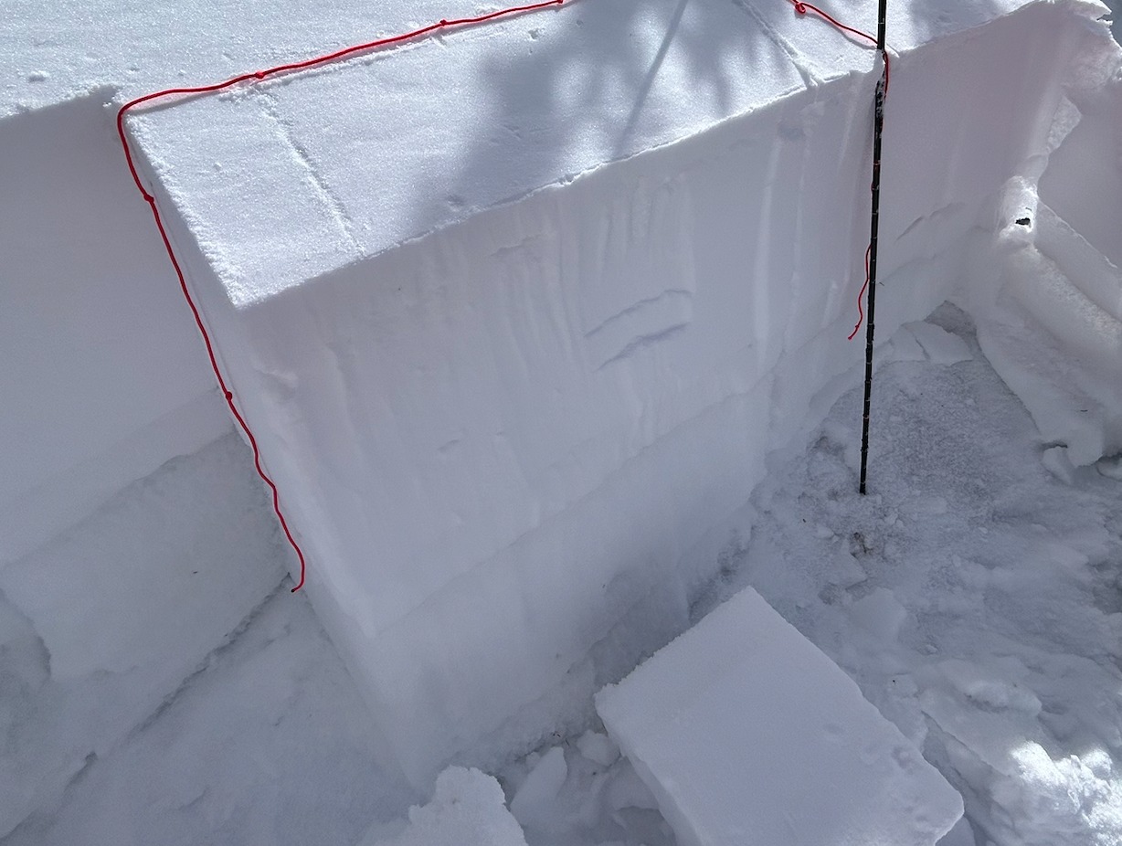
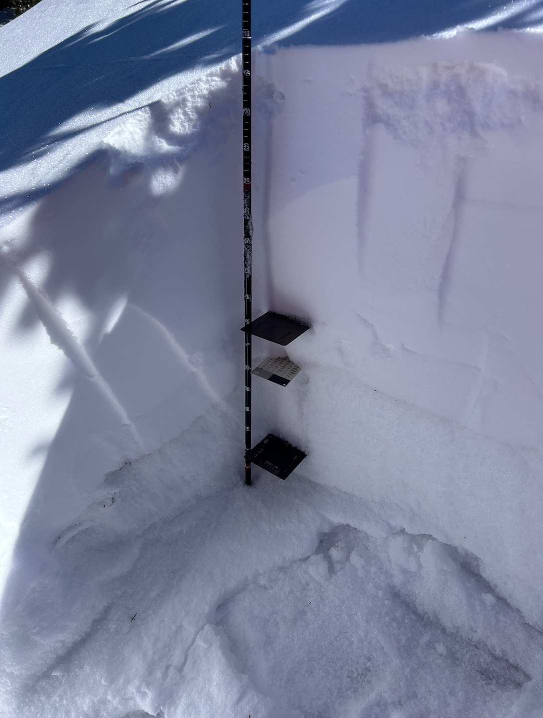
This was a 4 day project consisting of traveling to the same pit location in Upper Larry's Line; digging, testing, and observing the trends in the snowpack for signs of stabilization within the Valentines day/late Jan interface. The signs of instability in the snowpack trended towards a more stable condition in this particular pit location. These conditions can be seen in test results shown in the snow pilot images attached below. The weak layer was consistently seen on the new/old snow interface. Over the week, the weather was +/- freezing in the peak of the afternoon according to the Top Patrol weather station readings.
Weather
Throughout the week(2/18-2/21/2025) the weather observed was as follows: Sky:CLR/FEW; Temp: 1.4-3.9C; Wind Loading: Prev.; Wind:Calm.
Snowpack
The layer of concern(LOC) within the snowpack at the pit series location in Upper Larry's Line was on the Valentines day/Late Jan. interface. The new snow load could clearly be observed sliding easily and consistently on the near surface facets on the top and within the late Jan. snow. This instability trended towards a more stable snowpack throughout the week from results on 2/18 and 2/19/2025 being: CT11, SP@LOC; ECTP13@LOC; CT13, RP@LOC; and ECTP17@LOC, to more stable results later in the week with results on 2/21/2025 being: ECTP25@LOC, and CT18, RP@LOC. This trend in stable results was also matched with a healing(rounding) trend within the mixed grains within and on top of the late Jan. snow layer.