
Quick report
- Cracking
- specific
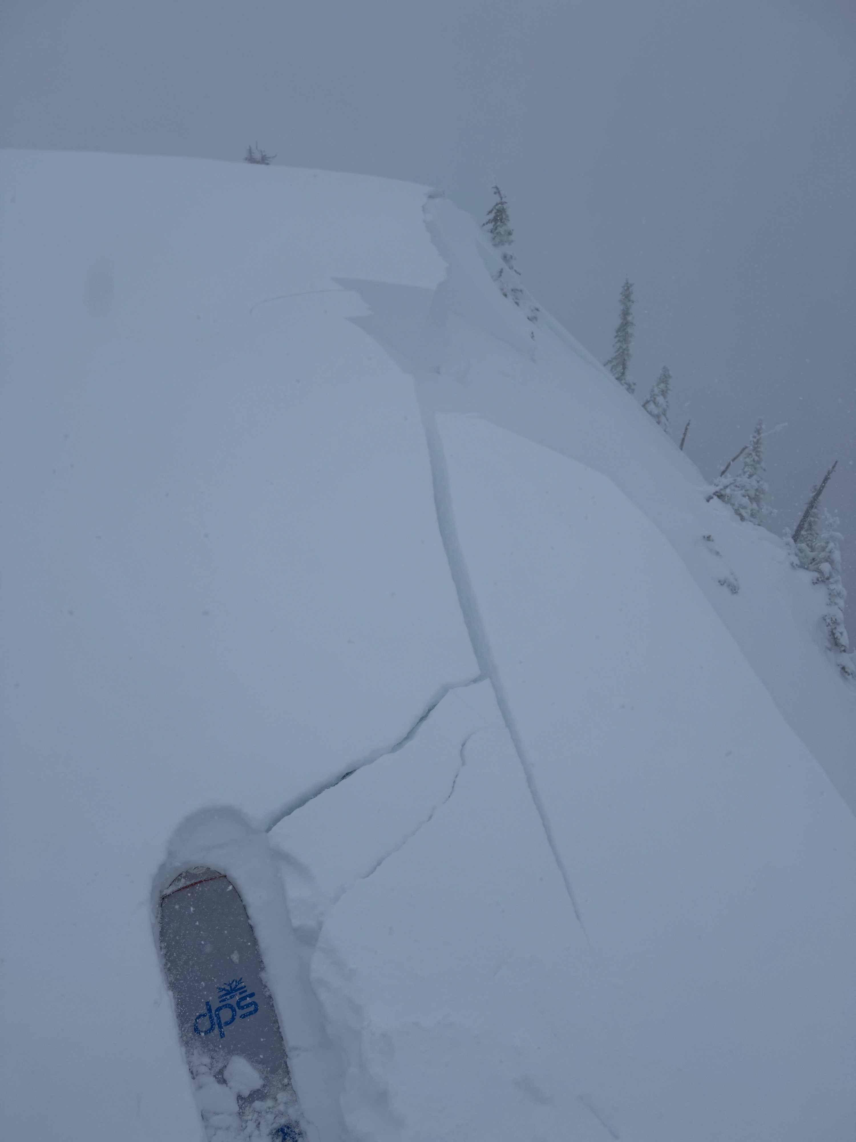
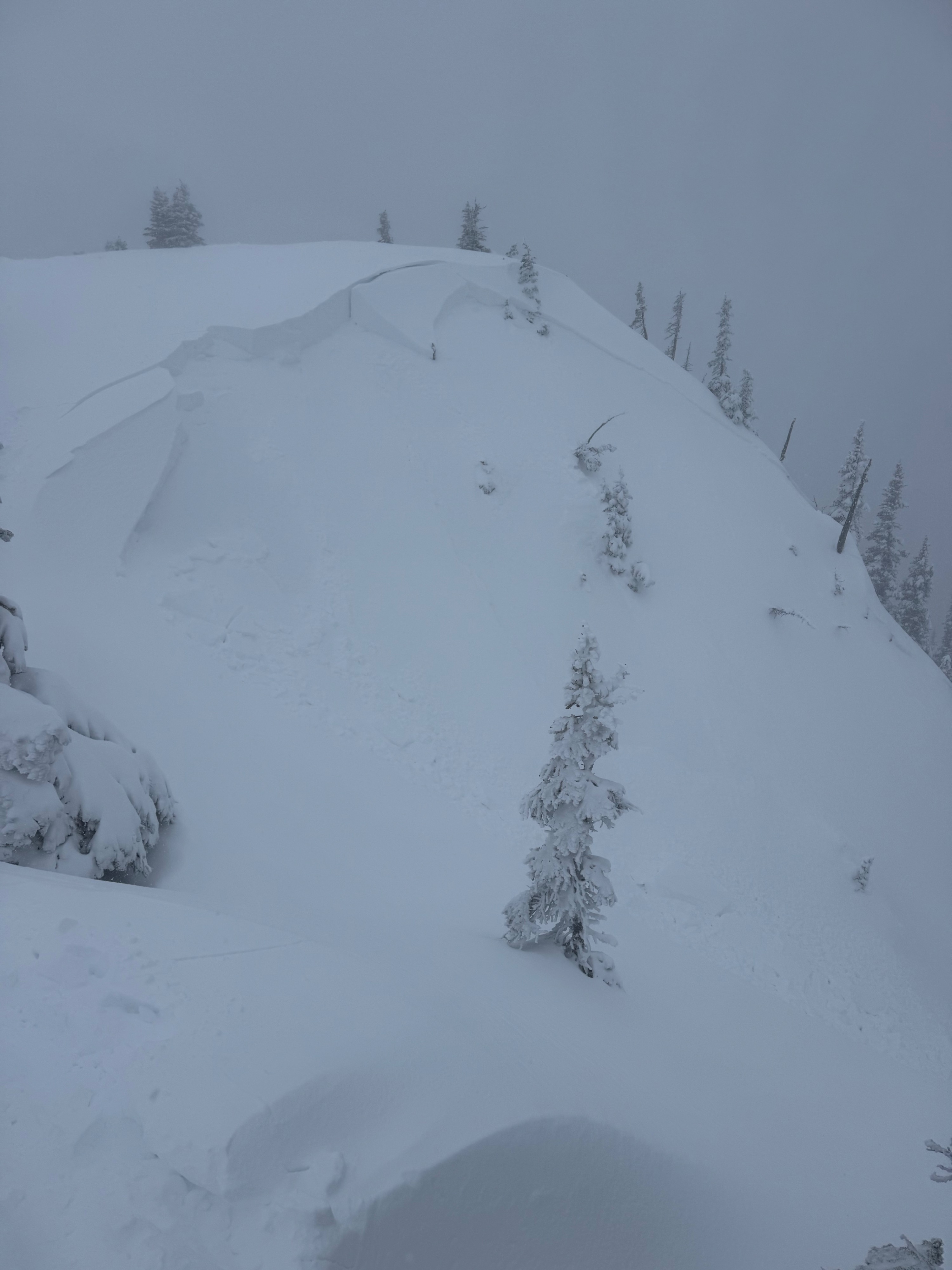
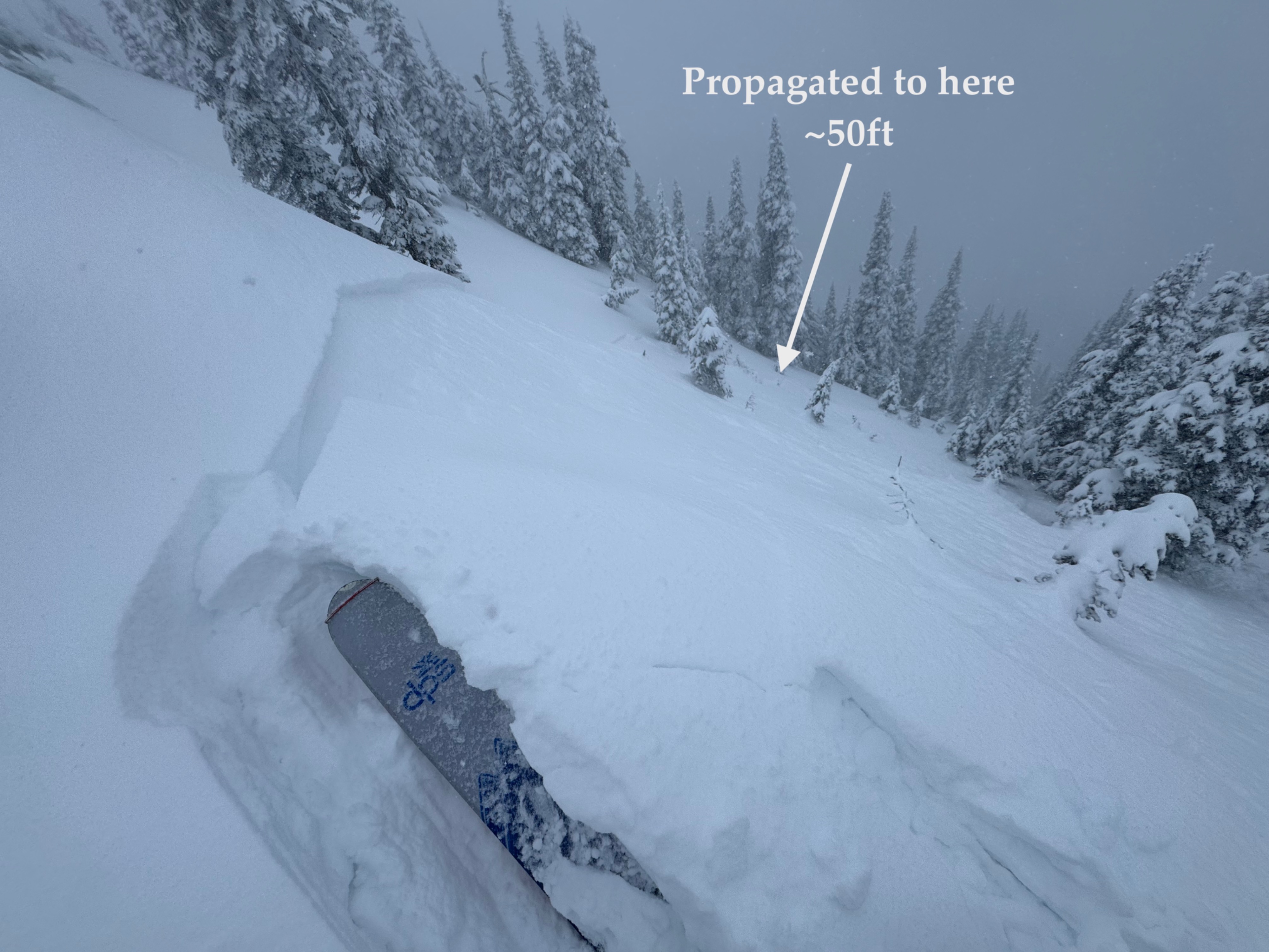
Today's fieldwork verified that the abundant new snow fall combined with moderate to strong wind is translating into heightened avalanche danger. The most obvious sensitivy was found near ridgetop on leeward slopes where with little effort I was able to easily trigger a few wind slab avalanches by stomping near the ridgecrest. Theses two slides were size 1 and 1.5, but in larger fetches, I am certain that larger dangerous avalanches could occur if provoked. Based on today's findings, it would be wise to plan to continue making conservative terrain choices during this period of unsettled weather.
Intentionally triggered two wind slab avalanches near the summit of Blue Mountain today. Freshly drifted snow was sensitive this afternoon and gave feedback by producing cracks around my skis as I traveled through exposed open terrain near ridgetop.Weather
- Air Temp
- 28
- Cloud Cover
- overcast
- Wind Loading
- moderate
- Rain Elevation
- 2800-3300
- Recent Snowfall
- 15cm
- Snow Avail For Transport
- moderate amounts
Overcast snowy day in the mountains. 15cm (6 inches) of new snow fell in the 7 hours that I was in the field and moderate snowfall rates continued as I departed the mountain. Winds were blowing moderate to strong out of the east and southeast, transporting lots of snow near ridgetops.
Snowpack
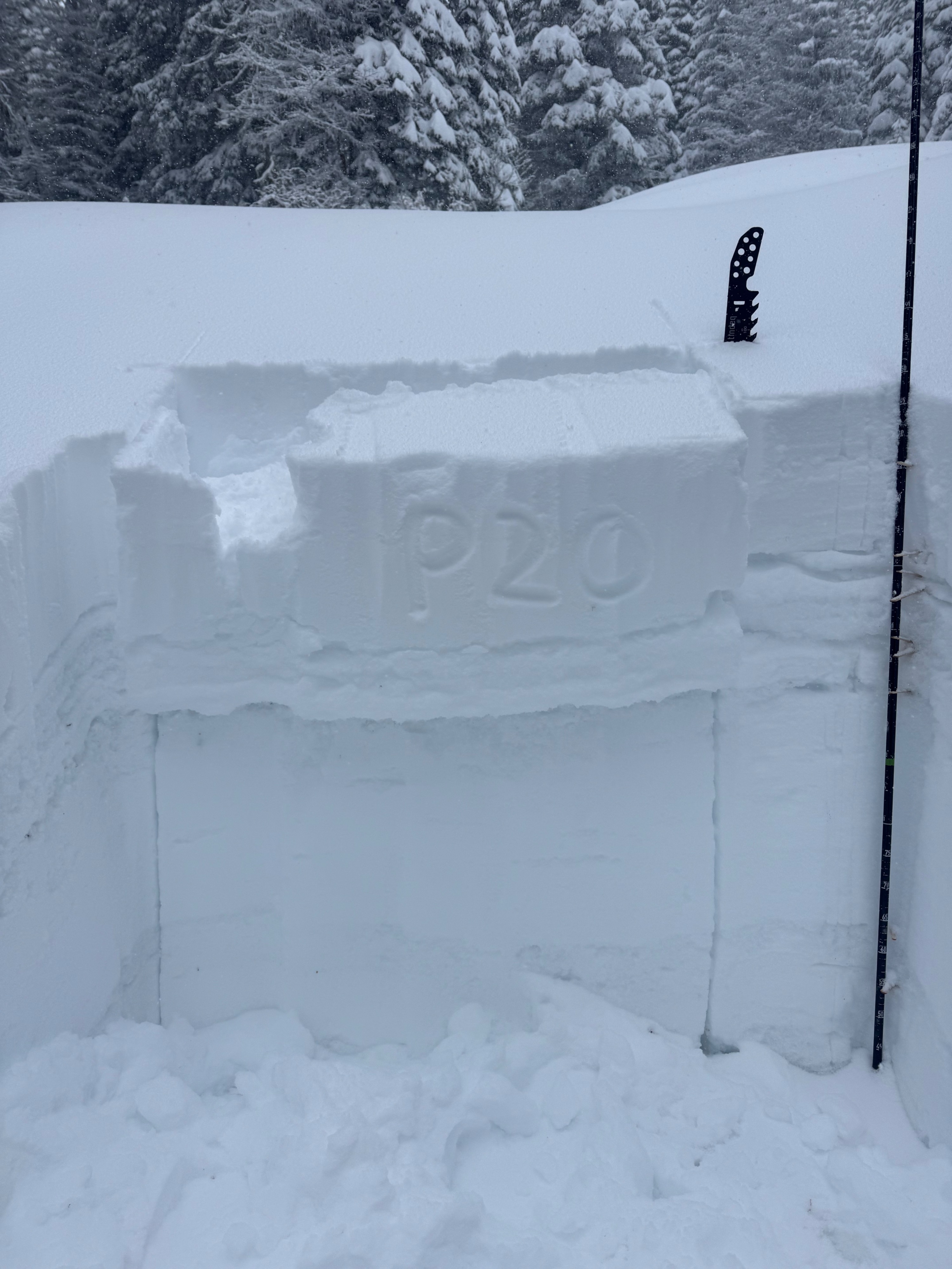
Collected detailed snowpack information and performed a variety of stability tests at two different sheltered locations within the middle elevation band.
5800 feet, East Facing Aspect-
- 149cm of total snow depth
- 13cm of new snow today and 27cm of recent snow since 2/13
- Jan28 interface was 39cm below the surface (15 inches)
- Jan28 here was a layer of small facets above a decomposing crust. Preserved surface hoar was not present.
- Tests Results: ECTP20 @ Jan28. ECTX, CT14 SC @ Jan28. PST (45/120) END @ Jan28. And CT3 SC down 13cm at the new snow interface.
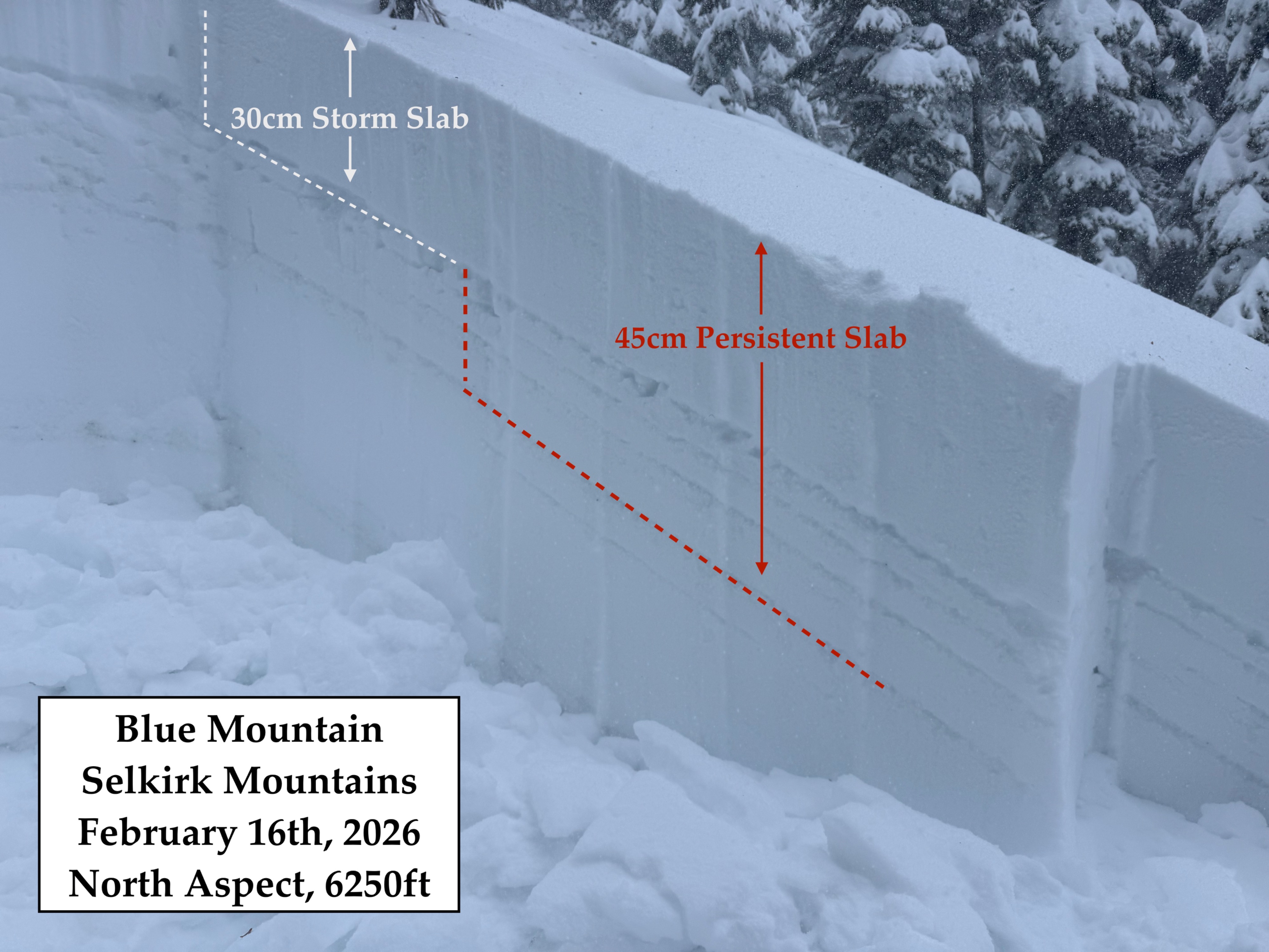
6250 feet, North Facing Aspect-
- 225cm of total snow depth
- 15cm of new snow today and 28cm of recent snow since 2/13
- Jan28 interface was 44cm below the surface (17inches)
- Jan28 here was a layer of small rounding facets above a decomposing crust. Preserved surface hoar was not present.
- Test Results: ECTN21 @ Jan28 (x2), CT17 SC @ Jan28, and CT7 SC down 15cm at the new snow interface.
*Near ridgetop and within exposed terrain, the soft new snow was being drifted heavily , stiffening the surface, resulting in upside down storm slab and sensitive wind slabs on leeward features. Drifted areas held sensitive slabs that were more than 2 feet thick.
Avalanche
- Size
- D1.5 R3
- Type
- SS
- Aspect
- N
- Trigger
- AS
- Elevation
- 6640 ft
Intentionally triggered two wind slab avlanches near the summit of Blue Mountain. The freshly formed slabs were developing on the steep north facing fetches and one swift kick near the ridgecrest was enough to release an avalanche below.