
Quick report
- Cracking
- isolated
We didn't find tons of signs of unstable snow, but there's a few things that still have my attention. Mainly, there's just a lot of recent snow and all the inter-strom interfaces are easily identifiable. It's hard to have a lot of confidence when there's so much new snow and so many layers in the upper snowpack.
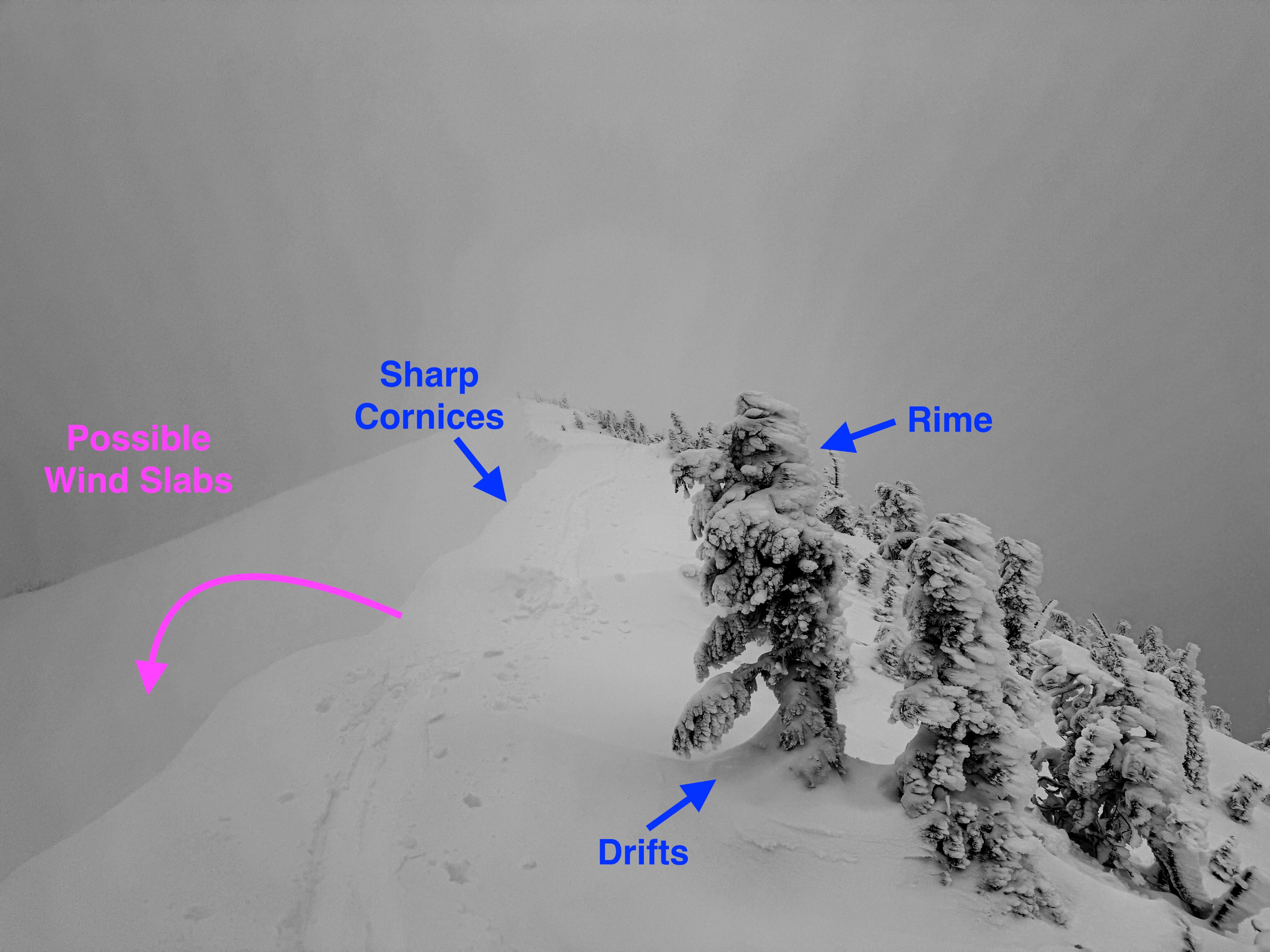
We were able to trigger very short cracks in wind loaded pillows along an exposed ridgeline. They were only a foot or two long and slabs did not displace.Weather
- Cloud Cover
- obscured
- Wind Loading
- light
- Rain Elevation
- 2500
- Recent Snowfall
- 4
- Snow Avail For Transport
- moderate amounts
Much snowier than we anticiapted with near constant light snowfall (S1). Winds were generally light along ridgelines with no actively blowing snow.
Snowpack
There's a lot of recent snow! You can tell by just looking around the mountains that it's been very snow the past few weeks. Since Christmas Day, White Pass ski area has received about 4ft of snow. Not surprisingly you can find several storm interfaces in the upper snowpack. In general, the recent snow is settling well and rather right-side-up. However, don't fully write all these storm interface off. It's hard to come out of such a prolonged storm cycle (since 12/21) with much certainty.
The main layers we noticed in the snowpack today were:
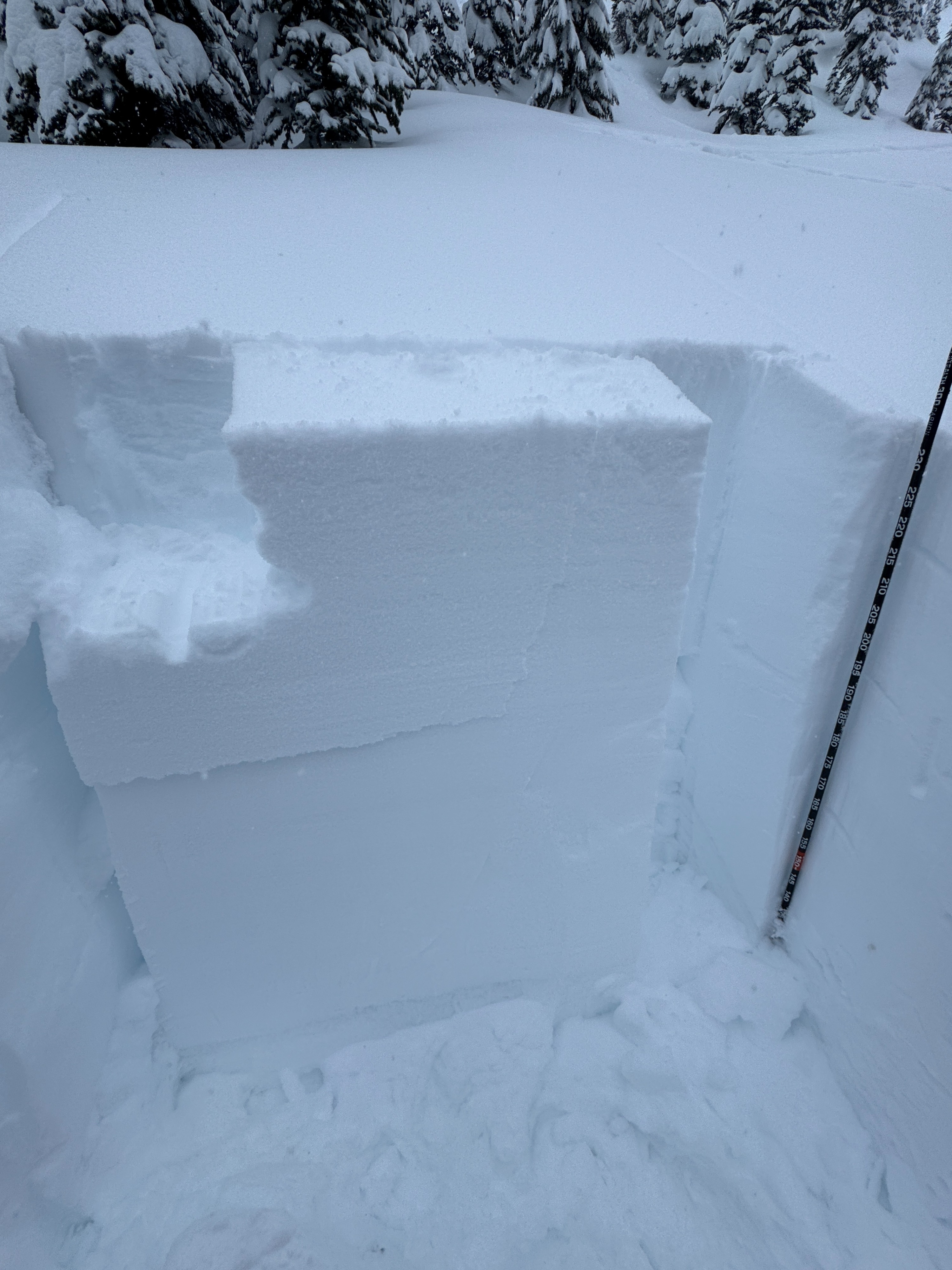
1/1: This very subtle interface below the most recent snow was easy to spot with handpits and shovel tilt tests. It was only 4 inches (10cm) or so deep today, but it was quite weak and failed easily. The loose dry avalanches we triggered mainly involved the snow above this interface.
12/27: This may be the most concern of the layers we observed in our 2 snow profiles. It failed in suffenly in small column tests, but failed to propagate the failure across the block in large column (ECT) tests. At this interface we found decomposing rimed stellars . This interface was about 15 inches (40cm) below the surface in our profiles.
12/25: A noticeable change in the strength of the snow occurred at this interface, likely from the wet heavy snow that fell on Christmas Day. In the lower profile (6000ft), there were a series of thin crust at this interface. We didn't see this layer fail in any snowpack tests.
Solstice Crust: We considered this firm and thick melt freeze crust the "new ground." It was about 4 ft (120cm) below the surface. You can easily feel it with a probe where ever you travel. Deep Tap Tests on this layer didn't produce any results.
Wind Loading: There was obvious drifting along the ridgelines forming sharp features behind trees, a crisp (all be it small) cornice line, and rime. On the lee side, we found firm pillows, but couldn't get them to fail in any meaningful way.
Avalanche
We could see a few shallow crowns in wind loaded terrain that likely occurred on New Year's Day. They were 4-6 inches (10-15cm) deep. One older larger crown was also observed below the main rock Buttress on Gunsight Peak. We triggered a few small dry loose avalanches in steeper terrain, but they didn't run particularly far nor entrain much additional snow.