
Quick report
What luck we had today with high clouds and no rain! We took in the final day of the pre-WMR season and toured out to Ghoulie's point.
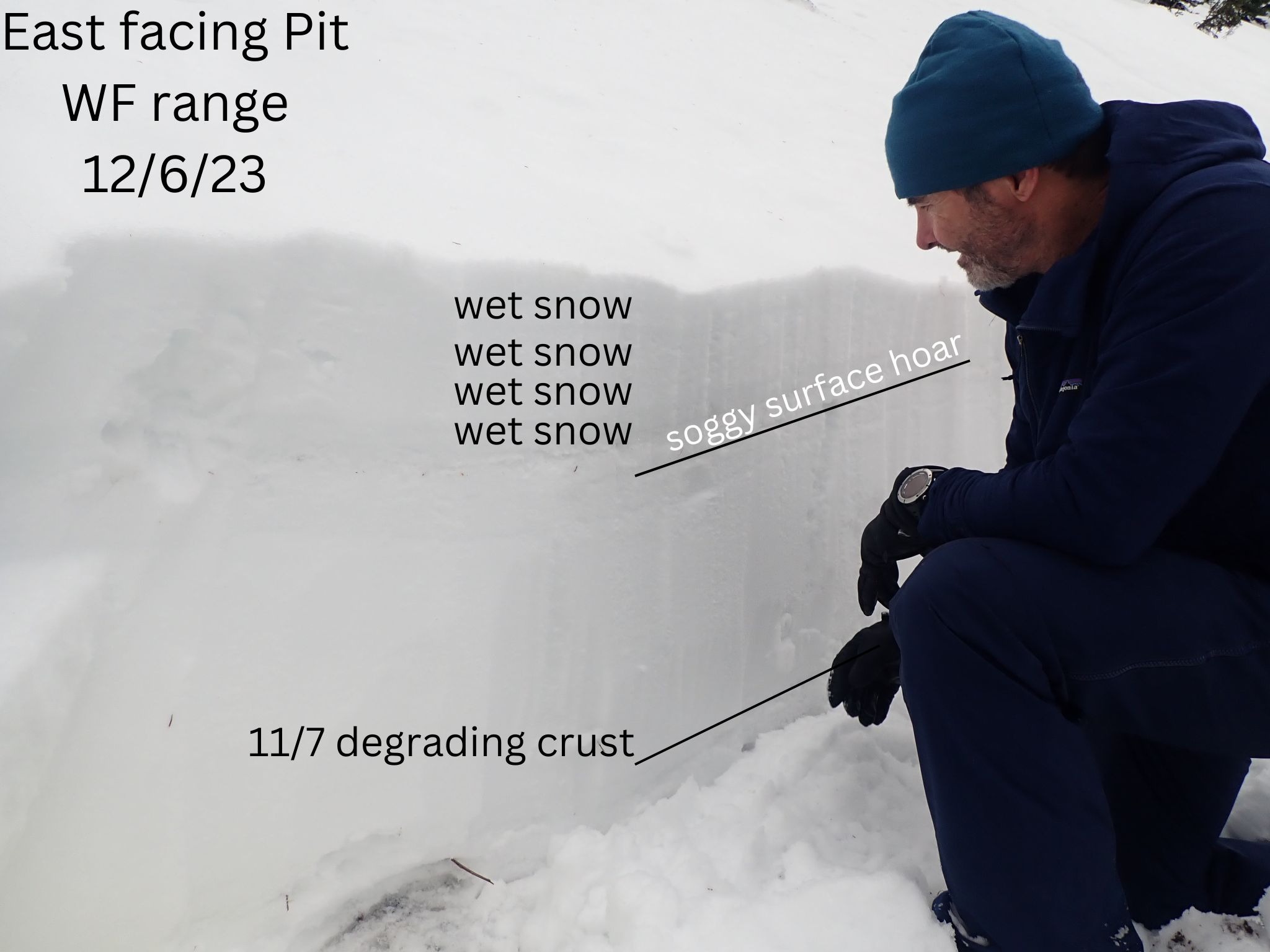
- As imagined, the top 8-10 inches had soaked up the 1.3 inches of rain that fell 12/4-5. This top layer is uncohesive and sits atop the crust/surface hoar from last week.
- We saw evidence of many wet loose avalanches from 12/4-5. These were all confined to the upper elevations (above 5500').
- The snow surface on shaded aspects already had a very thin crust forming at the surface. This crust should get thicker and more supportable as temperatures cool this week.
- Today, boot pen is as deep as your legs are long, with postholing a guaranteed thing once the skis are off.
- Terrain below 5,000' has so little snow that avalanches were not a concern.
Weather
- Air Temp
- above freezing
- Cloud Cover
- broken
- Wind Loading
- none
- Recent Snowfall
- 0
- Snow Avail For Transport
- none
A balmy day in the WF range. Temps above freezing, no precip and generally good visibiliy with high clouds.
Snowpack
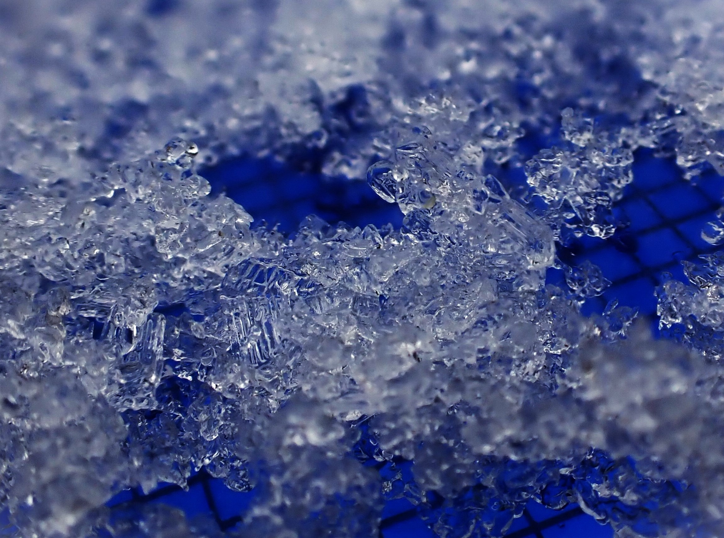
We found the crust from last week capped with surface hoar.
We had weakness at the said crust/surface hoar layer- CT9-11 Sudden Collapse and ECTN12.
- HS was consistently 30-34 inches
- The top 8-10 inches was wet.
- Large-grained surface hoar buried 12/1 was present but degrading - not standing up, rounding. This layer is roughly 8-10" below the surface and on sunnier aspects, is associated with a thin crust.
- Water was pooling at the thin crust
- The mid pack snow is dense and relatively dry.
- There is wet snow below the degrading 11/7 crust.
Avalanche
- Size
- D1.5
- Type
- WL
- Aspect
- SW
- Trigger
- N
- Elevation
- 6000 ft
Observed numerous wet loose avalanches from 12/4-5 atmmospheric river.