

Bollettino valanghe

Provo

Utah Avalanche Center
Vedi sulla mappa

Pericolo valanghe

  • Alta quota
  • Limite del bosco
  • Sotto il limite del bosco
Non aggiornato — questo bollettino è scaduto 7 years ago. Stai vedendo condizioni passate, non il bollettino in corso.

In sintesi

The avalanche hazard is generally Low, but a MODERATE avalanche danger exists on upper elevation slopes with wind drifted snow where there remains a chance for triggering a shallow soft slab avalanche.

Problemi valanghivi

  • Wind Slabs

    • Alta quota
    • Limite del bosco
    • Sotto il limite del bosco
    Probabilità
    Possible
    Dimensione
    2

    Yesterday I was finding instabilities with storm and wind-drifted snow to have largely settled out, but control work at resorts and a few backcountry observations indicated avalanching in recent wind drifts is still possible. You can find areas of wind-drifted snow on all aspects at the upper elevations. These drifts can be 6-18" thick, and run long distances if they are sitting on top of a firm wind or temperature crust. Watch for signs of recent wind drifts including dense slabs or rounded pillows of snow. Although ski cuts are an effective tool for mitigating this hazard, be sure no one is below you before ski cutting a slope.

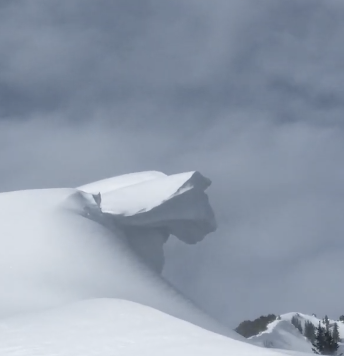
    Additionally, strong winds Tuesday and Wednesday added heft to existing cornices. These large cornices often break much further back than expected, so be sure to give them a wide berth when traveling along the exposed ridgelines.
Special Announcement

We are very sad to report an avalanche fatality from Saturday above Farmington Canyon. An 18-year-old male snowmobiler was caught, fully buried and killed. The final report is available HERE. Our deepest condolences go out to the friends, family, rescuers, and everyone affected by this tragic accident.

Join Drew Hardesty at the new Black Diamond Store at Trolley Square in Salt Lake at 7PM on January 27 for a Fireside Chat on Expert Intuition and the Avalanche Problem.

Recent Activity

Further north in the Salt Lake mountains, control work at resorts reported small soft slabs and dense wind drifts. In the backcountry, most observers noted instabilities of storm snow and wind drifts had largely settled out, but a few slides were reported including a 60' wide and 2' deep soft slab in upper Dry Fork (Observation) (pic: Jessie W)

Other avalanches in wind-drifted snow included Tuscarora (observation) and the South Face of Mount Superior (observation), the latter which may have run several hundred feet.

Warm temperatures yesterday led to damp snow with some wet roller balls below about 8,000'

Snow and Weather

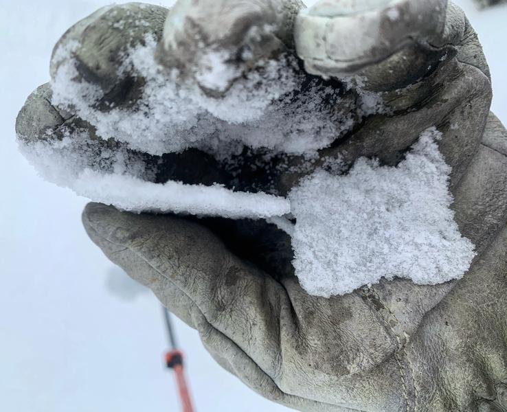
Currently: Temperatures in the Provo mountains range through the 20s F. Winds are out of the west/southwest and very light, < 10 mph, with gusts in the teens along the upper-most ridgelines. The mountains received 1-3" of dense snowfall over the past few days, with riming at the surface noted in some places.

For Today: Increasing clouds with light snow possible this afternoon. We'll likely squeeze a few inches out of this system. Winds will be out of the west/southwest and remain light, with gusts in the teens at the upper-most elevations. Temperatures will remain mild, rising above freezing to about 8500', and in the 20's above that.

This weekend: Dirty ridging in place with periods of mid and high clouds. Winds will remain light and temperatures mild, generally in the 20's. Another weak system expected later on Sunday.

Although Salt Lake-centric, our Week in Review which summarizes significant avalanche and weather events from this past week has been published. Click HERE.

Additional Info

Why dig and perform an extended column test (ECT)? Several reasons: (1) It helps you make informed decisions when traveling in avalanche terrain. (2) It forces you to slow down and discuss what is going on in the snowpack. (3) I consider digging a snowpit to be rescue practice because I become more proficient at digging in the snow and using my shovel.

General Announcements

CLICK HERE FOR MORE GENERAL INFO AND FAQ

This information does not apply to developed ski areas or highways where avalanche control is normally done. This forecast is from the U.S.D.A. Forest Service, which is solely responsible for its content. This forecast describes general avalanche conditions and local variations always occur.

Observations and Avalanches

Backcountry Emergency Procedures

Instagram

Facebook

Get Forecast Email

Previous Forecasts

Contact via email

Submit Observation

Regioni coperte